To install click the Add extension button. That's it.

The source code for the WIKI 2 extension is being checked by specialists of the Mozilla Foundation, Google, and Apple. You could also do it yourself at any point in time.

4,5
Kelly Slayton
Congratulations on this excellent venture… what a great idea!
Alexander Grigorievskiy
I use WIKI 2 every day and almost forgot how the original Wikipedia looks like.
Live Statistics
English Articles
Improved in 24 Hours
Added in 24 Hours
What we do. Every page goes through several hundred of perfecting techniques; in live mode. Quite the same Wikipedia. Just better.
.
Leo
Newton
Brights
Milds

From Wikipedia, the free encyclopedia

Mazorakopf
Falknishorn
Mazorakopf (left) viewed from the Swiss side
Highest point
Elevation2,451.5 m (8,043 ft)
Isolation0.2 km (0.12 mi) Edit this on Wikidata
Coordinates47°02′54.52″N 9°33′25.17″E / 47.0484778°N 9.5569917°E / 47.0484778; 9.5569917
Geography
Mazorakopf is located in Liechtenstein
Mazorakopf
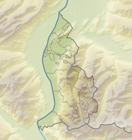
Mazorakopf
Location in Liechtenstein, on the border with Switzerland
LocationLiechtenstein / Switzerland
Parent rangeRätikon

Mazorakopf or Falknishorn (2,451.5 metres [8,043 ft]) is a mountain on the border between Switzerland and Liechtenstein. It is the southernmost point of the principality of Liechtenstein.


This page was last edited on 24 September 2023, at 18:17
Basis of this page is in Wikipedia. Text is available under the CC BY-SA 3.0 Unported License. Non-text media are available under their specified licenses. Wikipedia® is a registered trademark of the Wikimedia Foundation, Inc. WIKI 2 is an independent company and has no affiliation with Wikimedia Foundation.