
Mayagüez barrio-pueblo
Pueblo de Mayagüez | |
|---|---|
Municipality Seat[1] | |
 Plaza Colón in Mayagüez | |
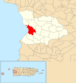 Location of Mayagüez barrio-pueblo within the municipality of Mayagüez shown in red | |
 Mayagüez barrio-pueblo Location of Puerto Rico | |
| Coordinates: 18°12′12″N 67°08′46″W / 18.203335°N 67.14617°W[2] | |
| Commonwealth | |
| Municipality | |
| Area | |
| • Total | 2.98 sq mi (7.7 km2) |
| • Land | 2.58 sq mi (6.7 km2) |
| • Water | 0.4 sq mi (1 km2) |
| Elevation | 13 ft (4 m) |
| Population (2010) | |
| • Total | 26,903 |
| • Density | 10,550.2/sq mi (4,073.5/km2) |
| Source: 2010 Census | |
| Time zone | UTC−4 (AST) |
Mayagüez barrio-pueblo is a barrio and the administrative center (seat) of Mayagüez, a municipality of Puerto Rico. Its population in 2010 was 26,903.[1][4][5][6]
As was customary in Spain, in Puerto Rico, the municipality has a barrio called pueblo which contains a central plaza, the municipal buildings (city hall), and a Catholic church. Fiestas patronales (patron saint festivals) are held in the central plaza every year.[7][8]
| Census | Pop. | Note | %± |
|---|---|---|---|
| 1910 | 16,503 | — | |
| 1920 | 19,124 | 15.9% | |
| 1930 | 37,060 | 93.8% | |
| 1940 | 50,376 | 35.9% | |
| 1950 | 58,944 | 17.0% | |
| 1960 | 50,147 | −14.9% | |
| 1970 | 0 | −100.0% | |
| 1980 | 40,247 | — | |
| 1990 | 35,279 | −12.3% | |
| 2000 | 32,043 | −9.2% | |
| 2010 | 26,903 | −16.0% | |
| U.S. Decennial Census 1899 (shown as 1900)[9] 1910-1930[10] 1930-1950[11] 1980-2000[12] 2010[13] | |||
The central plaza and its church
The central plaza, or square, is a place for official and unofficial recreational events and a place where people can gather and socialize from dusk to dawn. The Laws of the Indies, Spanish law, which regulated life in Puerto Rico in the early 19th century, stated the plaza's purpose was for "the parties" (celebrations, festivities) (Spanish: a propósito para las fiestas), and that the square should be proportionally large enough for the number of neighbors (Spanish: grandeza proporcionada al número de vecinos). These Spanish regulations also stated that the streets nearby should be comfortable portals for passersby, protecting them from the elements: sun and rain.[7]
Located across the central plaza in Mayagüez barrio-pueblo is the Catedral Nuestra Señora de la Candelaria, a Roman Catholic church[14] which was inaugurated in 1836. There have been a number of churches at the site since the first one which was made of wood and built in 1763. The subsequent church made of mamposteria (rubblework masonry) was built in 1780. In 1836, Vicente Piera designed the church which stands there now, however, the 1918 San Fermín earthquake damaged its towers and structure. In 1922 the facade was remodeled based on a design by Luis Perocier. The current church facade was designed by Carlos J. Ralat and was finished in 2004. The columns are reminiscent of Puerto Rico church artchitecture of the 19th century.[15]
Gallery
- Places in Mayagüez barrio-pueblo
-
 Plaza in Mayagüez
 -
 Catedral Nuestra Señora de la Candelaria
 -
 Detail on the door of Mayagüez City Hall
See also
References
- ^ a b Puerto Rico: 2010 Population and Housing Unit Counts.pdf (PDF). U.S. Dept. of Commerce, Economics and Statistics Administration, U.S. Census Bureau. 2010.
- ^ a b "US Gazetteer 2019". US Census. US Government.
- ^ U.S. Geological Survey Geographic Names Information System: Mayagüez barrio-pueblo
- ^ Picó, Rafael; Buitrago de Santiago, Zayda; Berrios, Hector H. Nueva geografía de Puerto Rico: física, económica, y social, por Rafael Picó. Con la colaboración de Zayda Buitrago de Santiago y Héctor H. Berrios. San Juan Editorial Universitaria, Universidad de Puerto Rico,1969.
- ^ Gwillim Law (20 May 2015). Administrative Subdivisions of Countries: A Comprehensive World Reference, 1900 through 1998. McFarland. p. 300. ISBN 978-1-4766-0447-3. Retrieved 25 December 2018.
- ^ "US Census Barrio-Pueblo definition". factfinder.com. US Census. Archived from the original on 13 May 2017. Retrieved 5 January 2019.
- ^ a b Santullano, Luis A. (10 March 2019). Mirada al Caribe. Vol. 54. Colegio de Mexico. pp. 75–78. doi:10.2307/j.ctvbcd2vs.12. JSTOR j.ctvbcd2vs.12.
- ^ Pariser, Harry S. (2003). Explore Puerto Rico, Fifth Edition. San Francisco: Manatee Press. pp. 52–55. Retrieved 10 February 2019.
- ^ "Report of the Census of Porto Rico 1899". War Department Office Director Census of Porto Rico. Archived from the original on July 16, 2017. Retrieved September 21, 2017.
- ^ "Table 3-Population of Municipalities: 1930 1920 and 1910" (PDF). United States Census Bureau. Archived (PDF) from the original on August 17, 2017. Retrieved September 21, 2017.
- ^ "Table 4-Area and Population of Municipalities Urban and Rural: 1930 to 1950" (PDF). United States Census Bureau. Archived (PDF) from the original on August 30, 2015. Retrieved September 21, 2014.
- ^ "Table 2 Population and Housing Units: 1960 to 2000" (PDF). United States Census Bureau. Archived (PDF) from the original on July 24, 2017. Retrieved September 21, 2017.
- ^ Puerto Rico: 2010 Population and Housing Unit Counts.pdf (PDF). U.S. Dept. of Commerce Economics and Statistics Administration U.S. Census Bureau. 2010. Archived (PDF) from the original on 2017-02-20. Retrieved 2019-08-02.
- ^ Marisa Gomez and Ester Cardona (July 1984). "National Register of Historic Places Inventory/Nomination: Thematic Nomination: Historic Churches of Puerto Rico". National Park Service. Retrieved June 5, 2023.
- ^ Mari Mut, José A. (2013-08-28). Los Pueblos de Puerto Rico y Las Iglesias de Sus Plazas [The Pueblos of Puerto Rico, and the Churches of its Plazas] (PDF) (in Spanish). pp. 157–159. Retrieved 2021-05-04.