
City of Matlosana | |
|---|---|
 Seal | |
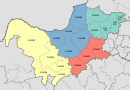
 Location in the North West | |
| Coordinates: 26°50′S 26°30′E / 26.833°S 26.500°E | |
| Country | South Africa |
| Province | North West |
| District | Dr Kenneth Kaunda |
| Seat | Klerksdorp |
| Wards | 35 |
| Government | |
| • Type | Municipal council |
| • Mayor | Cllr Nonhlupheko Tsolela (ANC) |
| Area | |
| • Total | 3,561 km2 (1,375 sq mi) |
| Population (2011)[2] | |
| • Total | 398,676 |
| • Density | 110/km2 (290/sq mi) |
| Racial makeup (2011) | |
| • Black African | 81.0% |
| • Coloured | 3.5% |
| • Indian/Asian | 0.8% |
| • White | 14.5% |
| First languages (2011) | |
| • Tswana | 36.7% |
| • Sotho | 20.3% |
| • Afrikaans | 17.6% |
| • Xhosa | 14.3% |
| • Other | 11.1% |
| Time zone | UTC+2 (SAST) |
| Municipal code | NW403 |
The City of Matlosana (Tswana: Toropo ya Matlosana; Sotho: Toropo ya Matlosana; Afrikaans: Stad Matlosana; Xhosa: IsiXeko saseMatlosana), formerly the City Council of Klerksdorp, is a local municipality within the Dr Kenneth Kaunda District Municipality, in the North West province of South Africa.
Main places
The 2001 census divided the municipality into the following main places:[3]
| Place | Code | Area (km2) | Population | Most spoken language |
|---|---|---|---|---|
| Buffelsfontein | 61901 | 0.24 | 1,825 | Sotho |
| Dominionville | 61903 | 6.24 | 542 | Afrikaans |
| Faan Meintjies Nature Reserve | 61904 | 8.86 | 18 | Xhosa |
| GTC Village | 61905 | 0.41 | 445 | Sotho |
| Hartebeesfontein | 61906 | 3.72 | 1,275 | Afrikaans |
| Hartebeestfontein Mine | 61907 | 60.65 | 4,350 | Sotho |
| Jouberton | 61908 | 15.74 | 104,977 | Tswana |
| Kanana | 61909 | 9.90 | 66,936 | Sotho |
| Khayalihle | 61910 | 0.09 | 1,501 | Xhosa |
| Khuma | 61911 | 7.08 | 42,963 | Tswana |
| Klerksdorp | 61912 | 115.17 | 59,509 | Afrikaans |
| Margaret Mine | 61913 | 56.23 | 0 | - |
| Orkney | 61914 | 137.70 | 15,539 | Afrikaans |
| Paballong Village | 61915 | 0.24 | 516 | Xhosa |
| Stilfontein Gold Mine | 61917 | 0.32 | 470 | Tswana |
| Stilfontein | 61916 | 7.63 | 14,713 | Afrikaans |
| Tigane | 61918 | 1.21 | 12,111 | Tswana |
| Vaal Reefs | 61919 | 6.15 | 11,345 | Xhosa |
| Remainder of the municipality | 61902 | 3,125.09 | 20,194 | Tswana |
Politics
The municipal council consists of seventy-seven members elected by mixed-member proportional representation. Thirty-nine councillors are elected by first-past-the-post voting in thirty-nine wards, while the remaining thirty-eight are chosen from party lists so that the total number of party representatives is proportional to the number of votes received. In the election of 1 November 2021 the African National Congress (ANC) won a majority of forty seats in the council.[4] The following table shows the results of the election.
| Party | Ward | List | Total seats | |||||
|---|---|---|---|---|---|---|---|---|
| Votes | % | Seats | Votes | % | Seats | |||
| African National Congress | 38,845 | 51.83 | 31 | 39,800 | 52.60 | 9 | 40 | |
| Democratic Alliance | 15,511 | 20.69 | 7 | 15,552 | 20.55 | 9 | 16 | |
| Economic Freedom Fighters | 8,528 | 11.38 | 0 | 8,750 | 11.56 | 9 | 9 | |
| Freedom Front Plus | 6,670 | 8.90 | 1 | 6,571 | 8.68 | 6 | 7 | |
| Forum for Service Delivery | 1,737 | 2.32 | 0 | 1,828 | 2.42 | 2 | 2 | |
| Patriotic Alliance | 1,386 | 1.85 | 0 | 1,517 | 2.00 | 2 | 2 | |
| African Christian Democratic Party | 510 | 0.68 | 0 | 476 | 0.63 | 1 | 1 | |
| Independent candidates | 941 | 1.26 | 0 | 0 | ||||
| 6 other parties | 825 | 1.10 | 0 | 1,178 | 1.56 | 0 | 0 | |
| Total | 74,953 | 100.00 | 39 | 75,672 | 100.00 | 38 | 77 | |
| Valid votes | 74,953 | 97.82 | 75,672 | 98.05 | ||||
| Invalid/blank votes | 1,672 | 2.18 | 1,504 | 1.95 | ||||
| Total votes | 76,625 | 100.00 | 77,176 | 100.00 | ||||
| Registered voters/turnout | 181,905 | 42.12 | 181,905 | 42.43 | ||||
Languages
The 2011 census indicated the following prevalence of languages in this municipality: 36.0% Setswana; 19.9% Sesotho; 17.3% Afrikaans; 14.0% IsiXhosa; 4.3% English; 2.1% IsiZulu; 1.2% Xitsonga ...[5]
References
- ^ "Contact list: Executive Mayors". Government Communication & Information System. Archived from the original on 14 July 2010. Retrieved 22 February 2012.
- ^ a b c "Statistics by place". Statistics South Africa. Retrieved 27 September 2015.
- ^ Lookup Tables - Statistics South Africa[permanent dead link]
- ^ "Election Result Table for LGE2021 — City of Matlosana". wikitable.frith.dev. Retrieved 2021-12-04.
- ^ "Local Municipality | Statistics South Africa".
External links
Municipalities of the North West | ||||||||||
|---|---|---|---|---|---|---|---|---|---|---|
| District and local |
|  | ||||||||