
Mastchoh District | |
|---|---|
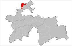 Location of Mastchoh District in Tajikistan | |
| Coordinates: 40°32′N 69°25′E / 40.533°N 69.417°E | |
| Country | |
| Region | Sughd Region |
| Capital | Buston |
| Area | |
| • Total | 1,000 km2 (400 sq mi) |
| Population (2020)[1] | |
| • Total | 128,400 |
| • Density | 130/km2 (330/sq mi) |
| Time zone | UTC+5 (TJT) |
Mastchoh District or Nohiya-i Mastchoh (Tajik: Ноҳияи Мастчоҳ, Nohiya‘i Mastçoh/Nohijaji Mastcoh) is a district in Sughd Region, Tajikistan. It is located at the extreme north of the country, between Ghafurov district and the border with Uzbekistan.[2] The district population is 128,400 (1 January 2020 est.)[1] and its administrative capital is Buston.
Administrative divisions
The district has an area of about 1,000 km2 (400 sq mi) and is divided administratively into three towns and four jamoats.[3] They are as follows:[4]
| Jamoat | Population (Jan. 2015)[4] |
|---|---|
| Buston (town) | 13,600[5] |
| Obshoron (town) | 3,100[5] |
| Sughdiyon (town) | 2,300[5] |
| Mastchoh | 21,929 |
| Navbahor | 13,388 |
| Obburdon | 37,104 |
| Paldorak | 20,837 |
References
- ^ a b "Population of the Republic of Tajikistan as of 1 January 2020" (PDF) (in Russian). Statistics office of Tajikistan. Retrieved 3 October 2020.
- ^ Republic of Tajikistan, map showing administrative division as of January 1, 2007, "Map Factory" Cartographic Press, Dushanbe
- ^ "Regions of the Republic of Tajikistan 2017" (PDF) (in Russian). Statistics office of Tajikistan. pp. 15–21. Retrieved 12 October 2020.
- ^ a b Jamoat-level basic indicators, United Nations Development Programme in Tajikistan, accessed 2 October 2020
- ^ a b c "Population of the Republic of Tajikistan as of 1 January 2015" (PDF) (in Russian). Statistics office of Tajikistan. Archived from the original (PDF) on 2 July 2015. Retrieved 2 October 2020.
Capital: Khujand | |||||||||||||||||||||||||
|  | ||||||||||||||||||||||||
|
| |||||||||||||||||||||||||
| |||||||||||||||||||||||||
This Tajikistan location article is a stub. You can help Wikipedia by expanding it. |