
Marrowbone, Kentucky | |
|---|---|
 Modern Woodmen lodge building on Kentucky Route 90 | |
 Marrowbone Location within the state of Kentucky  Marrowbone Marrowbone (the United States) | |
| Coordinates: 36°49′39″N 85°30′24″W / 36.82750°N 85.50667°W | |
| Country | United States |
| State | Kentucky |
| County | Cumberland |
| Area | |
| • Total | 1.29 sq mi (3.34 km2) |
| • Land | 1.27 sq mi (3.30 km2) |
| • Water | 0.01 sq mi (0.04 km2) |
| Elevation | 643 ft (196 m) |
| Population (2020) | |
| • Total | 147 |
| • Density | 115.38/sq mi (44.54/km2) |
| Time zone | UTC-6 (Central (CST)) |
| • Summer (DST) | UTC-5 (CDT) |
| ZIP codes | 42759 |
| FIPS code | 21-50124 |
| GNIS feature ID | 497558 |
Marrowbone is a census-designated place in Cumberland County, Kentucky, United States. As of the 2010 census it had a population of 217.[2] It has a post office, with the ZIP code of 42759.[3]
The Marrowbone Historic District, which includes three properties, is listed on the National Register of Historic Places.
YouTube Encyclopedic
-
1/3Views:3 2473371 696
-
I'm proud of being from Burkesville,Kentucky, KETTLE SCHOOL AND THE ALPINE VIEW
-
Eagles point Burkesville KY 1998
-
Beautiful aerial scenery - Bluegrass Region of Kentucky - Best Real Estate Agent in Kentucky
Transcription
Geography
It lies along Kentucky Route 90 west of the city of Burkesville, the county seat of Cumberland County.[4] Its elevation is 643 feet (196 m), and it is located at about (36.8288889, -85.5030556).[5]
Demographics
| Census | Pop. | Note | %± |
|---|---|---|---|
| 2020 | 147 | — | |
| U.S. Decennial Census[6] | |||
References
- ^ "2020 U.S. Gazetteer Files". United States Census Bureau. Retrieved March 18, 2022.
- ^ "Geographic Identifiers: 2010 Demographic Profile Data (G001): Marrowbone CDP, Kentucky". U.S. Census Bureau, American Factfinder. Archived from the original on February 12, 2020. Retrieved August 13, 2014.
- ^ Zip Code Lookup
- ^ Rand McNally. The Road Atlas '06. Chicago: Rand McNally, 2006, p. 42.
- ^ U.S. Geological Survey Geographic Names Information System: Marrowbone, Cumberland County, Kentucky, Geographic Names Information System, September 20, 1979. Accessed 2007-12-31.
- ^ "Census of Population and Housing". Census.gov. Retrieved June 4, 2016.
Municipalities and communities of Cumberland County, Kentucky, United States | ||
|---|---|---|
| City | 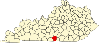 | |
| CDP | ||
| Other unincorporated communities | ||
This Cumberland County, Kentucky state location article is a stub. You can help Wikipedia by expanding it. |