
Marquette | |
|---|---|
 Marquette Location of Marquette in Manitoba | |
| Coordinates: 50°3′52″N 97°43′58″W / 50.06444°N 97.73278°W | |
| Country | |
| Province | |
| Region | Interlake Region |
| Census Division | No. 14 |
| Government | |
| • Governing Body | Rural Municipality of Woodlands Council |
| • MP | James Bezan |
| • MLA | Trevor King |
| Time zone | UTC−6 (CST) |
| • Summer (DST) | UTC−5 (CDT) |
| Postal Code | R0H 0V0 |
| Area code(s) | 204, 431 |
| NTS Map | 062I04 |
| GNBC Code | GAQFT |
| Website | http://www.rmwoodlands.info |
Marquette is an unincorporated community in the Rural Municipality of Woodlands in the Interlake Region of Manitoba, Canada. It is located approximately 46 kilometres (29 miles) northwest of Winnipeg.[1]
YouTube Encyclopedic
-
1/3Views:348383682
-
The End of an Era for Marquette
-
Neepawa Hwy 16, Manitoba Drive Through 2016
-
Gimli, Manitoba Drive Through 2016
Transcription
History
The post office opened in 1871 as Baie St. Paul, changed to Marquette in 1891. The community was first noted as Marquette Station in 1882, named for French-born Jesuit missionary Jacques Marquette.[2]
Climate
Marquette experiences a humid continental climate (Köppen Dfb[3]) with warm to hot summers and cold winters.
| Climate data for Marquette | |||||||||||||
|---|---|---|---|---|---|---|---|---|---|---|---|---|---|
| Month | Jan | Feb | Mar | Apr | May | Jun | Jul | Aug | Sep | Oct | Nov | Dec | Year |
| Record high °C (°F) | 8 (46) |
9.4 (48.9) |
17.2 (63.0) |
36.1 (97.0) |
37.8 (100.0) |
38 (100) |
35 (95) |
38.5 (101.3) |
37.5 (99.5) |
31 (88) |
23.9 (75.0) |
10.6 (51.1) |
38.5 (101.3) |
| Mean daily maximum °C (°F) | −12.6 (9.3) |
−8.1 (17.4) |
−0.9 (30.4) |
10.1 (50.2) |
19.3 (66.7) |
23.3 (73.9) |
25.6 (78.1) |
24.9 (76.8) |
18.5 (65.3) |
10.8 (51.4) |
−0.9 (30.4) |
−9.8 (14.4) |
8.4 (47.1) |
| Daily mean °C (°F) | −17.5 (0.5) |
−13.2 (8.2) |
−5.8 (21.6) |
4.1 (39.4) |
12.4 (54.3) |
17.1 (62.8) |
19.6 (67.3) |
18.6 (65.5) |
12.6 (54.7) |
5.6 (42.1) |
−4.9 (23.2) |
−14.3 (6.3) |
2.9 (37.2) |
| Mean daily minimum °C (°F) | −22.3 (−8.1) |
−18.2 (−0.8) |
−10.7 (12.7) |
−1.9 (28.6) |
5.5 (41.9) |
10.9 (51.6) |
13.5 (56.3) |
12.1 (53.8) |
6.7 (44.1) |
0.4 (32.7) |
−8.9 (16.0) |
−18.8 (−1.8) |
−2.6 (27.3) |
| Record low °C (°F) | −39.5 (−39.1) |
−41 (−42) |
−33.3 (−27.9) |
−27.8 (−18.0) |
−9 (16) |
−0.5 (31.1) |
2.8 (37.0) |
1.1 (34.0) |
−5 (23) |
−19 (−2) |
−35 (−31) |
−39.5 (−39.1) |
−41 (−42) |
| Average precipitation mm (inches) | 23.3 (0.92) |
18.3 (0.72) |
26.6 (1.05) |
32.7 (1.29) |
57.8 (2.28) |
87.3 (3.44) |
73.1 (2.88) |
70.5 (2.78) |
57 (2.2) |
39.1 (1.54) |
29.6 (1.17) |
23.5 (0.93) |
538.8 (21.21) |
| Source: Environment Canada[4] | |||||||||||||
Notable people
- Aganetha Dyck (born 1937), artist
References
- ^ "Geographical Names of Canada - Querying Distances". nrcan.gc.ca. October 24, 2011. Archived from the original on January 1, 2013. Retrieved October 30, 2012.
- ^ "Geographical Names of Manitoba" (PDF). Government of Manitoba. 2000. Retrieved August 28, 2021.
- ^ "Updated world map of the Köppen-Geiger climate classification" (PDF). University of Melbourne. Retrieved February 2, 2012.
- ^ Environment Canada Canadian Climate Normals 1971–2000, accessed 18 February 2014
Division No. 14, Manitoba (South Interlake) | ||
|---|---|---|
| Towns | 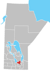 | |
| Rural municipalities | ||
| Unincorporated communities | ||
This Manitoba location article is a stub. You can help Wikipedia by expanding it. |