
Markham, Texas | |
|---|---|
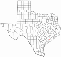 Location of Markham, Texas | |
 | |
| Coordinates: 28°57′46″N 96°03′52″W / 28.96278°N 96.06444°W[1] | |
| Country | United States |
| State | Texas |
| County | Matagorda |
| Area | |
| • Total | 2.3 sq mi (5.9 km2) |
| • Land | 2.3 sq mi (5.9 km2) |
| • Water | 0.0 sq mi (0.0 km2) |
| Elevation | 52 ft (16 m) |
| Population (2000) | |
| • Total | 1,138 |
| • Density | 497.5/sq mi (192.1/km2) |
| Time zone | UTC-6 (Central (CST)) |
| • Summer (DST) | UTC-5 (CDT) |
| ZIP code | 77456 |
| Area code | 979 |
| FIPS code | 48-46716[2] |
| GNIS feature ID | 2408182[1] |
Markham is a census-designated place (CDP) in Matagorda County, Texas, United States.[1] Named in 1903 for Charles H. Markham, a railroad engineer for Southern Pacific (and later President of the Illinois Central Railroad), the town was founded in 1901 as Cortes. In 1914, it was a designated stop on the Texas and New Orleans Railroad.
YouTube Encyclopedic
-
1/3Views:5307 5011 293
-
J. Nathan Kutz: "Coordinates, governing equations and limits of model discovery"
-
Embedded Recipes 2017 - Introduction to Yocto Project/OpenEmbedded - Mylène Josserand
-
pyjanitor: Clean APIs for Cleaning Data | SciPy 2019 | Eric Ma
Transcription
Geography
According to the United States Census Bureau, the CDP has a total area of 2.3 square miles (6.0 km2), all land. Markham lies southwest, approximately 90 miles or 1+1⁄2-hour drive to downtown Houston.
Demographics
As of the census[2] of 2000, there were 1,138 people, 386 households, and 306 families residing in the CDP. The population density was 497.5 inhabitants per square mile (192.1/km2). There were 446 housing units at an average density of 195.0 per square mile (75.3/km2). The racial makeup of the CDP was 79.88% White, 9.93% African American, 0.09% Native American, 0.09% Asian, 7.91% from other races, and 2.11% from two or more races. Hispanic or Latino of any race were 36.03% of the population.
There were 386 households, out of which 39.9% had children under the age of 18 living with them, 61.7% were married couples living together, 11.9% had a female householder with no husband present, and 20.7% were non-families. 17.9% of all households were made up of individuals, and 7.0% had someone living alone who was 65 years of age or older. The average household size was 2.95 and the average family size was 3.35.
In the CDP, the population was spread out, with 31.5% under the age of 18, 8.3% from 18 to 24, 27.4% from 25 to 44, 22.1% from 45 to 64, and 10.7% who were 65 years of age or older. The median age was 33 years. For every 100 females, there were 96.2 males. For every 100 females age 18 and over, there were 90.9 males.
The median income for a household in the CDP was $41,900, and the median income for a family was $49,792. Males had a median income of $32,391 versus $20,938 for females. The per capita income for the CDP was $17,302. About 7.6% of families and 11.4% of the population were below the poverty line, including 15.3% of those under age 18 and 19.7% of those age 65 or over.
Education
Markham is served by the Tidehaven Independent School District.
The designated community college for Tidehaven ISD is Wharton County Junior College.[3]
References
External links
- Markham, Texas from the Handbook of Texas Online
Municipalities and communities of Matagorda County, Texas, United States | ||
|---|---|---|
| Cities | 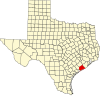 | |
| CDPs | ||
| Other communities | ||