
| Manu River | |
|---|---|
 | |
  | |
| Native name | মনু নদী (Bengali) |
| Location | |
| Countries | India and Bangladesh |
| State(s) | Tripura Sylhet |
| District(s) | Unakoti Moulvibazar |
| Cities | Kailashahar & Kumarghat (India) Moulvibazar (Bangladesh) |
| Physical characteristics | |
| Length | 167 km (104 mi) |
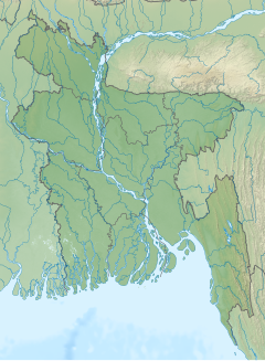
The Manu is an Indo-Bangladesh transboundary river that originates below the Kahosib Chura of the Shakhantang Mountains in the Indian state of Tripura, flowing north-east through Kumarghat and Kailasahar, and passes through the Moulvibazar district of Bangladesh to the Sylhet Plain,[1] later the Dholai River joins the Manu and then it flows northwest and meets the Kushiara Manumukh. It is 167 km (104 m) long, making it the longest river in Tripura.[2] It is located near the town of Manu.[3] The river has a width of 200 meters in the railway bridge area. The area of the basin is 500 square kilometres. The river flows throughout the year.[4]
YouTube Encyclopedic
-
1/3Views:1 6375 96313 840
-
TRIPURA RIVERS-II // TRIPURA GK// RIVERS OF TRIPURA// MANU RIVER// TPSC// TET
-
TRAVELLING BY RIVER MANU | RIVER IN BANGLADESH
-
GOMOTI RIVER DURING RAINY SEASON AT COMILLA IN BANGLADESH | বর্ষার গোমতী নদী, কুমিল্লা
Transcription
Legend
Some believe that a Hindu Shastrakar, Manu, used to worship Shiva on the banks of this river, hence the name of this river is Manu.[5]
See also
References
- ^ Md Mahbub Murshed (2012). "Manu River". In Sirajul Islam and Ahmed A. Jamal (ed.). Banglapedia: National Encyclopedia of Bangladesh (Second ed.). Asiatic Society of Bangladesh.
- ^ "Tripura Geography for the preparation of TPSC examinations..." tripuraexam.in. Retrieved 29 October 2020.
- ^ "Google Maps". Google Maps. Retrieved 16 June 2022.
- ^ Dr. Ashok Biswas, Rivers of Bangladesh, Gatidhara, Dhaka, February 2011, pp. 299-300.
- ^ Dr. Ashok Biswas, Rivers of Bangladesh, Gatidhara, Dhaka, February 2011, pp. 299-300.
External links
24°35′N 91°44′E / 24.583°N 91.733°E
This Sylhet Division location article is a stub. You can help Wikipedia by expanding it. |