
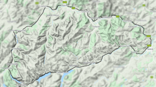
The Manor Hills, also known as the Tweedsmuir Hills, are a range of hills south of Peebles in the Scottish Borders, one of the ranges which collectively form the Southern Uplands. They are separated from the Moffat Hills by the Talla Reservoir, Megget Reservoir and St. Mary's Loch, the Moorfoot Hills by the A72 and the Culter Hills in South Lanarkshire by the A701. The western portion of the hills are designated as the 'Tweedsmuir Hills' Site of Special Scientific Interest and the 'Upper Tweeddale' National Scenic Area, with the major tributary rivers designated as Special Areas of Conservation.[1]
The Hills

A broad area, the higher hills could be said to generally split into three sections: those directly south of Peebles, those north of the Megget Reservoir and those southeast of Drumelzier. There is, however, a section of lower hills east of the B709 road as well as some isolated hills throughout. The highest point of the range is Broad Law, which is also the highest point in the historic county of Peeblesshire. The hills contain five Marilyns and thirteen Donalds, of which there is one Graham and one Corbett.[2]
In a roughly clockwise direction, the hills in the range over 2000 ft (excluding tops) are as follows:
| Summit | Height (m) | Listing[3] |
|---|---|---|
| Stob Law | 676 | Tu,Sim, D,GT,DN[4] |
| Glenrath Heights | 732 | Tu,Sim, D,GT,DN[5] |
| Dun Rig | 744 | Ma,Hu,Tu,Sim, G, D,DN,Y[6] |
| Birkscairn Hill | 661 | Tu,Sim, D,GT,DN[7] |
| Black Law | 698 | Hu,Tu,Sim, D,GT,DN,Y[8] |
| Greenside Law | 643 | Tu,Sim, D,GT,DN[9] |
| Dollar Law | 817 | Tu,Sim, D,CT,DN[10] |
| Cramalt Craig | 830 | Hu,Tu,Sim, D,sMa,CT,DN,Y,xC[11] |
| Broad Law | 840 | Ma,Hu,Tu,Sim, C, D,CoH,CoU,CoA,DN,Y,P600,P500[12] |
| Talla Cleuch Head | 691 | Tu,Sim, D,GT,DN[13] |
| Middle Hill | 717 | Tu,Sim, D,GT,DN[14] |
| Drumelzier Law | 668 | Tu,Sim, D,sHu,GT,DN[15] |
| Pykestone Hill | 737 | Hu,Tu,Sim, D,GT,DN,Y[16] |
Other Information
The Southern Upland Way passes through the eastern end of the range, coming close to the summit of Minch Moor; this is the second highest point of the route after the Lowther Hills.[17]
References
- ^ "SiteLink".
- ^ "The Donalds (Walkhighlands)". www.walkhighlands.co.uk.
- ^ Chris Crocker. "Database of British and Irish Hills: user guide". Hills-database.co.uk. Retrieved 23 April 2020.
- ^ "Mountain Search".
- ^ "Mountain Search".
- ^ "Mountain Search".
- ^ "Mountain Search".
- ^ "Mountain Search".
- ^ "Mountain Search".
- ^ "Mountain Search".
- ^ "Mountain Search".
- ^ "Mountain Search".
- ^ "Mountain Search".
- ^ "Mountain Search".
- ^ "Mountain Search".
- ^ "Mountain Search".
- ^ "Southern Upland Way 9: Traquair to Melrose".
55°34′36″N 3°11′46″W / 55.5767°N 3.1960°W
This Scottish location article is a stub. You can help Wikipedia by expanding it. |