
Mangalbare, Ilam
मंगलबारे | |
|---|---|
 Mangalbare, Ilam Location in Nepal  Mangalbare, Ilam Mangalbare, Ilam (Nepal) | |
| Coordinates: 26°57′N 87°50′E / 26.95°N 87.84°E | |
| Country | |
| Province | Province No. 1 |
| District | Ilam District |
| Government | |
| • Chair Person | Vim Lal Khanal |
| Population (1991) | |
| • Total | 5,593 |
| Time zone | UTC+5:45 (Nepal Time) |
| Postal code | 57307 |
| Area code | 027 |
Mangalbare is a town located in the Deumai municipality in Ilam District in the Province No. 1 of eastern Nepal. At the time of the 1991 Nepal census it had a population of 5,593 persons living in 1005 individual households.[1] Now, Mangalbare and dhuseni have become municipality combinedly & has been named as Deumai municipality. There are many beautiful places like Panitar, Gajurmukhi, Deumai river, Gufathumki, etc. People are engaged in Agriculture & some owns shop. Mangalbare bazaar is the hub centre for the neighbors like jitpur, dhuseni, Shantidanda, sangrumba, and Phuyatappa. This area is very fertile for the commercial crops such as cardamom, tea, ginger, as well as many horticultural commodities.Deumai Municipality Head office is located in Mangalbare.[2]
YouTube Encyclopedic
-
1/1Views:860
-
Betini Simsaar Urlabari 06 Mangalbare (बेतिनी सिमसार )
Transcription
References
- ^ "Nepal Census 2001". Nepal's Village Development Committees. Digital Himalaya. Archived from the original on 12 October 2008. Retrieved 17 September 2008.
- ^ "Deumai | Local Governance and Community Development Programme (LGCDP) - II". lgcdp.gov.np. Retrieved 2023-04-22.
External links
Headquarter: Ilam | ||
| Rural municipalities | 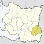 | |
| Municipalities | ||
This article about a location in Ilam District, Nepal is a stub. You can help Wikipedia by expanding it. |