
| Mala Bosna Little Bosna | |
|---|---|
 The Mala Bosna river flowing through Sarajevsko Polje | |
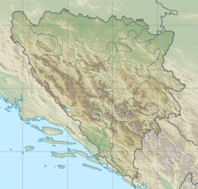
 Course of the Bosna (interactive map) | |
 | |
| Location | |
| Country | Bosnia and Herzegovina |
| Physical characteristics | |
| Source | Vrelo Bosne |
| • location | Igman, Ilidža, Bosnia and Herzegovina |
| • coordinates | 43°49′09″N 18°16′03″E / 43.819087008779974°N 18.267629784148387°E |
| • elevation | 520 m (1,710 ft);[1] (494.5 m (1,622 ft) a.s.l. according to an earlier source[2]) |
| Mouth | Sastavci confluence with the Željeznica river |
• location | Osjek (Ilidža), Bosnia and Herzegovina |
• coordinates | 43°50′22″N 18°17′13″E / 43.83935559520562°N 18.286950276020754°E |
• elevation | approx. 510 m (1,670 ft) |
| Length | 3.6 km (2.2 mi)[3] |
| Basin features | |
| Progression | Bosna→ Sava→ Danube→ Black Sea |
| Tributaries | |
| • right | Večerica |
The Mala Bosna river (transl. Little Bosna) is the river that runs through municipality of Ilidža at the outskirts of Sarajevo, Bosnia and Herzegovina. The Mala Bosna is a headwater course of the Bosna river. Its course is approximately 4 kilometers long and stretches between its source, Vrelo Bosne, and a confluence with its largest tributary in this section, the Željeznica.
Hydrology and sectioning

In terms of sectioning this whole area is the Upper Bosna, which is usually hydrologically regarded as a section between the river's source, Vrelo Bosne, and the mouth of the Lašva river, one of the major left tributaries, just upstream from Zenica. The section encompasses the entire region between Ilidža, near Sarajevo, and the Lašva, including the spacious valley between Ilijaš and Kakanj, with the Visoko region with its rich medieval heritage at the center of this area.
Vrelo Bosne springs
The Mala Bosna (or Bosna) source is the Vrelo Bosne spring, located at 520 m (1,710 ft) a.s.l.[1] (according to an earlier source, 494.5 m (1,622 ft) a.s.l.[2]) at the foothills of mount Igman, on the outskirts of Sarajevo, capital of Bosnia and Herzegovina.[1] The spring is one of Bosnia and Herzegovina's chief natural landmarks and tourist attractions.[4]
Course
The course of the river Bosna between its source and its largest tributary in this section, the Željeznica, which runs in from the right, is referred throughout of history, by locals and researchers alike, as the Mala Bosna (transl. Little Bosna), but the section is often extended all the way to its confluence with Miljacka, which also runs from the right some four kilometers downstream from Sastavci confluence with Željeznica.[5]
The Mala Bosna course is approximately 4 kilometers long and stretches between its source, Vrelo Bosne and a confluence with the Željeznica.[5] The confluence of two rivers is locally known as Sastavci (transl. confluence). After two rivers merge at the Sastavci the course becomes simply known as the Bosna River.
Tributaries
The Mala Bosna tributaries in the area before Sastavci confluence with the Željeznica, are the Večerica and Bukulaš, both fed by the strong well-springs of the Stojčevac.[6] In the area of extended Mala Bosna course (course after Sastavci, between the Željeznica and Miljacka), it further receives first the Željeznica from the right, then approx. 600 meters downstream the Zujevina, the only tributary from the left in this region, followed by the Dobrinja (a.k.a. Tilava) 1.5 km below, and then 2 km further downstream the Miljacka, both from the right.[5][6]
Gallery
-
 Vrelo Bosne, source of the river just outside Sarajevo
 -
 Mala Bosna river in Ilidža
 -
 Roman bridge over Mala Bosna river in Ilidža
See also
References
- ^ a b c PLAN UPRAVLJANJA SPOMENIKOM PRIRODE VRELO BOSNE 2020-2030 (PDF). p. 25. Retrieved 14 November 2023.
- ^ a b Aganović M. (1965). "Komparativna istraživanja režima ishrane, rasta, plodnosti i strukture populacija lipljena u rijekama Bosni i Plivi". Godišnjak - The Annual of the Institute of Biology. Institute of Biology - PMF University of Sarajevo. 18: 5. Retrieved 14 November 2023.
- ^ "Sava River Basin Analysis Report" (PDF). International Sava River Basin Commission. September 2009. p. 13. Archived from the original (PDF, 9.98 MB) on 2010-07-17.
- ^ PLAN UPRAVLJANJA SPOMENIKOM PRIRODE VRELO BOSNE 2020-2030 (PDF). pp. 9–53. Retrieved 14 November 2023.
- ^ a b c Aganović M. (1965). "Komparativna istraživanja režima ishrane, rasta, plod nosti i strukture populacija lipljena u rijekama Bosni i Plivi". Godišnjak - The Annual of the Institute of Biology. Institute of Biology - PMF University of Sarajevo. 18: 5, 6. Retrieved 14 November 2023.
- ^ a b The Geography of Bosnia and Herzegovina Between East and West. Springer. 2022. p. 373. ISBN 978-3-030-98522-6.
External links
- Rijeka Bosna / River Bosna - UG Bistro
