
Mafia District
Wilaya ya Mafia (Swahili) | |
|---|---|
   From top to bottom: Boat in Mafia District, Whale shark in Mafia Island Marine Park & Mangrove and gardens on Mafia Island | |
| Nickname: Home of the whale shark | |
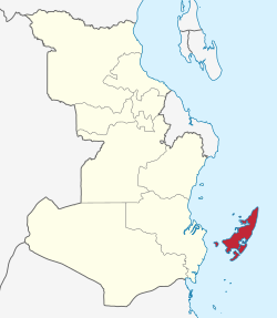 Mafia District in Pwani | |
| Coordinates: 5°3′31.68″S 38°51′8.28″E / 5.0588000°S 38.8523000°E | |
| Country | |
| Region | Pwani Region |
| Capital | Kilindoni |
| Area | |
| • Total | 642 km2 (248 sq mi) |
| • Rank | 6th in Pwani |
| Highest elevation (Ndagoni ward) | 232 m (761 ft) |
| Population (2012) | |
| • Total | 46,438 |
| • Rank | 6th in Pwani |
| • Density | 72/km2 (190/sq mi) |
| Ethnic groups | |
| • Settler | Swahili, Bajuni, Pokomo & Omani Arabs |
| • Native | Matumbi, Ndengereko & Rufiji |
| Time zone | UTC+3 (EAT) |
| Tanzanian Postcode | 617 |
| Website | Mafia District Council |
| Symbols of Tanzania | |
| Bird |  |
| Fish | |
| Mammal |  |
Mafia District Council (Swahili: Wilaya ya Mafia) is one of eight administrative districts of Pwani Region in Tanzania. It administers not only the main Mafia Island but the entire Mafia Archipelago. The District covers an area of 642.6 km2 (248.1 sq mi).[1] The Sea of Zanj completely encircles the District. Rufiji District is located on the other side of the Mafia Channel to the west. The district is comparable in size to the land area of Saint Lucia.[2] The town of Kilindoni serves as its administrative capital. The District is home to the largest concentration of Whale Sharks in Africa, Mafia Island Marine Park, Historic Chole Island Ruins, Kisimani Mafia and Kua Ruins; and Mlola Forest Reserve.[3][4] According to the 2012 Tanzania National Census, the population of the District was 46,438.[5]
YouTube Encyclopedic
-
1/3Views:8563 136546
-
Mafia Island from above.
-
Mafia Island Go Pro HD : Diving the best
-
MAFIA ISLAND DRONE MOVIE
Transcription
Administrative divisions
Mafia Island District was created in 1959 and contains 136 suburbs, 23 villages, 8 wards, and 2 divisions, North and South.[6]

The Mafia District is administratively divided into eight wards and twenty villages. Before 2010, Mafia District had seven wards, when Ndagoni Ward was created from the western part of Baleni Ward.
The wards listed with area and population:[7][8]
| Ward | Area km2 |
Population 2002 |
Population 2012 |
Division | Villages |
|---|---|---|---|---|---|
| Baleni | 132.1 | 9,137 | 5,870 | North | Baleni, Kungwi |
| Jibondo[9] | 21.9 | 3,405 | 3,729 | South | Jibondo, Chole, Juani |
| Kanga | 52.7 | 3,317 | 3,758 | North | Kanga, Bweni (Bueni) |
| Kiegeani | 40.3 | 3,379 | 4,094 | South | Kiegeani (Kiegani) (including Utende), Marimbani |
| Kilindoni | 36.8 | 11,696 | 14.221 | South | Kilindoni (including Bwejuu), Dongo |
| Kirongwe | 77.0 | 5,260 | 5,701 | North | Kirongwe, Jimbo (Jimba), Banja, Jojo |
| Miburani | 52.3 | 4,363 | 4,106 | South | Miburani, Mlongo, Chemuchemu (Chemchem) |
| Ngadoni | n/a[10] | n/a[10] | 4,959 | North | Ndagoni, Chunguruma |
| Mafia Island | 413 | 40,557 | 46,438 | 2 divisions | 20 villages |
Geography
The district is surrounded by the districts of Mkuranga on the northwestern part across the Mafia Channel, Rufiji and Kilwa of Lindi Region on the southwestern part, and the Indian Ocean on the eastern and southern parts. Mafia District has a total area of 972 km2, of which 407 km2 is made up of land and 565 km2 is water. In addition to Mafia Island, there are eight islands within Mafia District: Juani Island, Chole Island, Jibondo Island (Kibondo), Bwejuu Island, Shungumbili Island (Thanda), Barakuni Island, Miewi Island, and Niororo Island (Nyororo).[11]
The eastern side of Mafia is exposed to the full power of the Indian Ocean, and a 33 km outer fringing reef runs the whole length of the eastern seaboard and comprises Mafia, Jibondo, and Juani islands, with Kitutia Reef located at the southernmost point.[12]
Climate
Mafia Island has a hot and subhumid tropical climate that is affected by two monsoon winds and the East African Equatorial current, which flows north. While the southeast monsoon blows from June to October, the northeast monsoon blows from November to March. Between the varying monsoons, we may notice the prolonged rainfall. 1,900 mm of rain precipitation and 26.6 °C on average are the typical annual temperatures.[13]
Marine National Park
More than half of the Mafia Island Marine Park area, which covers an area of 822 km2, is located at a depth of less than 20 meters below mean tide levels. The vast area south of the bay bounded by Mafia, Jibondo, and Juani Islands, as well as other reef sections in south Bwejuu, make up the majority of the marine park. The region is home to a remarkable patchwork of tropical marine habitats, including mangrove swamps, coral reefs, and seagrass meadows. Additionally, it is home to a wide variety of fish and other excellent marine species. The park offers a home for two threatened species of sea turtles.[14]
The park also includes a portion of the lowland coastal forest that runs along the island's eastern shore. A total of 23,000 people live inside the park, spread across 14 communities that are entirely or partially located along the park's perimeter.[15]
History
The earliest inhabitants of Mafia Island are Bantu communities from the Matumbi, Ndengereko and the Rufiji from across the Mafia strait on the mainland. On Mafia Island, those who claim to be of Bantu ancestry, yet occasionally identify as Washirazi make up the largest group. This indicates their longstanding Muslim status and they claim to be descended from Persian immigrants who arrived on the East Coast about the tenth century A.D. However, in Mafia, these individuals frequently refer to themselves as "Wambwera" rather than "Washirazi." Wapokomo, who is claimed to have arrived in the community from northern Kenya during the Portuguese era, belongs to a second, considerably smaller category. Since the Wambwera and the Wapokomo have intermarried, a significant section of the population now considers themselves to be either one depending on the circumstances.[16]
First written records for of the island begin with various conquests ; The Swahili Sultanate of Kilwa (11th–15th century AD), then the Portuguese (16th–17th century AD), Oman Arabs (18th century AD), Germany (AD 1890–1915), and British (AD 1915–1922).[17]
The coastal civilizations of Swahili city-states were at their height during the twelfth and fifteenth centuries. Their kings and merchants constructed mosques, pillar tombs, and palaces, issued coins, and imported products from most of the known world, including Tang and Ming China. Africans and traders from other parts of the Indian Ocean, particularly the Persian Gulf region, coexisted in these settlements.[18]
Mafia Island had taken a leading role in the long-distance trade networks circling the Indian Ocean during the Swahili period. Following its absorption in the 11th century AD, the Mafia's connection to the sultanate of Kilwa expanded its role in commerce networks. The Kisimani Mafia was founded on the strength of Kilwa's power. Coins recovered at both Kisimani Mafia and Kua also demonstrate this. According to the discovery of Kilwa coins, Kisimani peaked during the 11th and 13th centuries AD. The Kilwa Chronicle also mentions that some of the first Kilwa sultan's sons made their way to Kisimani Mafia, a modern-day name for the island's southwest tip. The Mafia Island was taken over by the Portuguese when they came in the 16th century AD. To oversee and protect the trade connections with the far east of the island, they constructed a fort on the east coast.[19]
Since the Kilwa sultanate, colonial control has had a mixed impact on the history of the Mafia archipelago. The Islands' current sociopolitical situation has been mostly negatively affected by both German and British colonial rule.[20]
According to historian Revington, slaves of affluent people whose descendants now live in Kua and Kisimani Mafia were the main inhabitants of Mafia Island in the 17th century AD. The Madagascar-born Sakalava people "arrived with small canoes called 'laka' and captured many people" in the 18th century AD, raiding local treasuries of these small cities on Mafia Island. Despite the eventual release of the prisoners, Kua was never again conquered, and as a result of the attack, the sultan's capital was transferred to Chole Island.[21]

The Imams of Muscat took over control of Mafia in the beginning of the 18th century AD. This gained momentum when the Omani Sultan Seyyid Said moved his headquarters to Zanzibar and annexed the islands. Many of the settler Arabs moved to the southern region of Mafia during the Omani Arab colonial era, where they established extensive coconut plantations that were staffed by slave labor imported from the mainland. The original Mafia residents, who went by the names Wambwera or Washirazi, were driven into the northern region of the island, where the soil is better suited for sustaining crops than for coconuts.[22]
Mafia, which had been a part of the Sultan of Zanzibar's realm, joined German East Africa in 1890. The production of coconuts increased. To provide copra, which was widely used at the time in several procedures, and to have money with which to pay taxes, the Germans themselves developed sizable plantations and also mandated that all adult males grow at least fifty coconut trees.[23]
After the borders between Germany and the British Empire were established in 1890, Germans took control of the Mafia Island. The German government relocated from Chole to Kilindoni, the former Mafia capital, in 1912. British troops captured Mafia in 1915, and Tanganyika Territory received Mafia Island in 1922. More European-owned coconut plantations were created in the south of Mafia during the British era. After the enslaved were set free by the British colonizers in 1922, the Arab plantations went into decline.[24]

Archaeology
The oldest ruins are found in Kisimani Mafia, which is close to Kilindoni. The earliest strata of mosques, according to archaeologist Neville Chittick, who performed excavations there in the 1950s, date from about the tenth and eleventh centuries. However, many of them have since been washed into the sea. Coins from the thirteenth to the fifteenth century were discovered on Juani island by a second British archaeological expedition in the 1950s. Even though Kua is dated to that period by many archaeologists, others place it later.[25] The Tanzanian archaeologist Felix Chami has recently finished his work on the Mafia, pushing back the origins of the Swahili peoples of the coast and their connections to both the interior of Africa and the Indian Ocean. On Juani Island, he just finished a cave excavation.[26]
Etymology
The names of the archipelago have been up for debate among academics. depicted that in the late 19th century AD, the Mafia's major island was called "Chole Shamba" and its smaller island, " Chole Mjini". Following the sacking of Kua by the Sakalafa in the 18th century AD, Arab elites moved to the small island that came to be known as Chole Mjini and Chole Shamba, respectively. Some academics think that the name Mafia originated after the Portuguese arrived in the late 16th to early 17th century AD as a shortened version of their spelling of Monifiyeh.[27] Mafia is referred to as "Monfia" in the Kilwa Chronicles, and it appears to have been thus named and included in the realm of the first sultan of Kilwa, whose father, Ali bin Hassan, had dispatched his son to conquer the region around 1000 A.D. It is believed that the Portuguese, who later controlled the Indian Ocean, abbreviated the term to Mafia.[28]
Economy
Since ancient times, Mafia Island's economy was mixed but mostly agrarian, depending on both subsistence, fishing and commercial agricultural. Growing Coconuts, taro, dry and wet rice, cassava, beans, peas, corn, tomatoes, and other crops are more prevalent towards the north of the island, where there is more access to bushland. The majority of the southern side of the island is covered in coconut and cashew nut trees, the two longest-running cash crops for the Mafia. Direct exports to markets of Dar es Salaam are made for both the larger cashew nut crop and the smaller coconut crop. Both crops' prices have varied recently.[29] In 2012, unemployment in Mafia District was 1.5%.[30]
Tourism
Tourism on Mafia Island has grown quickly, with numerous small hotels being built, especially inside the Marine Park in Utende in the southeast corner of the island, in large part due to the presence of the Mafia Island Marine Park. The majority of visitors come to take advantage of the fantastic diving, snorkeling, fishing, and seeing the Whale shark.[31] Flights run by Auric Air may take passengers from Dar es Salaam to the island's Mafia Airport.[32] and Coastal Aviation.[33]
Sport fishing
The majority of sport fishing is done in Mafia island waters within 40 miles of the lodge, in places like Forbes bay. Kinassi Passes, Chole Bay, Rass Mkumbi, Fungu Sefu, Tunny Bay, Okuza Island of the Songosongo Archipelago, and Nyuni off Juani are a few places to mention. Off Sheikh Yusuf, off the Miewi Island, are Jibondo Gap and Kibondo Island. However, Tutia Reef was regarded to be the best fishing location.[34]
Rock cod (known in Kiswahili as Chewa), Epinephelus sp., dolphin fish (known in Kiswahili as Faloosi, Panje), wahoo, and kingfish (known in Kiswahili as Nguru, ngaziga) are some of the area's most well-known sports fish. Acanthocybium solandri (C.V.), Barracuda (Mzia, in Kiswahili), Sphyraena barracuda (Walbaum), Striped marlin (Nduaw in Kiswahili) and Sailfish (Mbassi, nsulinsah in Kiswahili) are some examples of fish found in the Mafian waters. Skipjack (Kiswahili name Sehewa), Yellowfin Tuna (Jodari, in Kiswahili), Caranx ignobilis (Karambesi,in Kiswahili), Caranx melampygus (Kole Kole ,in Kiswahili), Red snapper, and others.[35]
December through March is the best time of year to go sport fishing, especially for reef species. However, due to the north east monsoon's intense winds during most of January and part of February, late February is the safest time to go fishing. During the off-season, from May to August, only a few king fish might be seen. King fish come in great numbers from September to November, as the monsoon starts to shift back to the north.[36]
Demographics
The District had 46,438 residents as of the 2012 Tanzania National Census. [37] Mafia District has an adult literacy rate of 77.3%, primarily only in Swahili.[38] Historically, six cognatic descent groups on the island, who hold authority over practically all of the land, include the Wapokomo and the Wambwera. Many people belong to many groups and identify with various groups at various times and in various circumstances as a result of out-group marriage. However, the number of groups to which an individual can belong is constrained by preference kin marriage, which is marriage to a person with a common ancestry group. The remaining people are mostly made up of a few Wabajuni immigrants, a single Hadhrami Arab family, and a small number of descendants of slaves and ex-slaves who very infrequently intermarry with the 'freeborn' Wapokomo and Wambwera. These persons do not belong to the descending group.[39]
Historic Social Stratification of Mafia Island
The hierarchy in the village Minazini is a little more intricate. Because there are so few Arabs, who are Ibadhi Muslims rather than Sunni like most people in the Mafia Island, they hardly make up a significant group and have very little interaction with the other settlements. Instead, individuals deemed to be "most like Arabs muslims" i.e. with Islamic piety have the highest position in the social order. These include some Sharifs (descendants of the Prophet), immigrants known as the Wabajuni, who have long asserted their Arab origins, which are untrue, as well as the family of a Sheikh from Zanzibar who immigrated and intermarried with certain Wambwera.[40]
The 'pure' Wambwera, or those who tend not to intermarry with the Wapokomo, those of mixed Wambwera-Pokomo origin, and the 'pure' Wapokomo, in descending order, make up the intermediate ranks. The descendants of slaves are located at the bottom. The Wabajuni and the Sheikh's family members held practically all of the political power in the village, which I define as principally control over the Friday mosque and village council offices. These are the people who, as will be seen, have rejected the rituals that are the focus of this piece. I make an effort to link their rejection of the rituals to their attempts to stand out from the rest of the villagers and to maintain political power.[41]
References
- ^ "Tanzania: Coastal Zone(Districts and Wards) - Population Statistics, Charts and Map".
- ^ 616 km2 (238 sq mi) for Saint Lucia at "Area size comparison". Nation master. 2022. Retrieved 25 July 2023.
- ^ "field guide to common elamobrachs of East Africa". Retrieved 2023-09-03.
- ^ "The Effects of Deforestation in Mlola Forest Reserves, Mafia District, Tanzania". Retrieved 2023-09-03.
- ^ 2012 Census database Archived 2016-03-05 at the Wayback Machine
- ^ "The Effects of Deforestation in Mlola Forest Reserves, Mafia District, Tanzania". Retrieved 2023-09-03.
- ^ "Technical and Operation Report" (PDF). National Sample Census of Agriculture 2007/2008. National Bureau of Statistics (Tanzania). December 2011. pp. 75–76.
- ^ Administrator. "Policies". mca-t.go.tz. Archived from the original on 2012-04-25.
- ^ Note: Jibondo ward comprises smaller islands off the south coast of Mafia Island.
- ^ a b Note: The area and 2002 population of Ndagoni ward are included with the figures for Baleni ward, from which it was separated between the 2002 and 2012 Censuses.
- ^ "The Effects of Deforestation in Mlola Forest Reserves, Mafia District, Tanzania". Retrieved 2023-09-03.
- ^ "Mafia Island Underwater Heritage Survey 2012" (PDF). Retrieved 2023-09-03.
- ^ "Mafia Island Underwater Heritage Survey 2012" (PDF). Retrieved 2023-09-03.
- ^ "Mafia Island Underwater Heritage Survey 2012" (PDF). Retrieved 2023-09-03.
- ^ "Mafia Island Underwater Heritage Survey 2012" (PDF). Retrieved 2023-09-03.
- ^ Caplan, A. P. “Boys’ Circumcision and Girls’ Puberty Rites among the Swahili of Mafia Island, Tanzania.” Africa: Journal of the International African Institute, vol. 46, no. 1, 1976, pp. 21–33. JSTOR, https://doi.org/10.2307/1159090. Accessed 3 Sept. 2023.
- ^ "Mafia Island Underwater Heritage Survery 2012" (PDF). Retrieved 2023-09-03.
- ^ "Short History of Mafia Island". Retrieved 2023-09-03.
- ^ "Mafia Island Underwater Heritage Survey 2012" (PDF). Retrieved 2023-09-03.
- ^ "Mafia Island Underwater Heritage Survey 2012" (PDF). Retrieved 2023-09-03.
- ^ "Mafia Island Underwater Heritage Survey 2012" (PDF). Retrieved 2023-09-03.
- ^ "Short History of Mafia Island". Retrieved 2023-09-03.
- ^ "Short History of Mafia Island". Retrieved 2023-09-03.
- ^ "Mafia Island Underwater Heritage Survey 2012" (PDF). Retrieved 2023-09-03.
- ^ "Mafia Island Underwater Heritage Survey 2012" (PDF). Retrieved 2023-09-03.
- ^ "Mafia Island Underwater Heritage Survey 2012" (PDF). Retrieved 2023-09-03.
- ^ "Mafia Island Underwater Heritage Survey 2012" (PDF). Retrieved 2023-09-03.
- ^ "Mafia Island Underwater Heritage Survey 2012" (PDF). Retrieved 2023-09-03.
- ^ "Mafia Island Economy". Retrieved 2023-09-03.
- ^ Office of Chief Government Statistician 2016, p. 92
- ^ "Mafia Island Economy". Retrieved 2023-09-03.
- ^ "Auric Air". Auric Air Services Ltd. March 30, 2012. Retrieved March 30, 2012.
- ^ "Coastal Aviation". August 5, 2017.
- ^ Adibi, S. A. H., et al. "A study on the trend of sports fishery of Mafia Island (Tanzania) along the East African coast from 1961-1972." (1977).
- ^ Adibi, S. A. H., et al. "A study on the trend of sports fishery of Mafia Island (Tanzania) along the East African coast from 1961-1972." (1977).
- ^ Adibi, S. A. H., et al. "A study on the trend of sports fishery of Mafia Island (Tanzania) along the East African coast from 1961-1972." (1977).
- ^ "2012 Population and Housing Census" (PDF). Development Partners Group Tanzania. Retrieved 7 August 2023.
- ^ Office of Chief Government Statistician (2016). "Pwani Region: Basic Demographic and Socio-Economic Profile (2012 Population and Housing Census)". National Bureau of Statistics (Tanzania). p. 68–74. Archived from the original on 14 November 2017.
- ^ Caplan, A. P. “Boys’ Circumcision and Girls’ Puberty Rites among the Swahili of Mafia Island, Tanzania.” Africa: Journal of the International African Institute, vol. 46, no. 1, 1976, pp. 21–33. JSTOR, https://doi.org/10.2307/1159090. Accessed 3 Sept. 2023.
- ^ Caplan, A. P. “Boys’ Circumcision and Girls’ Puberty Rites among the Swahili of Mafia Island, Tanzania.” Africa: Journal of the International African Institute, vol. 46, no. 1, 1976, pp. 21–33. JSTOR, https://doi.org/10.2307/1159090. Accessed 3 Sept. 2023.
- ^ Caplan, A. P. “Boys’ Circumcision and Girls’ Puberty Rites among the Swahili of Mafia Island, Tanzania.” Africa: Journal of the International African Institute, vol. 46, no. 1, 1976, pp. 21–33. JSTOR, https://doi.org/10.2307/1159090. Accessed 3 Sept. 2023.