
Maevatanana II
Suberbieville | |
|---|---|
 Betsiboka Bridge, near Maevatanana | |
 Maevatanana II Location in Madagascar | |
| Coordinates: 16°57′S 46°50′E / 16.950°S 46.833°E | |
| Country | |
| Region | Betsiboka |
| District | Maevatanana |
| Elevation | 70 m (230 ft) |
| Population (2018 census) | |
| • Total | 16,000 |
| Time zone | UTC3 (EAT) |
| Postal code | 412 |
| Climate | Aw |
Maevatanana II is a rural municipality in Madagascar. It covers the villages around the town of Maevatanana and belongs to the district of Maevatanana, which is a part of Betsiboka Region. The population of the commune was estimated to be approximately 16,000 in 2001 commune census.[2]
Maevatanana II has a riverine harbour. Only primary schooling is available. The majority 80% of the population of the commune are farmers, while an additional 15% receives their livelihood from raising livestock. The most important crops are rice and tobacco, while other important agricultural products are peanuts and cassava. Additionally fishing employs 5% of the population.[2]
Infrastructure
- Route Nationale 4 from Antananarivo (329 km) to Mahajanga (249 km).
Rivers
Maevatanana lies between the Ikopa River & the Betsiboka River. Secondary rivers are the Menavava, Mandrava, Andriantoany, Nandronjia and the Isinko river.[3]
Mining
There are important gold mining operations near the town where 20 kgs of gold are extracted weekly.[4]
References
- ^ Estimated based on DEM data from Shuttle Radar Topography Mission
- ^ a b "ILO census data". Cornell University. 2002. Retrieved 2008-03-05.
- ^ L’ALIMENTATION EN EAU POTABLE DE LA VILLE DE MAEVATANANA
- ^ L’or, le mal malgache !
Capital: Maevatanana | ||
| Kandreho (7) - 411 | 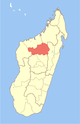 | |
| Maevatanana (20) - 412 | ||
| Tsaratanana (13) - 421 | ||
3 districts; 32 communes | ||
16°57′00″S 46°50′00″E / 16.95°S 46.8333°E
This Betsiboka location article is a stub. You can help Wikipedia by expanding it. |