
Mae La Noi
แม่ลาน้อย | |
|---|---|
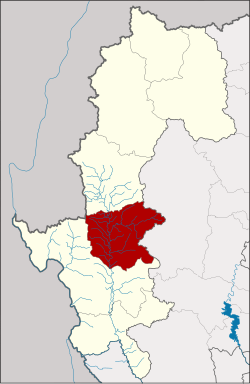 District location in Mae Hong Son province | |
| Coordinates: 18°23′4″N 97°56′13″E / 18.38444°N 97.93694°E | |
| Country | Thailand |
| Province | Mae Hong Son |
| Seat | Mae La Noi |
| Area | |
| • Total | 1,456.6 km2 (562.4 sq mi) |
| Population (2005) | |
| • Total | 34,126 |
| • Density | 23.4/km2 (61/sq mi) |
| Time zone | UTC+7 (ICT) |
| Postal code | 58120 |
| Geocode | 5805 |
Mae La Noi (Thai: แม่ลาน้อย, pronounced [mɛ̂ː lāː nɔ́ːj]) is a district (amphoe) in the southern part of Mae Hong Son province, northern Thailand.
History
The minor district (king amphoe) was created on 10 February 1967, consisting of the two tambons, Mae La Noi and Mae La Luang.[1] It was made a subordinate of Mae Sariang district, from which the tambon Mae La Noi was split off. Mae La Luang originally belonged to Khun Yuam district.[2] It was upgraded to a full district on 21 August 1975.[3]
Geography

Neighboring districts are (from southwest clockwise): Mae Sariang of Mae Hong Son Province, Kayah State of Myanmar, Khun Yuam of Mae Hong Son Province and Mae Chaem of Chiang Mai province.
The important rivers of Mae La Noi are the Yuam, Mae La Luang and Mae La Noi Rivers.
Administration
The district is divided into eight sub-districts (tambons), which are further subdivided into 69 villages (mubans). Mae La Noi is also a township (thesaban tambon) which covers parts of tambon Mae La Noi. There are eight tambon administrative organizations (TAO).
| No. | Name | Thai name | Villages | Pop. | |
|---|---|---|---|---|---|
| 1. | Mae La Noi | แม่ลาน้อย | 15 | 8,674 | |
| 2. | Mae La Luang | แม่ลาหลวง | 9 | 5,140 | |
| 3. | Tha Pha Pum | ท่าผาปุ้ม | 8 | 4,052 | |
| 4. | Mae Tho | แม่โถ | 8 | 3,456 | |
| 5. | Huai Hom | ห้วยห้อม | 9 | 4,346 | |
| 6. | Mae Na Chang | แม่นาจาง | 7 | 3,094 | |
| 7. | Santi Khiri | สันติคีรี | 8 | 2,669 | |
| 8. | Khun Mae La Noi | ขุนแม่ลาน้อย | 5 | 2,695 |
References
- ^ ประกาศกระทรวงมหาดไทย เรื่อง แบ่งท้องที่ตั้งเป็นกิ่งอำเภอ: แบ่งท้องที่อำเภอแม่สะเรียง ตั้งเป็น กิ่งอำเภอแม่ลาน้อย (PDF). Royal Gazette (in Thai). 84 (16 ง special issue): 4. 15 Feb 1967. Archived from the original (PDF) on May 4, 2012.
- ^ พระราชกฤษฎีกาเปลี่ยนแปลงเขตอำเภอขุนยวมและกิ่งอำเภอแม่ลาน้อย อำเภอแม่สะเรียง จังหวัดแม่ฮ่องสอน พ.ศ. ๒๕๑๐ (PDF). Royal Gazette (in Thai). 84 (114 ก special issue): 29–30. 23 Feb 1967. Archived from the original (PDF) on May 4, 2012.
- ^ พระราชกฤษฎีกาตั้งอำเภอแวงน้อย อำเภอป่าแดด อำเภอเรณูนคร อำเภอคูเมือง อำเภอคุระบุรี อำเภอแม่ลาน้อย อำเภอเสริมงาม อำเภอไพรบึง และอำเภอหนองโดน พ.ศ. ๒๕๑๘ (PDF). Royal Gazette (in Thai). 92 (166 ก special issue): 1–4. 21 Aug 1975. Archived from the original (PDF) on September 30, 2007.
External links
 Mae La Noi travel guide from Wikivoyage
- amphoe.com
This Mae Hong Son province location article is a stub. You can help Wikipedia by expanding it. |