
Mabalacat | |
|---|---|
| City of Mabalacat | |
     From top, left to right: Clark Freeport Zone Skyline, Nayong Pilipino at the Clark Freeport Zone, Sanctuario de San Angelo (Our Lady of Sorrows Parish), Dau Bus Terminal, City Hall | |
 Flag  Seal | |
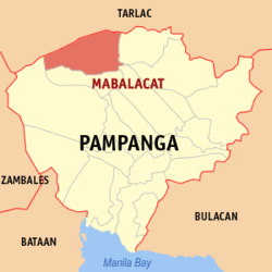 Map of Pampanga with Mabalacat highlighted | |
OpenStreetMap  | |
 Mabalacat Location within the Philippines | |
| Coordinates: 15°13′N 120°35′E / 15.22°N 120.58°E | |
| Country | Philippines |
| Region | Central Luzon |
| Province | Pampanga |
| District | 1st district |
| Founded | 1712 |
| Cityhood | July 21, 2012 |
| Barangays | 27 (see Barangays) |
| Government | |
| • Type | Sangguniang Panlungsod |
| • Mayor | Crisostomo C. Garbo |
| • Vice Mayor | Gerald Guttrie P. Aquino |
| • Representative | Carmelo B. Lazatin II |
| • Councilors | List
|
| • Electorate | 131,974 voters (2022) |
| Area | |
| • Total | 83.18 km2 (32.12 sq mi) |
| Elevation | 166 m (545 ft) |
| Highest elevation | 1,135 m (3,724 ft) |
| Lowest elevation | 5 m (16 ft) |
| Population (2020 census)[3] | |
| • Total | 293,244 |
| • Density | 3,500/km2 (9,100/sq mi) |
| • Households | 74,707 |
| Economy | |
| • Income class | 3rd city income class |
| • Poverty incidence | 4.40 |
| • Revenue | ₱ |
| • Assets | ₱ |
| • Expenditure | ₱ |
| • Liabilities | ₱ |
| Service provider | |
| • Electricity | Pampanga 2 Electric Cooperative (PELCO 2) |
| Time zone | UTC+8 (PST) |
| ZIP code | 2010, 2026 (Dau only), 2023 (portions under Clark Freeport and Special Economic Zone) |
| PSGC | |
| IDD : area code | +63 (0)45 |
| Native languages | Kapampangan Tagalog |
| Website | mabalacatcity |
Mabalacat, officially Mabalacat City[5] (Kapampangan: Lakanbalen/Ciudad ning Mabalacat; Filipino: Lungsod ng Mabalacat), is a 3rd class component city in the province of Pampanga, Philippines. According to the 2020 census, it has a population of 293,244 people.[3]
Mabalacat is in the urban core of Metro Clark,[6] also known as Metro Angeles, an urban area in Pampanga. This area is considered the industrial and residential heartland of Central Luzon.[7] Metro Clark is also identified as a regional center by the national government.[6]
YouTube Encyclopedic
-
1/2Views:5 1864 002
-
MALELDO 2024 GOOD FRIDAY, MABALACAT CITY
-
MALELDO 2024 WEDNESDAY IN MABALACAT CITY
Transcription
Etymology
Mabalacat's name was derived from indigenous Negrito word mabalacat meaning "forest of balacats", a species of tree that were prominent in the area.
History

Prior to 1712, Mabalacat was a barrio (barangay) of Bambang (now Bamban, Tarlac). It became a town in 1792, and was named after the abundant Balacat tree (Ziziphus talanai), a fourth class timber tree with bark that possess antimicrobial properties. Once a settlement of an Aeta tribe, the area was a virtual forest of balacat trees. "Ma-balacat" in the native Kapampangan language means "full of Balacats." Mabalacat in Maranao is "Mababaapalaqat" (Palacat), which means "maiksing hagdan" in Tagalog.
In 1853, Mabalacat had a population of 2,611 and four barangays, namely, Babangdapu, Duquit, Malabni, and Paglimbunan. By 1903 its population increased to 7,049 in 19 barangays. These were Bical, Bundagul, Dapdap, Dau, Dolores, Iba, Mabiga, Mamatitang, Mangalit, Matas, Mawaque, Paralayunan, Poblacion, Quitangil (later renamed to San Francisco), San Joaquin, Santa Ines, Santa Maria, Sapang Balen, and Sapang Biabas. In 1948, Mabalacat's barangays increased to 20 with the addition of Fort Stotsenburg.
In 1860, a military command was established by authorities of the Spanish Governor-General due to the lawlessness and depredations perpetrated by the negritos (Aetas, or derogatorily called balugas). The Pampanga towns of Bamban, Capas, Concepcion, Victoria, Tarlac, Magalang, Porac, and Floridablanca and Mabalacat were created into what was called a Commandancia Militar. However, in 1873, the Military Command returned Mabalacat together with the towns of Magalang, Floridablanca, and Porac to the parent province, Pampanga.
Cityhood
The former municipality was officially upgraded to a city following a referendum on July 21, 2012, and became the third in Pampanga after Angeles City and San Fernando. It is home to roughly most of the Clark Freeport Zone, the rest in nearby Angeles, where the main gate is located. Clark International Airport, as well as the numerous hotels, casinos, golf courses, and resorts in Clark Freeport, are mostly situated in Mabalacat.[8]
Geography
Mabalacat has a land area of 83.18 square kilometers (32.12 sq mi). It is 93 kilometers (58 mi) from Manila, 10 kilometers (6.2 mi) from Angeles, and 27 kilometers (17 mi) from the provincial capital, San Fernando.
The soil is charcoal black and shiny, a sign of fertility, and is suitable for growing rice, sugarcane and other rootcrops. Like the neighbouring cities of Angeles and San Fernando and the towns/municipalities of Porac, Bacolor, Santa Rita, Mexico, Magalang and Arayat, this city rarely gets inundated by floods from heavy rains and typhoons because it is situated on an elevated, well-drained part of the Central Luzon plains known as the "Upper Pampanga".
Barangays
Mabalacat is politically subdivided into 27 barangays. Each barangay consists of puroks and some have sitios.
- Atlu-Bola (San Isidro)
- Bical (San Roque)
- Bundagul (San Antonio)
- Cacutud (San Roque)
- Calumpang (San Jose Obrero)
- Camachiles (Inmaculada Concepcion)
- Dapdap (including Madapdap Resettlement: Santo Rosario)
- Dau (Center Business Downtown: San Isidro)
- Dolores (Virgen de Dolores)
- Duquit (San Jose)
- Lakandula (Virgen de Fatima)
- Mabiga (San Rafael Arkanghel)
- Macapagal Village (Inmaculada Concepcion)
- Mamatitang (San Roque)
- Mangalit (San Jose Obrero)
- Marcos Village (San Martin de Porres)
- Mawaque (Sta. Teresita)
- Paralayunan (San Antonio)
- Poblacion (Virgen de Gracia)
- San Francisco (San Francisco de Assisi)
- San Joaquin (San Joaquin y Sta. Ana)
- Santa Ines (Sta. Ines de Roma)
- Santa Maria (Sta. Maria Magdalena)
- Santo Rosario (Virgen Santo Rosario)
- Sapang Balen (San Carlos Borromeo)
- Sapang Biabas (including Mauaque Resettlement: San Vicente Ferrer)
- Tabun (San Isidro)
The largest barangay is Dau, which became a barrio in 1936 by virtue of Presidential Proclamation No. 1. It is now a business center whose commercial output runs parallel to that of downtown. A former terminus of the North Luzon Expressway, it is the most urban and most populous area in Mabalacat, home to roughly 23% of the city's population.
San Francisco, the second largest barangay, along with San Joaquin, Santa Ines, Poblacion, Calumpang and other barangays are categorized as urban in view of their proximity to the city proper. Sapang Balen, with a population of 166 persons, is the smallest barangay.
Climate
| Climate data for Mabalacat 1997–2020 | |||||||||||||
|---|---|---|---|---|---|---|---|---|---|---|---|---|---|
| Month | Jan | Feb | Mar | Apr | May | Jun | Jul | Aug | Sep | Oct | Nov | Dec | Year |
| Record high °C (°F) | 33.5 (92.3) |
34.9 (94.8) |
36.5 (97.7) |
37.1 (98.8) |
38.3 (100.9) |
37.5 (99.5) |
36.0 (96.8) |
35.4 (95.7) |
35.1 (95.2) |
34.2 (93.6) |
34.0 (93.2) |
34.0 (93.2) |
38.3 (100.9) |
| Mean daily maximum °C (°F) | 30.0 (86.0) |
30.9 (87.6) |
32.5 (90.5) |
34.0 (93.2) |
33.3 (91.9) |
31.9 (89.4) |
30.8 (87.4) |
30.3 (86.5) |
30.8 (87.4) |
31.2 (88.2) |
31.1 (88.0) |
30.4 (86.7) |
31.4 (88.5) |
| Daily mean °C (°F) | 25.5 (77.9) |
26.0 (78.8) |
27.5 (81.5) |
28.9 (84.0) |
28.8 (83.8) |
28.0 (82.4) |
27.3 (81.1) |
27.0 (80.6) |
27.2 (81.0) |
27.3 (81.1) |
27.0 (80.6) |
26.3 (79.3) |
27.2 (81.0) |
| Mean daily minimum °C (°F) | 21.0 (69.8) |
21.1 (70.0) |
22.4 (72.3) |
23.8 (74.8) |
24.4 (75.9) |
24.1 (75.4) |
23.7 (74.7) |
23.7 (74.7) |
23.6 (74.5) |
23.4 (74.1) |
23.0 (73.4) |
22.1 (71.8) |
23.0 (73.4) |
| Record low °C (°F) | 15.8 (60.4) |
16.9 (62.4) |
17.9 (64.2) |
19.5 (67.1) |
19.8 (67.6) |
20.8 (69.4) |
21.1 (70.0) |
21.7 (71.1) |
20.0 (68.0) |
18.1 (64.6) |
17.4 (63.3) |
17.0 (62.6) |
15.8 (60.4) |
| Average rainfall mm (inches) | 13.6 (0.54) |
16.3 (0.64) |
52.5 (2.07) |
60.6 (2.39) |
196.1 (7.72) |
254.1 (10.00) |
514.6 (20.26) |
695.1 (27.37) |
305.5 (12.03) |
201.6 (7.94) |
97.0 (3.82) |
47.5 (1.87) |
2,454.5 (96.63) |
| Average rainy days (≥ 1.0 mm) | 3 | 3 | 3 | 5 | 13 | 16 | 20 | 22 | 18 | 11 | 7 | 5 | 126 |
| Average relative humidity (%) | 70 | 68 | 66 | 65 | 74 | 80 | 84 | 86 | 84 | 78 | 75 | 73 | 75 |
| Source: PAGASA[9][10] | |||||||||||||
Demographics
|
| |||||||||||||||||||||||||||||||||||||||||||||||||||
| Source: Philippine Statistics Authority[11][12][13][14] | ||||||||||||||||||||||||||||||||||||||||||||||||||||
Economy

Mabalacat has an average annual income of ₱504,149,053.16 as of 2011 derived mostly from municipal license fees, land tax, Internal Revenue allotment, roads and bridges fund. In 1997, there were 2,447 business establishments registered in the Mabalacat City, consisting of 79 manufacturers mostly involved in sash factory, iron works, ceramics, bakery and 1,806 trading companies. The financial needs are served by eleven banks, mostly concentrated in Dau.
Public utilities include the Mabalacat Water System, Pampanga Electric Cooperative II (PELCO II), three telephone companies namely, Datelcom Corporation (DATELCOM), Smart Communications (SMART) and Digital Telecommunications Philippines, Incorporated (DIGITEL) and one cable television network (PRO-SAT) which runs solely for Mabalacat.

The city is also a major transportation hub; a number of major road networks including the North Luzon Expressway, Subic–Clark–Tarlac Expressway, and MacArthur Highway cut across the region. At the southern part of the city is the Dau Bus Terminal, which caters to passengers bound for Metro Manila and provinces in Northern Luzon such as Tarlac, Pangasinan, Ilocos Norte, Ilocos Sur, Nueva Ecija, La Union, Bataan, Baguio, and Zambales.
Government
Local government
Mabalacat City Government is composed of a Mayor as a Chief Executive and Sangguniang Panlungsod headed by the City Vice Mayor and 10 Sangguniang Panlungsod members with 3 ex-officio.
The following are the elected officials of Mabalacat City who assumed office on the noon of June 30, 2022 (except for the Ex-Officio members)
Ex-Officio Members:
- ABC President Rey Pineda (since December 18, 2023)
- SK President Paul Andre Tiongco (since November 14, 2023)
- Ruvielane S. Margarito
During the 2022 Presidential and Local Elections, Garbo's ticket under the Nationalists People's Coalition (NPC) gain a historic victory by a landslide on both Mayoral and Vice-Mayoral race together with the entire slate making it the first ever ticket in Mabalacat to win 10 out of 10 seats in the City Council of Mabalacat.[22]
City Fiesta

Legend tells us that when the early settlers were clearing the forests, Cabezang Laureana's workers found, hidden among the bushes, a statue of the Blessed Virgin Mary with baby Jesus sitting on her lap. On February 2, the statue was presented by Caragan as a gift to Padre Maximo Manuguid, the priest of the early Mabalacat Church that was made of sawali and cogon grass. From then on, the city fiesta was observed on the second of February.
The old town hall was named Tabnuan: Mabalacat Cultural Center, or museum of arts, cultural displays and exhibits. It opened on February 28, 2024, the city’s Balacat Festival.[23]
Pastorella
The pastorella (Misa de Pastores in honor of the shepherds at the birth of Jesus Christ - a set of Latin hymns of the 9-day Christmas Masses) ceased in Pampanga towns for 40 years after Vatican II.
In Mabalacat, however, at Our Lady of Divine Grace Parish, pastorella lives on: In the 4:30 a.m. mass on Monday, the pastorella repertoire includes the Kyrie (Lord, Have Mercy), Gloria (Glory to God in the Highest), Credo (Nicene Creed), Sanctus (Holy) and Agnus Dei (Lamb of God). The hymns are in Latin, except for Kyrie, which is in Greek."[24]
Parishes
- Our Lady of Grace Parish (Poblacion, Mabalacat City, Pampanga)
- Our Lady of Victories Parish (Dau, Mabalacat City, Pampanga)
- San Rafael Arkanghel Parish (Mabiga, Mabalacat City, Pampanga)
- San Lorenzo Ruiz Parish (Dau Access Road, Mabalacat City, Pampanga)
- Parish of the Lord's Resurrection (Madapdap Resettlement, Dapdap, Mabalacat City, Pampanga)
- Parish of Christ the Prince of Peace (Mauaque Resettlement, Sapang Biabas, Mabalacat City, Pampanga)
- Our Lady of Sorrows Parish (Xevera, Tabun, Mabalacat City, Pampanga)
Education

There are 31 educational institutions in Mabalacat: one state college, one private college, one technical training school, two secondary public, two private high schools and 25 public elementary schools divided into two districts, Mabalacat North and Mabalacat South. Technical Education and Skills Development Authority (TESDA) accredited institutions offering vocational-technical skills abound in the area.
State University
The University of the Philippines - Diliman Extension Program in Pampanga (Clark) is located in a portion of Clark Freeport Zone that is located in Mabalacat City. It offers undergraduate courses such as BA Applied Psychology, BA Business Economics and BS Business Management. It also offers a non-thesis graduate course, Master in Management (MM) (University of the Philippines Diliman - Extension Program in Pampanga, 2020).
Private schools

Private schools in Mabalacat listed with the Department of Education are Livingstone International School, Athena's Cradle Center, Inc., Brightstone Learning Center, Children of Fatima School, Inc., Christian Vision Academy Madapdap, Dee Hwa Liong College Foundation, Don Bosco Academy Pampanga (originally from Bacolor; moved to Mabalacat after lahar struck the old campus), Don Teodoro V. Santos Institute, Doña Asuncion Lee Integrated School, Great Shepherd Christian Academy, Immanuel Montessori School, Inc., Clark College of Science and Technology, Jose C. Feliciano College, Mabalacat Christian Academy, Mary Help of Christians School, Inc., Montessori School of St. Nicholas, Nehemiah Christian School, Inc., School of the Infant Jesus the Empowered Zone for Excellence in Education, Inc. Dau, Shield of Victory Christian School, St. Anthony College of Technology, St. Mutien College, and Divine Grace Academy, FDSA Aviation College of Science and Technology Inc.
Listed with and accredited by TESDA is the Asian Institute of Computer Studies (AICS), a private technical school offering I.T. courses.
Gallery
-
 Entering Mabalacat
 -
 Parish of Christ the Prince of Peace, located at Mauaque Resettlement, Sapang Biabas
 -
 Mabalacat welcome arch
 -
 Robinsons Supermarket
References
- ^ City of Mabalacat | (DILG)
- ^ "2015 Census of Population, Report No. 3 – Population, Land Area, and Population Density" (PDF). Philippine Statistics Authority. Quezon City, Philippines. August 2016. ISSN 0117-1453. Archived (PDF) from the original on May 25, 2021. Retrieved July 16, 2021.
- ^ a b Census of Population (2020). "Region III (Central Luzon)". Total Population by Province, City, Municipality and Barangay. Philippine Statistics Authority. Retrieved July 8, 2021.
- ^ "PSA Releases the 2018 Municipal and City Level Poverty Estimates". Philippine Statistics Authority. December 15, 2021. Retrieved January 22, 2022.
- ^ "Republic Act No. 10164" (PDF). Official Gazette. Presidential Communications Office. Retrieved July 1, 2023.
- ^ a b "Philippine Development Plan 2015-2022" (PDF). National Economic Development Authority. Retrieved November 21, 2023.
- ^ http://rdc.rdc2.gov.ph/images/pdf/lsdf.pdf. Retrieved November 21, 2023.
{{cite web}}: Missing or empty|title=(help) - ^ "Business Establishments". Archived from the original on March 23, 2014.
- ^ "Clark International Airport Pampanga Climatological Normal Values" (PDF). Philippine Atmospheric, Geophysical and Astronomical Services Administration. Archived from the original (PDF) on March 2, 2022. Retrieved June 24, 2022.
- ^ "Clark International Airport Pampanga Climatological Extremes" (PDF). Philippine Atmospheric, Geophysical and Astronomical Services Administration. Archived from the original (PDF) on March 7, 2022. Retrieved June 24, 2022.
- ^ Census of Population (2015). "Region III (Central Luzon)". Total Population by Province, City, Municipality and Barangay. Philippine Statistics Authority. Retrieved June 20, 2016.
- ^ Census of Population and Housing (2010). "Region III (Central Luzon)" (PDF). Total Population by Province, City, Municipality and Barangay. National Statistics Office. Retrieved June 29, 2016.
- ^ Censuses of Population (1903–2007). "Region III (Central Luzon)". Table 1. Population Enumerated in Various Censuses by Province/Highly Urbanized City: 1903 to 2007. National Statistics Office.
{{cite encyclopedia}}: CS1 maint: numeric names: authors list (link) - ^ "Province of Pampanga". Municipality Population Data. Local Water Utilities Administration Research Division. Retrieved December 17, 2016.
- ^ "Poverty incidence (PI):". Philippine Statistics Authority. Retrieved December 28, 2020.
- ^ "Estimation of Local Poverty in the Philippines" (PDF). Philippine Statistics Authority. November 29, 2005.
- ^ "2003 City and Municipal Level Poverty Estimates" (PDF). Philippine Statistics Authority. March 23, 2009.
- ^ "City and Municipal Level Poverty Estimates; 2006 and 2009" (PDF). Philippine Statistics Authority. August 3, 2012.
- ^ "2012 Municipal and City Level Poverty Estimates" (PDF). Philippine Statistics Authority. May 31, 2016.
- ^ "Municipal and City Level Small Area Poverty Estimates; 2009, 2012 and 2015". Philippine Statistics Authority. July 10, 2019.
- ^ "PSA Releases the 2018 Municipal and City Level Poverty Estimates". Philippine Statistics Authority. December 15, 2021. Retrieved January 22, 2022.
- ^ Cayabyab, Charlene A. (May 10, 2022). "Team MCG scores big win in Mabalacat City". www.sunstar.com. SunStar Publishing Inc. Retrieved July 20, 2023.
- ^ Cayabyab, Charlene (February 23, 2024). "Old municipio to reopen as Mabalacat City arts center". SunStar Cebu. Retrieved February 28, 2024.
- ^ Inquirer.net, Latin hymns sung in masses in Pampanga Archived April 23, 2009, at the Wayback Machine
External links
- Philippine Standard Geographic Code
- Philippine Census Information
- Local Governance Performance Management System
Places adjacent to Mabalacat | ||||||||||||||||
|---|---|---|---|---|---|---|---|---|---|---|---|---|---|---|---|---|
| ||||||||||||||||
