
M'sila
المسيلة | |
|---|---|
 Overview of M'sila | |
 | |
 M'sila | |
| Coordinates: 35°42′7″N 4°32′49″E / 35.70194°N 4.54694°E | |
| Country | |
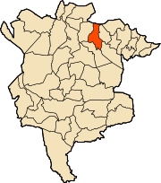
| Province | M'Sila Province |
| District | M'Sila District |
| Elevation | 471 m (1,545 ft) |
| Population (2008 census) | |
| • Total | 132,975 |
| Time zone | UTC+1 (CET) |
M'sila (also spelled Msila) (Arabic: المسيلة); is the capital of M'Sila Province, Algeria, and is co-extensive with M'sila District. It has a population of 132,975 as per the 2008 census.[1] M'sila University is also located in this city.
YouTube Encyclopedic
-
1/3Views:5937 3281 007
-
"M'SILA" Top 1 Tourist Place | M'Sila Tourism | ALGERIA
-
M'sila MERVEILLEUX PAYSAGES ET HISTOIRES (مسيلة (الجزائر
-
Histoire ancienne de M'sila - Emission Patrimunium - 17 mars 2018
Transcription
History
The city was founded c. 924 under the name al-Muhammadiya, named after the second Fatimid caliph, al-Qa'im, during the latter's campaign against the rebellious Berber tribes of central Algeria. Meant to cement Fatimid control over the Hodna plain, the construction of the city was entrusted to Ali ibn Hamdun al-Andalusi, who became its first governor. Much building material for the new city was taken from a nearby ruined Roman city (likely Lambaesis or Timgad).[2]
M'sila was the location of the first village constructed as part of a government-run program to transition nomadic Algerians to sedentary life using local materials. The village, now complete, was dubbed Maader and consists of houses, public and trading areas, and a mosque. Today it is much more developed with many companies, business offices, religious centers and schools.
Geography
Climate
M'sila has a cold semi-arid climate (Köppen climate classification BSk). Rainfall is higher in winter than in summer. The average annual temperature in M'Sila is 15.8 °C (60.4 °F). About 229 mm (9.02 in) of precipitation falls annually.
| Climate data for M'Sila | |||||||||||||
|---|---|---|---|---|---|---|---|---|---|---|---|---|---|
| Month | Jan | Feb | Mar | Apr | May | Jun | Jul | Aug | Sep | Oct | Nov | Dec | Year |
| Mean daily maximum °C (°F) | 12.8 (55.0) |
13.9 (57.0) |
16.5 (61.7) |
19.6 (67.3) |
23.0 (73.4) |
27.1 (80.8) |
30.7 (87.3) |
30.7 (87.3) |
27.1 (80.8) |
22.3 (72.1) |
17.3 (63.1) |
14.1 (57.4) |
21.3 (70.3) |
| Mean daily minimum °C (°F) | 4.1 (39.4) |
4.6 (40.3) |
6.3 (43.3) |
8.1 (46.6) |
11.0 (51.8) |
14.7 (58.5) |
17.2 (63.0) |
17.4 (63.3) |
15.7 (60.3) |
11.9 (53.4) |
8.2 (46.8) |
5.3 (41.5) |
10.4 (50.7) |
| Average precipitation mm (inches) | 25 (1.0) |
15 (0.6) |
25 (1.0) |
17 (0.7) |
26 (1.0) |
12 (0.5) |
5 (0.2) |
5 (0.2) |
21 (0.8) |
22 (0.9) |
34 (1.3) |
22 (0.9) |
229 (9.0) |
| Source: Climate-Data.org,Climate data | |||||||||||||
Economy
M'sila is primarily known for its farming and small business.
References
- ^ "Algeria: Provinces & Major Cities - Population Statistics, Maps, Charts, Weather and Web Information".
- ^ Halm, Heinz (1991). Das Reich des Mahdi: Der Aufstieg der Fatimiden [The Empire of the Mahdi: The Rise of the Fatimids] (in German). Munich: C. H. Beck. p. 242. ISBN 978-3-406-35497-7.
External links
- Encycloepaedia of the Orient-a brief description of M'Sila, focusing on its capital
- BBC - a news article about some recent violence in M'Sila
- Archnet - focuses on the Maader village project
- Wetlands International - an in-depth description of M'Sila's wetland
35°42′07″N 4°32′50″E / 35.70194°N 4.54722°E


| International | |
|---|---|
| National | |
This article about a location in M'Sila Province is a stub. You can help Wikipedia by expanding it. |