51°53′56″N 0°28′44″W / 51.899°N 0.479°W

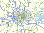
The Luton/Dunstable urban area, according to the Office for National Statistics, is the conurbation (continuous built up area) including the settlements of Luton, Dunstable and Houghton Regis, in Bedfordshire, East of England.
Despite straddling district boundaries the conurbation shares many facilities including an integrated bus service and the large Luton and Dunstable University Hospital. The conurbation is located in the southern part of the ceremonial county of Bedfordshire, England, and includes the unitary authority of Luton, and part of Central Bedfordshire. The current population (2021 census) is 286,803.[1] This is an increase of 9% from the 2011 population of 258,018.
YouTube Encyclopedic
-
1/5Views:4 439 7901 087 0541 4055165 127
-
The Luton Double Murders (Murder Investigation Documentary) | Real Stories
-
Top 10 Worst Places to Live in England
-
How To Pronounce Luton - Pronunciation Academy
-
Luton Busway - Dirty Wrightbus
-
Historic Four Carriage LNER 'Quad-Art' Trainset In Action At The North Norfolk Railway.
Transcription
Future growth
The area is expected to grow due to development within and physical expansion of the three towns and large re-development of Luton, including redevelopment of the former Vauxhall Motors factory complex.
The Luton & Dunstable urban area is considered part of the Milton Keynes and South Midlands Sub Region, part of the East of England. the East of England Regional Spatial Strategy has outlined the identified the urban area for growth, as part of the Sustainable Communities Plan. It is also considered part of the London Commuter Belt.[2][3]
References
- ^ "Luton/Dunstable Urban Area: human settlement in United Kingdom". Retrieved 27 March 2023.
- ^ "British urban pattern: population data" (PDF). ESPON project 1.4.3 Study on Urban Functions. European Spatial Planning Observation Network. March 2007. p. 119. Archived from the original (pdf) on 24 September 2015. Retrieved 22 February 2010.
- ^ "World Gazetteer: London – largest cities (Per geographical entity)". world-gazetteer.com. Archived from the original on 9 February 2013. Retrieved 2 February 2022.
External links
- Luton population (PDF; archived)


