
| Lungmu Lake | |
|---|---|
 Sentinel-2 image (2021) | |
 Lungmu Lake | |
| Location | Rutog County, Ngari Prefecture, Tibet Autonomous Region, China |
| Coordinates | 34°36′52″N 80°27′36″E / 34.61444°N 80.46000°E |
| Lake type | Salt lake |
| Catchment area | 570 km2 (200 sq mi) |
| Basin countries | China |
| Max. length | 17.2 km (11 mi) |
| Max. width | 9.1 km (6 mi) |
| Surface area | 97 km2 (0 sq mi) |
| Average depth | 1 m (3 ft) |
| Surface elevation | 5,002 m (16,411 ft) |
| References | [1] |
Lungmu (Tibetan: ལུང་མུ་མཚོ, Wylie: lung mu mtsho; Chinese: 龙木错; pinyin: Lóngmù Cuò), also Longmu, Longmu Co or Longmucuo, is a glacial lake in Rutog County in the Ngari Prefecture in the northwest of the Tibet Autonomous Region of China. It was explored in 1989 in a Sino-French expedition to western Tibet.[2]
Climate
| Climate data for Longmu Lake | |||||||||||||
|---|---|---|---|---|---|---|---|---|---|---|---|---|---|
| Month | Jan | Feb | Mar | Apr | May | Jun | Jul | Aug | Sep | Oct | Nov | Dec | Year |
| Mean daily maximum °C (°F) | −12.4 (9.7) |
−10.3 (13.5) |
−5.5 (22.1) |
0.8 (33.4) |
5.7 (42.3) |
11.6 (52.9) |
15.4 (59.7) |
14.9 (58.8) |
10.4 (50.7) |
2.6 (36.7) |
−4.3 (24.3) |
−9.5 (14.9) |
1.6 (34.9) |
| Daily mean °C (°F) | −19.4 (−2.9) |
−16.9 (1.6) |
−11.9 (10.6) |
−5.9 (21.4) |
−1.5 (29.3) |
4.1 (39.4) |
8.1 (46.6) |
7.8 (46.0) |
2.8 (37.0) |
−5.3 (22.5) |
−12.1 (10.2) |
−17.0 (1.4) |
−5.6 (21.9) |
| Mean daily minimum °C (°F) | −26.3 (−15.3) |
−23.5 (−10.3) |
−18.2 (−0.8) |
−12.6 (9.3) |
−8.6 (16.5) |
−3.3 (26.1) |
0.9 (33.6) |
0.7 (33.3) |
−4.7 (23.5) |
−13.2 (8.2) |
−19.8 (−3.6) |
−24.4 (−11.9) |
−12.7 (9.1) |
| Average precipitation mm (inches) | 1 (0.0) |
1 (0.0) |
1 (0.0) |
2 (0.1) |
4 (0.2) |
4 (0.2) |
11 (0.4) |
16 (0.6) |
3 (0.1) |
1 (0.0) |
1 (0.0) |
2 (0.1) |
47 (1.7) |
| Source: Climate-Data.org | |||||||||||||
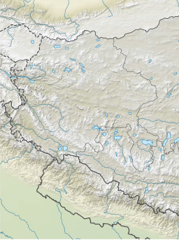
Map gallery

Notes
- ^ From map: "THE DELINEATION OF INTERNATIONAL BOUNDARIES ON THIS MAP MUST NOT BE CONSIDERED AUTHORITATIVE."
References
- ^ Sumin, Wang; Hongshen, Dou (1998). Lakes in China. Beijing: Science Press. p. 417. ISBN 978-7-03-006706-7.
- ^ Fontes, J.Ch (1993). "Table isotope and radiocarbon balances of two Tibetan lakes (Sumxi Co, Longmu Co) from 13,000 BP". Quaternary Science Reviews. 12 (10): 875–887. doi:10.1016/0277-3791(93)90026-I.
| County-level divisions |  | |
|---|---|---|
| Towns and villages | ||
| Geography | ||
| Landmarks | ||
This Ngari Prefecture, Tibet location article is a stub. You can help Wikipedia by expanding it. |