
 Location of Morton Strait in the South Shetland Islands | |
| Geography | |
|---|---|
| Location | Antarctica |
| Coordinates | 62°42′S 61°11′W / 62.700°S 61.183°W |
| Archipelago | South Shetland Islands |
| Length | 0.72 km (0.447 mi) |
| Width | 0.18 km (0.112 mi) |
| Highest elevation | 13 m (43 ft) |
| Administration | |
| Administered under the Antarctic Treaty System | |
| Demographics | |
| Population | Uninhabited |


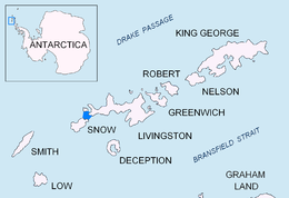
Long Rock is a large rock extending 720 m (787 yd) in east–west direction, 180 m (197 yd) wide and rising to 13 m (42.7 ft) in the northeast of Morton Strait in the South Shetland Islands, Antarctica. The area was visited by early 19th century sealers operating on Byers Peninsula.
The feature was named by Discovery Investigations personnel that charted Morton Strait in 1930–31.
YouTube Encyclopedic
-
1/3Views:14 221 3322 246 4482 489
-
Girls defy death at Victoria Falls! Devil's Pool, Livingstone Island, Zambia
-
Zimbabwe Devil's Pool at Victoria Waterfall
-
Plovdiv - Ancient and Eternal
Transcription
Location
The rock is located 1.6 km (0.99 mi) south-southwest of Vardim Rocks, 2.1 km (1.30 mi) south-southwest of Devils Point, 4.2 km (2.61 mi) north of President Head, Snow Island, 7 km (4.35 mi) east-northeast of Cape Timblón, Snow Island and 6.93 km (4.31 mi) southeast of Benson Point, Rugged Island (British mapping in 1933 and 1968, Argentine in 1946 and 1953, Chilean in 1947 and 1971, French in 1951, detailed Spanish mapping in 1992, and Bulgarian mapping in 2005 and 2009).
See also
- Composite Antarctic Gazetteer
- List of Antarctic islands south of 60° S
- SCAR
- Territorial claims in Antarctica
Maps
- Península Byers, Isla Livingston. Mapa topográfico a escala 1:25000. Madrid: Servicio Geográfico del Ejército, 1992.
- L.L. Ivanov et al. Antarctica: Livingston Island and Greenwich Island, South Shetland Islands. Scale 1:100000 topographic map. Sofia: Antarctic Place-names Commission of Bulgaria, 2005.
- L.L. Ivanov. Antarctica: Livingston Island and Greenwich, Robert, Snow and Smith Islands. Scale 1:120000 topographic map. Troyan: Manfred Wörner Foundation, 2009. ISBN 978-954-92032-6-4
References
External links
![]() This article incorporates public domain material from "Long Rock, Livingston Island". Geographic Names Information System. United States Geological Survey.
This article incorporates public domain material from "Long Rock, Livingston Island". Geographic Names Information System. United States Geological Survey.
This Livingston Island location article is a stub. You can help Wikipedia by expanding it. |