
| Long Draw Fire | |
|---|---|
 | |
| Date(s) | July 8, 2012 - July 17, 2012 |
| Location | Oregon |
| Coordinates | 42°30′N 117°40′W / 42.5°N 117.67°W |
| Statistics[1] | |
| Burned area | 557,648 acres (2,257 km2) |
| Ignition | |
| Cause | Lightning |
| Map | |
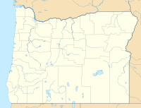 Location of fire in Oregon | |
The Long Draw Fire was a wildfire started by a lightning strike on July 8, 2012 that burned 557,648 acres (2,257 km2) acres in southeastern Oregon, in the Western United States.[1][2] It was Oregon's largest wildfire since the 1865 Silverton Fire which burned over 1 million acres.[3]
YouTube Encyclopedic
-
1/3Views:4 890327 890193 896
-
The Long Draw Fire
-
How To Draw The Fire Emoji 🔥
-
How To Draw A Helicopter
Transcription
Fuel Conditions
Up until a few years prior to the fire, the area was often saturated by heavy rains which spurred the growth of shrubs and dense snowpack which crushed the foliage and helped it decompose. But because there hadn't been snow, the bushes and grasses remained in an upright position which helped the fire spread more rapidly. Much of the area was covered in sagebrush and native grasses which were unable, due to the dry conditions, to produce the typical seedling coverage witnessed in the past.[4]
Events
The Long Draw Fire was reported on July 8, 2012, at 6:04 PM. It was located north of McDermitt, Nevada. The source of the fire was a lightning strike.[1] During the first night, the fire moved north and ravaged over 30,000 acres and grew to 300,000 acres by the second night. The onset of heavy smoke coupled with the darkness of the night made it unsafe for aerial firefighting operations (helicopters and air tankers) to operate. Thus, the blaze grew rapidly during the nights. Firefighting asset prioritization and supply continued to be a problem during the first few days since there were additional fires in the same geographical area that demanded more resources as well such as the Holloway, Tenmile, Lake Complex and Lava fires. Realizing that additional resources would be slow to arrive, local farmers and ranchers helped create firebreaks. By July 12, the blaze had burned over 560,000 acres, destroyed hundreds of utility poles as well as a Department of Transportation building in Basque.[4]
By July 13, the fire had spread to Owyhee Canyon.[5] The next day, July 14, firefighters reported that cattle had died in the fire. Highway 95 was reopened, too.[6] The fire was 100% contained by July 15.[1]
In all, approximately 500 firefighters fought the blaze, assisted by 6 helicopters, 89 fire engines, 7 bulldozers, 15 water tenders.[7]
The fire was so large that it was visible from space via the Aqua (satellite).[8]
Aftermath
Due to the extensive ecological damage to the fire area and its surroundings, the Bureau of Land Management created the 'Long Draw Fire Emergency Stabilization and Rehabilitation Plan' which was estimated to cost $5.5 million. The plan promoted seeding native foliage, restore habitat and aid in the reduction of erosion.[9] The burn area was also habitat of the Greater sage-grouse an endangered bird species. Thus, special consideration was taken by the Department of the Interior to ensure proper habitat restoration.[10]
See also
References
- ^ a b c d "InciWeb the Incident Information System: Long Draw". InciWeb. Retrieved August 12, 2012.
- ^ "Long Draw fire in Oregon's southeast corner biggest in nearly 150 years". The Oregonian. 13 July 2012. Retrieved July 15, 2012.
- ^ "Large Fires & Fatalities". U.S. Department of the Interior. Retrieved July 15, 2012.
- ^ a b "The Long Draw Fire". Oregon Bureau of Land Management. December 17, 2012. Retrieved February 2, 2022.
- ^ "Long Draw Fire evening update, Friday, July 13, 2012". inciweb.nwcg.gov. Retrieved 5 September 2017.
- ^ "Long Draw Fire Update July 14, 2012 9:00am P T". inciweb.nwcg.gov. Retrieved 5 September 2017.
- ^ "Long Draw fire tops 560,000 acres, and officials fear problematic day". The Oregonian. January 10, 2019. Retrieved February 2, 2022.
- ^ "Brush Fires in Eastern Oregon". NASA. July 11, 2012. Retrieved February 2, 2022.
- ^ "Post-Wildfire Restoration in Southeast Oregon – Long Draw Fire". USGS. January 10, 2019. Retrieved February 2, 2022.
- ^ "Documentation of Land Use Plan Conformance and NEPA Adequacy Long Draw (G1HG) Fire Emergency Stabilization and Rehabilitation Plan DNA" (PDF). US Department of the Interior. 2012. Retrieved February 2, 2022.