Littlejohn Island, Maine | |
|---|---|
 Littlejohn Island viewed from Cousins Island | |
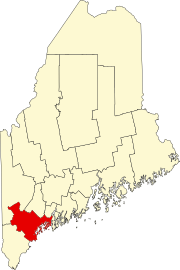
 Location in Cumberland County and the state of Maine. | |
| Coordinates: 43°45′41″N 70°7′36″W / 43.76139°N 70.12667°W | |
| Country | United States |
| State | Maine |
| County | Cumberland |
| Town | Yarmouth |
| Area | |
| • Total | 0.73 sq mi (1.89 km2) |
| • Land | 0.34 sq mi (0.88 km2) |
| • Water | 0.39 sq mi (1.01 km2) |
| Elevation | 93 ft (28 m) |
| Population (2020) | |
| • Total | 116 |
| • Density | 339.18/sq mi (131.13/km2) |
| Time zone | UTC-5 (Eastern (EST)) |
| • Summer (DST) | UTC-4 (EDT) |
| Area code | 207 |
| FIPS code | 23-40470 |
Littlejohn Island is an island and census-designated place (CDP) in the town of Yarmouth in Cumberland County, Maine, United States. The population of the CDP was 118 at the 2010 census.[2]
It is part of the Portland–South Portland–Biddeford, Maine Metropolitan Statistical Area.
The island, Cousins River and Cousins Island are named after Englishman John Cousins (c. 1596–1682), who emigrated from Marlborough, Wiltshire.
Geography
Littlejohn Island is located in Casco Bay at 43°45′41″N 70°7′36″W / 43.76139°N 70.12667°W. It is connected by a causeway to Cousins Island, which is connected by a bridge to the mainland in Yarmouth. According to the United States Census Bureau, the Littlejohn Island CDP has a total area of 0.73 square miles (1.9 km2), of which 0.35 square miles (0.9 km2) is the island and 0.39 square miles (1.0 km2), or 53.25%, is in the water surrounding the island.[3]
Demographics
| Census | Pop. | Note | %± |
|---|---|---|---|
| 2020 | 116 | — | |
| U.S. Decennial Census[4] | |||
References
- ^ "2020 U.S. Gazetteer Files". United States Census Bureau. Retrieved April 8, 2022.
- ^ "Profile of General Population and Housing Characteristics: 2010 Demographic Profile Data (DP-1): Littlejohn Island CDP, Maine". United States Census Bureau. Retrieved June 14, 2012.
- ^ "Geographic Identifiers: 2010 Demographic Profile Data (G001): Littlejohn Island CDP, Maine". United States Census Bureau. Retrieved June 14, 2012.
- ^ "Census of Population and Housing". Census.gov. Retrieved June 4, 2016.

