To install click the Add extension button. That's it.

The source code for the WIKI 2 extension is being checked by specialists of the Mozilla Foundation, Google, and Apple. You could also do it yourself at any point in time.

4,5
Kelly Slayton
Congratulations on this excellent venture… what a great idea!
Alexander Grigorievskiy
I use WIKI 2 every day and almost forgot how the original Wikipedia looks like.
Live Statistics
English Articles
Improved in 24 Hours
Added in 24 Hours
What we do. Every page goes through several hundred of perfecting techniques; in live mode. Quite the same Wikipedia. Just better.
.
Leo
Newton
Brights
Milds

List of seamounts in the Marshall Islands

From Wikipedia, the free encyclopedia

Bathymetric map of Micronesia-Marshall Islands, with seamounts
Bathymetric map of Micronesia-Marshall Islands, with seamounts

The Marshall Islands are the site of a number of seamounts. These volcanoes form several groups, including the Ralik Chain, the Ratak Chain and some seamounts around Anewetak.[1] These seamounts are in turn part of a larger province that extends from the South Pacific to the Mariana Trench and is characterized by unusually shallow ocean ground.[2]

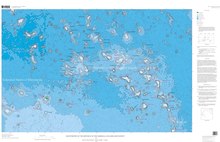
These seamounts and volcanoes do not have simple hotspot-like age progressions, with some volcanoes being younger than one would expect from age progression and having more than one active episode. In some places, a middle Cretaceous and a late Cretaceous episode of volcanic activity have been determined by radiometric dating. Despite this, some hotspot-based genesis models have been formulated, often implying that French Polynesian hotspots are responsible for the formation of seamounts,[1] with the Society hotspot, Rurutu hotspot, Rarotonga hotspot and the Macdonald hotspot being candidate hotspots responsible for the development of the Marshall Islands seamounts.[3] Such linkages are in part supported by geochemical data.[4] Some discrepancies between the age and position of such seamounts and the predictions of the hotspot model may reflect the activity of short-lived hotspots linked to large mantle plumes that produce more than one hotspot.[5]

Name Other names Etymology Coordinates Depth below sea level Age Volume Details
Aean̄-Kaņ[6] Marovoiy[7] A taboo fishing spot at Eniwetok[8] 14°52.98′N 160°27.38′E / 14.88300°N 160.45633°E / 14.88300; 160.45633[9] 850 metres (2,790 ft)[9] Mid-Cretaceous[10] 10,389 cubic kilometres (2,492 cu mi).[9] Since the Eocene manganese nodules developed on the seamount,[11] which may have been created by the Macdonald hotspot.[10]
Neen-Koiaak[6] According to legend, the fastest runner in the Marshall Islands[8] 14°22.62′N 161°01.16′E / 14.37700°N 161.01933°E / 14.37700; 161.01933[12] 1,025 metres (3,363 ft)[12] 102 million years[12] 7,083 cubic kilometres (1,699 cu mi)[12] Samples dredged from Neen-Koiaak include hawaiite[13] containing clinopyroxene, olivine and plagioclase.[14]
Wōd-Eņ Rok[6] South-Wod-En[15] A coral head[16] 15°13.20′N 163°00.00′E / 15.22000°N 163.00000°E / 15.22000; 163.00000[15] 76 million years[15] While its position makes it a candidate member of the Ralik hotspot trail, it appears to be too old.[17] There is some geochemical similarity to the Rurutu hotspot.[4]
Wōd-Eņ Iōn̄[6] North-Wod-En,[18] Nazimova[7] A coral head[16] 16°06.00′N 163°02.40′E / 16.10000°N 163.04000°E / 16.10000; 163.04000[18] 86 million years[18] While its position makes it a candidate member of the Ralik hotspot trail, it appears to be too old.[17] There is some geochemical similarity to the Rurutu hotspot.[4]
Ļewa[6] A person who received canoe building knowledge, one of the first two[16] 14°01.80′N 163°07.80′E / 14.03000°N 163.13000°E / 14.03000; 163.13000[19] 100 million years[19] Part of the Ralik Chain,[20] Albian-age fossils have been dredged from this seamount.[21]
Ļōbbadede[6] Lobhadode[22] A chief from Bikini[16] 13°52.80′N 163°51.60′E / 13.88000°N 163.86000°E / 13.88000; 163.86000[22] 94 million years[22] Depending on the plate reconstruction model chosen, Lobbadede appears to coincide with the location of the Macdonald hotspot.[10] Limestone and fossils of Campanian-Cenomanian age have been found on Lobbadede,[3] which appears to have had a second volcanic episode in the Cretaceous.[20]
Wōden-Kōpakut[6] Ratak[23] A coral head[16] 13°56.40′N 167°28.80′E / 13.94000°N 167.48000°E / 13.94000; 167.48000[23] 1,320 metres (4,330 ft)[24] 85 million years[23] or 82.2 ± 1.6 million years[25] Part of the Ratak Chain with Limalok,[20] it was also active during the late Cretaceous[21] and has a well developed summit platform.[26] One reconstruction of plate motion places Woden-Kopakut close to the Rurutu hotspot.[1] Hawaiite has been dredged from the seamount and contains iron oxides, plagioclase and zeolites.[27]
Radik[6] A chief on Ujlan[8]
Ļainjin[6] A legendary navigator[8] 11°09.00′N 161°03.00′E / 11.15000°N 161.05000°E / 11.15000; 161.05000[28]
Ļōjemeja[6] A chief in Ujlan[8] 11°26.40′N 161°05.40′E / 11.44000°N 161.09000°E / 11.44000; 161.09000[29] 1,750 metres (5,740 ft)[30] Steep upper flanks, and a volcanic pinnacle is found between the summit and a sediment-covered terrace.[30]
Ļami[6] According to legend an Eniwetok giant[8] 11°54.60′N 161°24.60′E / 11.91000°N 161.41000°E / 11.91000; 161.41000[31] 1,295 metres (4,249 ft)[30] 86 million years[31] Slumps and terraces, terraces that appear to be congruent with these on Lomilik, surround this seamount. Its summit plateau is covered by sediments, sediment-filled basins and volcanic knolls.[30]
Peto-Eņ[6] A taboo channel at Eniwetok[8] 12°22.80′N 161°19.20′E / 12.38000°N 161.32000°E / 12.38000; 161.32000[32]
Lomilik[6] A place at Eniwetok with good fishing opportunities[8] 11°42′N 161°37′E / 11.700°N 161.617°E / 11.700; 161.617[33] The summit has volcanic knobs and sediment-filled basins in between. The north flank has a terrace and the rest of the slopes is covered with slumps, talus and sediments.[30]
Litōrmālu[6] A legendary navigator[8] 10°53.40′N 161°27.60′E / 10.89000°N 161.46000°E / 10.89000; 161.46000[34]
Ļo-Wūliej[6] A cape at Eniwetok[8] 12°09.60′N 162°15.60′E / 12.16000°N 162.26000°E / 12.16000; 162.26000[35]
North Ļāānṃōjānjān[6] Reference to shipbuilding techniques[16] 13°07.80′N 162°47.20′E / 13.13000°N 162.78667°E / 13.13000; 162.78667[36] 1,090 metres (3,580 ft)[30] Has a rugged appearance with little sediment.[37] It also features several terraces and two large slumps.[30]
South Ļāānṃōjānjān[6] Reference to shipbuilding techniques[16] 12°41.56′N 162°37.17′E / 12.69267°N 162.61950°E / 12.69267; 162.61950[38] 1,395 metres (4,577 ft)[38] 1,611 cubic kilometres (386 cu mi)[38] Has a rugged appearance with little sediment.[37]
Bwewa Kaņ[6] Named after canoe keels[16] 13°33.60′N 164°25.20′E / 13.56000°N 164.42000°E / 13.56000; 164.42000[39] 88 million years[39] Part of the Ralik Chain, may have been formed by a hotspot together with a stage of Wodejebato.[17]
Lōjabōn-Bar[6] A strong traditional personage at Bikini[16] 13°09.00′N 164°30.00′E / 13.15000°N 164.50000°E / 13.15000; 164.50000[40]
Wōdejebato[6] Sylvania[41] Bikini's most feared sea god[16] 11°55.95′N 164°51.72′E / 11.93250°N 164.86200°E / 11.93250; 164.86200[41] 1,290 metres (4,230 ft)[41] 82 million years[41] 12,476 cubic kilometres (2,993 cu mi)[41]
Look[6] 12°12.00′N 166°13.80′E / 12.20000°N 166.23000°E / 12.20000; 166.23000[42] 999 metres (3,278 ft)[37] 140 million years[42] Look is the oldest known seamount.[43] Flat-topped seamount that can be considered a guyot[44] and is located between the Ratak Chain and the Ralik Chain,[45] and fairly old. Its geochemistry is intermediate between these two chains as well, which may indicate that volcanism was strongly influenced by the crust.[46] Look Seamount is dotted by volcanic cones and has a rilled appearance[47] as well as slumps; the summit is covered by sediment that mostly buries small volcanic pinnacles and sediment-filled depressions.[37]
Ruwitūn̄tūn̄[6] 11°49.80′N 167°00.00′E / 11.83000°N 167.00000°E / 11.83000; 167.00000[48] 1,215 metres (3,986 ft)[37] 66 million years[48] Flat-topped seamount that can be considered a guyot;[44] basins and volcanic knolls dot its summit platform and some pinnacles contain craters.[37] Fossils indicate that Ruwituntun developed either during or before the Albian.[21]
Ļāwūn-Pikaar[6] Bikar[49] Legendary chief in Pikaar[16] 12°09.60′N 168°51.60′E / 12.16000°N 168.86000°E / 12.16000; 168.86000[50] Ankaramite-like rock containing clinopyroxene and degradation products of olivine and mellilite has been dredged[27]
Ļōkōto-N̄ōrn̄ōr[6] 13°06.00′N 169°26.40′E / 13.10000°N 169.44000°E / 13.10000; 169.44000[51]
Jebo[6] 11°03.00′N 170°39.60′E / 11.05000°N 170.66000°E / 11.05000; 170.66000[52]
Pali[6] Name given by the government of Micronesia.[53] Probably Cretaceous[54] The seamount is surrounded by a sediment cover and might feature slumps. Hyaloclastite and phosphorite have been dredged from it.[55]
Likelep[6] A site on Ujlan[8] 10°36.00′N 160°28.80′E / 10.60000°N 160.48000°E / 10.60000; 160.48000[56] 1,545 metres (5,069 ft)[57] 82 million years[56] Biotite, hornblende and plagioclase have been dredged from Likelep, and the seamount is of Campanian age. Likelep may be part of a seamount trail[58] and is part of the Ujlān volcanic complex.[59] A sediment cap and volcanic structures are found on its top, with a volcanic cone protruding through the sediment. Slumps occur on its flanks and a seamount farther north is connected to Likelep.[57]
Lalibjet[6] A sea god[8] 10°08.40′N 159°55.20′E / 10.14000°N 159.92000°E / 10.14000; 159.92000[60] 1,439 metres (4,721 ft)[61] 74 million years[60] May have been produced by the Rarotonga hotspot together with Eniwetok[62] and is part of the Ujlān volcanic complex.[59] Part of the sediment cap on its summit appears to have been removed by a slump.[57]
Ujlān[6] Ujelang[63] 9°46.80′N 160°25.20′E / 9.78000°N 160.42000°E / 9.78000; 160.42000[63] 1,250 metres (4,100 ft)[57] 80 million years[63] Seamount with three separate summits.[47] Ujlan may be part of a seamount trail[58] and is part of the Ujlān volcanic complex.[59] The southwestern flank has a terrace.[57]
Ļōtab[6] A descendant of Litōrmālu[8] 10°13.80′N 160°43.20′E / 10.23000°N 160.72000°E / 10.23000; 160.72000[64] 1,557 metres (5,108 ft)[61] 80 million years[64] Lotab may be part of a seamount trail[58] and is part of the Ujlān volcanic complex;[59] it also features traces of mass failures[57] and on the northeastern flank it is connected to another seamount.[61]
Ļajutōkwa[6] A navigator[8] 10°28.80′N 160°46.80′E / 10.48000°N 160.78000°E / 10.48000; 160.78000[65] 1,585 metres (5,200 ft)[30] 81 million years[65] Lajutokwa may be part of a seamount trail[58] and is part of the Ujlān volcanic complex.[59]
Lo-En[6] Hess[66] Named after the hibiscus tree[8] 10°06.00′N 162°52.20′E / 10.10000°N 162.87000°E / 10.10000; 162.87000[66] 113 million years[66]
Mij-Lep[6] A gap between islands on Ujlan[8] 8°48.60′N 163°12.60′E / 8.81000°N 163.21000°E / 8.81000; 163.21000[67] 1,105 metres (3,625 ft)[61] 106 million years[67] A number of pinnacles, including a flat topped one on the summit, cover Mij-Lep.[61]
Ļemkein[6] 9°18′N 166°05′E / 9.300°N 166.083°E / 9.300; 166.083[33]
Ļewōnjoui[6] 10°32.31′N 166°27.83′E / 10.53850°N 166.46383°E / 10.53850; 166.46383[68] 2,985 metres (9,793 ft)[68] 1,441 cubic kilometres (346 cu mi)[68]
Ļōkkwōrkwōr[6] Erikub[69] 9°09.00′N 170°00.00′E / 9.15000°N 170.00000°E / 9.15000; 170.00000[69] 1,400 metres (4,600 ft)[26] 87 million years[69] Alkali basalts and hawaiite have been dredged, which contain clinopyroxene, olivine derivatives and plagioclase and show evidence of having been eroded above the water surface[27]
Litakpooki[6] 8°18.60′N 160°38.40′E / 8.31000°N 160.64000°E / 8.31000; 160.64000[70]
Ṃaanjidep[6] A chief from Jalwoj[16] 6°43.80′N 169°19.80′E / 6.73000°N 169.33000°E / 6.73000; 169.33000[71] 2,215 metres (7,267 ft)[61] The depth probably does not refer to the actual summit.[61]
Ļoṃjenaelik[6] A chief from Arno[16]
Ļōmōļkā[6] A chief from Mile[16] 6°37.80′N 172°21.60′E / 6.63000°N 172.36000°E / 6.63000; 172.36000[72]
Limalok[6] Harrie[73] A chiefess from Mile[16] 5°36.00′N 172°21.60′E / 5.60000°N 172.36000°E / 5.60000; 172.36000[73] 68 million years[73]

See also

References

  1. ^ a b c Bergersen 1995, p. 605.
  2. ^ Koppers et al. 2003, p. 9.
  3. ^ a b Bergersen 1995, p. 607.
  4. ^ a b c Koppers et al. 2003, p. 25.
  5. ^ Koppers et al. 2003, p. 39.
  6. ^ a b c d e f g h i j k l m n o p q r s t u v w x y z aa ab ac ad ae af ag ah ai aj ak al am an ao Hein, James R.; Wong, Florence L.; Mosier, Dan L. (1999). "Bathymetry of the Republic of the Marshall Islands and vicinity". Miscellaneous Field Studies Map.
  7. ^ a b Asavin, A. M.; Daryin, A. V.; Melnikov, M. E. (21 December 2014). "Microrhythmic distribution of Co, Mn, Ni, and La contents in cobalt-rich ferromanganese crusts from the Magellan Seamounts". Geochemistry International. 53 (1): 23. doi:10.1134/s0016702915010024. ISSN 0016-7029.
  8. ^ a b c d e f g h i j k l m n o p Hein et al. 1990, p. 245.
  9. ^ a b c "Aean Kan Guyot". Seamount Catalog. Retrieved 24 June 2018.
  10. ^ a b c Bergersen 1995, p. 610.
  11. ^ Hein, James R.; Zielinski, S.E.; Staudigel, Hubert; Chang, Se-Won; Greene, Michelle; Pringle, M.S. (1997). "Composition of Co-rich ferromanganese crusts and substrate rocks from the NW Marshall Islands and international waters to the north, Tunes 6 cruise". Open-File Report. ISSN 2331-1258.
  12. ^ a b c d "Neen-Koiaak Guyot". Seamount Catalog. Retrieved 24 June 2018.
  13. ^ Koppers, Staudigel & Wijbrans 2000, p. 142.
  14. ^ Koppers, Staudigel & Wijbrans 2000, p. 145.
  15. ^ a b c "South-Wod-En Guyot". Seamount Catalog. Retrieved 24 June 2018.
  16. ^ a b c d e f g h i j k l m n o Hein et al. 1990, p. 246.
  17. ^ a b c Koppers et al. 2003, p. 21.
  18. ^ a b c "North-Wod-En Guyot". Seamount Catalog. Retrieved 24 June 2018.
  19. ^ a b "Lewa Guyot". Seamount Catalog. Retrieved 24 June 2018.
  20. ^ a b c Haggerty & Premoli Silva 1995, p. 935.
  21. ^ a b c Haggerty & Premoli Silva 1995, p. 938.
  22. ^ a b c "Lobbadede Guyot". Seamount Catalog. Retrieved 24 June 2018.
  23. ^ a b c "Rataka Guyot". Seamount Catalog. Retrieved 25 June 2018.
  24. ^ Davis et al. 1989, pp. 5757–5758.
  25. ^ Davis et al. 1989, p. 5770.
  26. ^ a b Davis et al. 1989, p. 5757.
  27. ^ a b c Davis et al. 1989, p. 5761.
  28. ^ "Lainjin Seamount". Seamount Catalog. Retrieved 25 June 2018.
  29. ^ "Lojemeja Seamount". Seamount Catalog. Retrieved 25 June 2018.
  30. ^ a b c d e f g h Hein et al. 1990, p. 5.
  31. ^ a b "Lami Seamount". Seamount Catalog. Retrieved 25 June 2018.
  32. ^ "Peto-En Seamount". Seamount Catalog. Retrieved 25 June 2018.
  33. ^ a b Hyeong et al. 2013, p. 294.
  34. ^ "Litormalu Seamount". Seamount Catalog. Retrieved 25 June 2018.
  35. ^ "Lo-Wuliej Seamount". Seamount Catalog. Retrieved 25 June 2018.
  36. ^ "North Laanmojanjan Seamount". Seamount Catalog. Retrieved 25 June 2018.
  37. ^ a b c d e f Hein et al. 1990, p. 4.
  38. ^ a b c "South Laanmojanjan Seamount". Seamount Catalog. Retrieved 25 June 2018.
  39. ^ a b "Bwewa-Kan Seamount". Seamount Catalog. Retrieved 25 June 2018.
  40. ^ "Lojabon-Bar Seamount". Seamount Catalog. Retrieved 25 June 2018.
  41. ^ a b c d e "Wodejebato Guyot". Seamount Catalog. Retrieved 25 June 2018.
  42. ^ a b "Look Seamount". Seamount Catalog. Retrieved 25 June 2018.
  43. ^ Hubert Staudigel; Anthony A.P. Koppers (1 January 2015). Seamounts and Island Building. p. 420. doi:10.1016/B978-0-12-385938-9.00022-5. ISBN 9780123859389. {{cite book}}: |journal= ignored (help)
  44. ^ a b Hein et al. 1990, p. 2.
  45. ^ Koppers et al. 2003, p. 24.
  46. ^ Koppers et al. 2003, p. 27.
  47. ^ a b Hein et al. 1990, p. 3.
  48. ^ a b "Ruwituntun Seamount". Seamount Catalog. Retrieved 25 June 2018.
  49. ^ Davis et al. 1989, p. 5759.
  50. ^ "Lawun-Pikaar Seamount". Seamount Catalog. Retrieved 25 June 2018.
  51. ^ "Lokoto-Nornor Seamount". Seamount Catalog. Retrieved 25 June 2018.
  52. ^ "Jebo Seamount". Seamount Catalog. Retrieved 25 June 2018.
  53. ^ Hein et al. 1992, p. 1.
  54. ^ Hein et al. 1992, p. 7.
  55. ^ Hein et al. 1992, p. 4.
  56. ^ a b "Likelep Guyot". Seamount Catalog. Retrieved 25 June 2018.
  57. ^ a b c d e f Hein et al. 1990, p. 6.
  58. ^ a b c d Koppers et al. 2003, p. 20.
  59. ^ a b c d e Hein et al. 1990, p. 1.
  60. ^ a b "Lalibjet Seamount". Seamount Catalog. Retrieved 25 June 2018.
  61. ^ a b c d e f g Hein et al. 1990, p. 7.
  62. ^ Bergersen 1995, p. 612.
  63. ^ a b c "Ujlan Guyot". Seamount Catalog. Retrieved 25 June 2018.
  64. ^ a b "Lotab Seamount". Seamount Catalog. Retrieved 25 June 2018.
  65. ^ a b "Lajutokwa Guyot". Seamount Catalog. Retrieved 25 June 2018.
  66. ^ a b c "Lo-En Guyot". Seamount Catalog. Retrieved 25 June 2018.
  67. ^ a b "Mij-Lep Seamount". Seamount Catalog. Retrieved 25 June 2018.
  68. ^ a b c "Lewonjoui Guyot". Seamount Catalog. Retrieved 25 June 2018.
  69. ^ a b c "Erikub Seamount". Seamount Catalog. Retrieved 25 June 2018.
  70. ^ "Litakpooki Seamount". Seamount Catalog. Retrieved 25 June 2018.
  71. ^ "Maanjidep Seamount". Seamount Catalog. Retrieved 25 June 2018.
  72. ^ "Lomolka Seamount". Seamount Catalog. Retrieved 25 June 2018.
  73. ^ a b c "Limalok Guyot". Seamount Catalog. Retrieved 25 June 2018.

Sources

This page was last edited on 29 January 2024, at 19:04
Basis of this page is in Wikipedia. Text is available under the CC BY-SA 3.0 Unported License. Non-text media are available under their specified licenses. Wikipedia® is a registered trademark of the Wikimedia Foundation, Inc. WIKI 2 is an independent company and has no affiliation with Wikimedia Foundation.