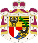
| Municipalities of Liechtenstein Die Gemeinden von Liechtenstein (German) | |
|---|---|
 | |
| Category | Unitary state |
| Location | Principality of Liechtenstein |
| Number | 11 municipalities |
| Populations | 473 (Planken) – 6,039 (Schaan) |
| Areas | 3.6 km2 (1.4 sq mi) (Schellenberg) – 30 km2 (11.5 sq mi) (Triesenberg) |
| Government |
|
| Subdivisions | |
 |
|---|
The principality of Liechtenstein is divided into eleven municipalities (German: Gemeinden, singular Gemeinde), most consisting of only a single town. Five of the Gemeinden fall within the electoral district of Unterland (lower country), while the other six are within the Oberland (upper country).
YouTube Encyclopedic
-
1/5Views:45 983810 723182 5492 398 798813
-
How did the Principality of Liechtenstein come into existence? (History of Liechtenstein)
-
Greenland - Geography & Municipalities | Countries of the World
-
Flag/ Fan Friday LIECHTENSTEIN (Geography Now!)
-
Geography Now! LIECHTENSTEIN
-
Liechtenstein - How Big Is Liechtenstein 🇱🇮 Actually?
Transcription
Municipalities
| Coat of arms | Flag | Name | Population (December 31, 2019)[1] |
Area (km2)[2] |
Postal code | Towns/Villages |
|---|---|---|---|---|---|---|
| Electoral District of Unterland | ||||||
| Ruggell | 2,322 | 7.4 | 9491 | Ruggell | ||
| Schellenberg | 1,107 | 3.5 | 9488 | Schellenberg | ||
| Gamprin | 1,690 | 6.1 | 9487 | Gamprin Bendern | ||
| Eschen | 4,466 | 10.3 | 9492 | Eschen Nendeln | ||
| Mauren | 4,401 | 7.5 | 9493 | Mauren Schaanwald | ||
| Electoral District of Oberland | ||||||
| Schaan | 6,039 | 26.8 | 9494 | Schaan | ||
| Planken | 473 | 5.3 | 9498 | Planken | ||
| Vaduz | 5,696 | 17.3 | 9490 | Vaduz Ebenholz, Mühleholz | ||
| Triesenberg | 2,638 | 29.8 | 9497 | Triesenberg Gaflei, Malbun, Masescha, Rotenboden, Silum, Steg, Sücka, Wangerberg | ||
| Triesen | 5,275 | 26.4 | 9495 | Triesen | ||
| Balzers | 4,642 | 19.6 | 9496 | Balzers Mäls | ||
| Liechtenstein | 38,749 | 160.0 | ||||
Exclaves and enclaves
The municipalities of Liechtenstein, the Gemeinden, exhibit complex shapes, despite their small size.
Seven of the Gemeinden have one or more exclaves, in addition to the main territory:
- Gamprin: 1 exclave
- Eschen: 1 exclave
- Planken: 4 exclaves, of which 1 is a true enclave
- Schaan: 4 exclaves, of which 1 is a true enclave
- Vaduz: 6 exclaves, of which 2 are true enclaves
- Triesenberg: 1 exclave
- Balzers: 2 exclaves
Data codes
In ISO 3166-2, the codes of the municipalities start with LI-, followed by two digits (01–11, assigned in alphabetical order).
In FIPS 10-4 (standard withdrawn in 2008), the codes of the municipalities started with LS-, followed by the same two digits as the ISO codes.
As a member of the EFTA, Liechtenstein is included in the Nomenclature of Territorial Units for Statistics (NUTS). The three NUTS levels all correspond to the country itself (NUTS-1: LI0; NUTS-2: LI00; NUTS-3: LI000). Below the NUTS levels, there are two LAU levels (LAU-1: electoral districts; LAU-2: municipalities).
See also
References
- ^ "Bevolkerungsstatistik" (PDF). www.llv.li. 30 June 2017. Retrieved 2019-05-30.
- ^ Statistisches Jahrbuch Liechtensteins 2016, page 35. Retrieved 25 March 2016
External links
- Communes of Liechtenstein, Statoids.com

