
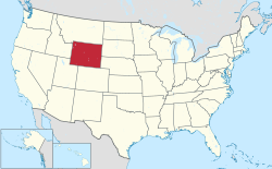
Wyoming is a state in the Western United States. According to the 2020 United States Census, Wyoming is the least populous state with 576,851 inhabitants but the 9th largest by land area spanning 97,093.14 square miles (251,470.1 km2) of land.[1] Wyoming has 23 counties and 99 municipalities consisting of cities and towns.[1] Wyoming's municipalities cover only 0.3% of the state's land mass but are home to 68.3% of its population.[2]
Wyoming's largest municipality by population is the capital city Cheyenne with 65,132 residents,[1] and the largest municipality by land area is Casper, which spans 26.9 sq mi (70 km2), while the smallest municipality in both categories is Lost Springs with 6 residents[1] and an area of 0.09 sq mi (0.23 km2).[2]
A Wyoming statute indicates towns are municipalities with populations of less than 4,000. Municipalities of 4,000 or more residents are considered "first-class cities".[3]
YouTube Encyclopedic
-
1/5Views:237 3391 599271 72499 4411 274
-
Free Government Grants For Individuals And Small Businesses (Top 5 Best)
-
Finex Webinars: Credit Scores and Reports
-
What to Do AFTER You Form an LLC - 6 Steps You Must Take
-
Did COVID-19 Destroy The Restaurant Industry Overnight
-
How Alaska Taxes Retirees
Transcription
Cities and towns
- Largest municipalities in Wyoming by population
-
 Downtown Cheyenne, capital and most populous city of Wyoming
 -
 Casper, second most populous city in Wyoming
 -
 View of Gillette, third most populous city in Wyoming
 -
 Downtown Laramie, fourth most populous city in Wyoming
 -
 Downtown Rock Springs, fifth most populous city in Wyoming
State capital and county seat ‡
| Rank | Name | Type[2] | County[2] | Population (2020)[1] |
Population (2010)[2] |
Change (%) | Land area (2010)[2] |
Density | |
|---|---|---|---|---|---|---|---|---|---|
| sq mi | km2 | ||||||||
| 28 | Afton | Town | Lincoln | 2,172 | 1,911 | +13.7% | 4.18 | 10.8 | 519.6/sq mi (200.6/km2) |
| 80 | Albin | Town | Laramie | 169 | 181 | −6.6% | 0.15 | 0.39 | 1,126.7/sq mi (435.0/km2) |
| 38 | Alpine | Town | Lincoln | 1,220 | 828 | +47.3% | 0.70 | 1.8 | 1,742.9/sq mi (672.9/km2) |
| 59 | Baggs | Town | Carbon | 411 | 440 | −6.6% | 0.51 | 1.3 | 805.9/sq mi (311.2/km2) |
| 91 | Bairoil | Town | Sweetwater | 68 | 106 | −35.8% | 1.41 | 3.7 | 48.2/sq mi (18.6/km2) |
| 22 | Bar Nunn | Town | Natrona | 2,981 | 2,213 | +34.7% | 2.10 | 5.4 | 1,419.5/sq mi (548.1/km2) |
| 36 | Basin† | Town | Big Horn | 1,288 | 1,285 | +0.2% | 2.40 | 6.2 | 536.7/sq mi (207.2/km2) |
| 51 | Bear River | Town | Uinta | 522 | 518 | +0.8% | 1.90 | 4.9 | 274.7/sq mi (106.1/km2) |
| 61 | Big Piney | Town | Sublette | 395 | 552 | −28.4% | 0.45 | 1.2 | 877.8/sq mi (338.9/km2) |
| 18 | Buffalo† | City | Johnson | 4,415 | 4,585 | −3.7% | 4.46 | 11.6 | 989.9/sq mi (382.2/km2) |
| 67 | Burlington | Town | Big Horn | 314 | 288 | +9.0% | 1.01 | 2.6 | 310.9/sq mi (120.0/km2) |
| 66 | Burns | Town | Laramie | 356 | 301 | +18.3% | 3.05 | 7.9 | 116.7/sq mi (45.1/km2) |
| 50 | Byron | Town | Big Horn | 562 | 593 | −5.2% | 0.91 | 2.4 | 617.6/sq mi (238.4/km2) |
| 2 | Casper† | City | Natrona | 59,038 | 55,316 | +6.7% | 26.90 | 69.7 | 2,194.7/sq mi (847.4/km2) |
| 1 | Cheyenne‡ | City | Laramie | 65,132 | 59,466 | +9.5% | 24.52 | 63.5 | 2,656.3/sq mi (1,025.6/km2) |
| 79 | Chugwater | Town | Platte | 175 | 212 | −17.5% | 3.06 | 7.9 | 57.2/sq mi (22.1/km2) |
| 86 | Clearmont | Town | Sheridan | 116 | 142 | −18.3% | 0.16 | 0.41 | 725.0/sq mi (279.9/km2) |
| 11 | Cody† | City | Park | 10,028 | 9,520 | +5.3% | 10.20 | 26.4 | 983.1/sq mi (379.6/km2) |
| 53 | Cokeville | Town | Lincoln | 502 | 535 | −6.2% | 1.18 | 3.1 | 425.4/sq mi (164.3/km2) |
| 48 | Cowley | Town | Big Horn | 762 | 655 | +16.3% | 0.84 | 2.2 | 907.1/sq mi (350.2/km2) |
| 46 | Dayton | Town | Sheridan | 822 | 757 | +8.6% | 0.53 | 1.4 | 1,550.9/sq mi (598.8/km2) |
| 81 | Deaver | Town | Big Horn | 154 | 178 | −13.5% | 1.01 | 2.6 | 152.5/sq mi (58.9/km2) |
| 52 | Diamondville | Town | Lincoln | 520 | 737 | −29.4% | 1.17 | 3.0 | 444.4/sq mi (171.6/km2) |
| 91 | Dixon | Town | Carbon | 74 | 97 | −23.7% | 0.13 | 0.34 | 569.2/sq mi (219.8/km2) |
| 15 | Douglas† | City | Converse | 6,386 | 6,120 | +4.3% | 4.58 | 11.9 | 1,394.3/sq mi (538.4/km2) |
| 44 | Dubois | Town | Fremont | 911 | 971 | −6.2% | 3.42 | 8.9 | 266.4/sq mi (102.8/km2) |
| 74 | East Thermopolis | Town | Hot Springs | 229 | 254 | −9.8% | 0.18 | 0.47 | 1,272.2/sq mi (491.2/km2) |
| 82 | Edgerton | Town | Natrona | 153 | 195 | −21.5% | 0.25 | 0.65 | 612.0/sq mi (236.3/km2) |
| 83 | Elk Mountain | Town | Carbon | 150 | 191 | −21.5% | 0.28 | 0.73 | 535.7/sq mi (206.8/km2) |
| 56 | Encampment | Town | Carbon | 452 | 450 | +0.4% | 1.60 | 4.1 | 282.5/sq mi (109.1/km2) |
| 8 | Evanston† | City | Uinta | 11,747 | 12,359 | −5.0% | 10.27 | 26.6 | 1,143.8/sq mi (441.6/km2) |
| 23 | Evansville | Town | Natrona | 2,746 | 2,544 | +7.9% | 3.54 | 9.2 | 775.7/sq mi (299.5/km2) |
| 77 | Fort Laramie | Town | Goshen | 206 | 230 | −10.4% | 0.27 | 0.70 | 763.0/sq mi (294.6/km2) |
| 84 | Frannie | Town | Big Horn, Park | 145 | 157 | −7.6% | 0.44 | 1.1 | 329.5/sq mi (127.2/km2) |
| 3 | Gillette† | City | Campbell | 33,403 | 29,087 | +14.8% | 18.97 | 49.1 | 1,760.8/sq mi (679.9/km2) |
| 72 | Glendo | Town | Platte | 237 | 205 | +15.6% | 0.53 | 1.4 | 447.2/sq mi (172.7/km2) |
| 26 | Glenrock | Town | Converse | 2,420 | 2,576 | −6.1% | 2.28 | 5.9 | 1,061.4/sq mi (409.8/km2) |
| 87 | Granger | Town | Sweetwater | 98 | 139 | −29.5% | 2.53 | 6.6 | 38.7/sq mi (15.0/km2) |
| 7 | Green River† | City | Sweetwater | 11,825 | 12,515 | −5.5% | 13.72 | 35.5 | 861.9/sq mi (332.8/km2) |
| 33 | Greybull | Town | Big Horn | 1,651 | 1,847 | −10.6% | 1.81 | 4.7 | 912.2/sq mi (352.2/km2) |
| 39 | Guernsey | Town | Platte | 1,130 | 1,147 | −1.5% | 1.02 | 2.6 | 1,107.8/sq mi (427.7/km2) |
| 49 | Hanna | Town | Carbon | 683 | 841 | −18.8% | 2.04 | 5.3 | 334.8/sq mi (129.3/km2) |
| 94 | Hartville | Town | Platte | 64 | 62 | +3.2% | 0.25 | 0.65 | 256.0/sq mi (98.8/km2) |
| 57 | Hudson | Town | Fremont | 431 | 458 | −5.9% | 0.43 | 1.1 | 1,002.3/sq mi (387.0/km2) |
| 68 | Hulett | Town | Crook | 309 | 383 | −19.3% | 0.87 | 2.3 | 355.2/sq mi (137.1/km2) |
| 9 | Jackson† | Town | Teton | 10,760 | 9,577 | +12.4% | 2.91 | 7.5 | 3,697.6/sq mi (1,427.6/km2) |
| 70 | Kaycee | Town | Johnson | 247 | 263 | −6.1% | 0.40 | 1.0 | 617.5/sq mi (238.4/km2) |
| 27 | Kemmerer† | City | Lincoln | 2,415 | 2,656 | −9.1% | 7.80 | 20.2 | 309.6/sq mi (119.5/km2) |
| 90 | Kirby | Town | Hot Springs | 76 | 92 | −17.4% | 0.15 | 0.39 | 506.7/sq mi (195.6/km2) |
| 62 | La Barge | Town | Lincoln | 394 | 551 | −28.5% | 0.97 | 2.5 | 406.2/sq mi (156.8/km2) |
| 65 | La Grange | Town | Goshen | 372 | 448 | −17.0% | 0.41 | 1.1 | 907.3/sq mi (350.3/km2) |
| 13 | Lander† | City | Fremont | 7,546 | 7,487 | +0.8% | 4.66 | 12.1 | 1,619.3/sq mi (625.2/km2) |
| 4 | Laramie† | City | Albany | 31,407 | 30,816 | +1.9% | 17.74 | 45.9 | 1,770.4/sq mi (683.6/km2) |
| 60 | Lingle | Town | Goshen | 403 | 468 | −13.9% | 0.31 | 0.80 | 1,300.0/sq mi (501.9/km2) |
| 96 | Lost Springs | Town | Converse | 6 | 4 | +50.0% | 0.09 | 0.23 | 66.7/sq mi (25.7/km2) |
| 25 | Lovell | Town | Big Horn | 2,243 | 2,360 | −5.0% | 1.10 | 2.8 | 2,039.1/sq mi (787.3/km2) |
| 35 | Lusk† | Town | Niobrara | 1,541 | 1,567 | −1.7% | 2.07 | 5.4 | 744.4/sq mi (287.4/km2) |
| 29 | Lyman | Town | Uinta | 2,135 | 2,115 | +0.9% | 1.71 | 4.4 | 1,248.5/sq mi (482.1/km2) |
| 89 | Manderson | Town | Big Horn | 88 | 114 | −22.8% | 0.85 | 2.2 | 103.5/sq mi (40.0/km2) |
| 88 | Manville | Town | Niobrara | 92 | 95 | −3.2% | 0.27 | 0.70 | 340.7/sq mi (131.6/km2) |
| 45 | Marbleton | Town | Sublette | 861 | 1,094 | −21.3% | 0.86 | 2.2 | 1,001.2/sq mi (386.6/km2) |
| 72 | Medicine Bow | Town | Carbon | 245 | 284 | −13.7% | 3.46 | 9.0 | 70.8/sq mi (27.3/km2) |
| 68 | Meeteetse | Town | Park | 309 | 327 | −5.5% | 0.87 | 2.3 | 355.2/sq mi (137.1/km2) |
| 69 | Midwest | Town | Natrona | 285 | 404 | −29.5% | 0.43 | 1.1 | 662.8/sq mi (255.9/km2) |
| 19 | Mills | Town | Natrona | 4,034 | 3,461 | +16.6% | 2.15 | 5.6 | 1,876.3/sq mi (724.4/km2) |
| 43 | Moorcroft | Town | Crook | 946 | 1,009 | −6.2% | 1.26 | 3.3 | 750.8/sq mi (289.9/km2) |
| 37 | Mountain View | Town | Uinta | 1,278 | 1,286 | −0.6% | 0.84 | 2.2 | 1,521.4/sq mi (587.4/km2) |
| 21 | Newcastle† | City | Weston | 3,374 | 3,532 | −4.5% | 2.55 | 6.6 | 1,323.1/sq mi (510.9/km2) |
| 94 | Opal | Town | Lincoln | 64 | 96 | −33.3% | 0.39 | 1.0 | 164.1/sq mi (63.4/km2) |
| 73 | Pavillion | Town | Fremont | 230 | 231 | −0.4% | 0.21 | 0.54 | 1,095.2/sq mi (422.9/km2) |
| 40 | Pine Bluffs | Town | Laramie | 1,172 | 1,129 | +3.8% | 3.22 | 8.3 | 364.0/sq mi (140.5/km2) |
| 30 | Pinedale† | Town | Sublette | 2,005 | 2,030 | −1.2% | 2.15 | 5.6 | 932.6/sq mi (360.1/km2) |
| 54 | Pine Haven | Town | Crook | 493 | 490 | +0.6% | 1.31 | 3.4 | 376.3/sq mi (145.3/km2) |
| 14 | Powell | City | Park | 6,419 | 6,314 | +1.7% | 4.24 | 11.0 | 1,513.9/sq mi (584.5/km2) |
| 41 | Ranchester | Town | Sheridan | 1,064 | 855 | +24.4% | 0.61 | 1.6 | 1,744.3/sq mi (673.5/km2) |
| 12 | Rawlins† | City | Carbon | 8,221 | 9,259 | −11.2% | 8.24 | 21.3 | 997.7/sq mi (385.2/km2) |
| 93 | Riverside | Town | Carbon | 66 | 52 | +26.9% | 0.27 | 0.70 | 244.4/sq mi (94.4/km2) |
| 10 | Riverton | City | Fremont | 10,682 | 10,615 | +0.6% | 9.86 | 25.5 | 1,083.4/sq mi (418.3/km2) |
| 76 | Rock River | Town | Albany | 211 | 245 | −13.9% | 2.33 | 6.0 | 90.6/sq mi (35.0/km2) |
| 5 | Rock Springs | City | Sweetwater | 23,526 | 23,036 | +2.1% | 19.34 | 50.1 | 1,216.4/sq mi (469.7/km2) |
| 58 | Rolling Hills | Town | Converse | 427 | 440 | −3.0% | 0.66 | 1.7 | 647.0/sq mi (249.8/km2) |
| 32 | Saratoga | Town | Carbon | 1,702 | 1,690 | +0.7% | 3.40 | 8.8 | 500.6/sq mi (193.3/km2) |
| 6 | Sheridan† | City | Sheridan | 18,737 | 17,444 | +7.4% | 10.93 | 28.3 | 1,714.3/sq mi (661.9/km2) |
| 55 | Shoshoni | Town | Fremont | 471 | 649 | −27.4% | 3.58 | 9.3 | 131.6/sq mi (50.8/km2) |
| 64 | Sinclair | Town | Carbon | 374 | 433 | −13.6% | 2.43 | 6.3 | 153.9/sq mi (59.4/km2) |
| 31 | Star Valley Ranch | Town | Lincoln | 1,866 | 1,503 | +24.2% | 2.70 | 7.0 | 691.1/sq mi (266.8/km2) |
| 42 | Sundance† | Town | Crook | 1,032 | 1,182 | −12.7% | 3.05 | 7.9 | 338.4/sq mi (130.6/km2) |
| 78 | Superior | Town | Sweetwater | 184 | 336 | −45.2% | 1.09 | 2.8 | 168.8/sq mi (65.2/km2) |
| 71 | Ten Sleep | Town | Washakie | 246 | 260 | −5.4% | 0.18 | 0.47 | 1,366.7/sq mi (527.7/km2) |
| 63 | Thayne | Town | Lincoln | 380 | 366 | +3.8% | 1.39 | 3.6 | 273.4/sq mi (105.6/km2) |
| 24 | Thermopolis† | Town | Hot Springs | 2,725 | 3,009 | −9.4% | 2.38 | 6.2 | 1,145.0/sq mi (442.1/km2) |
| 16 | Torrington† | City | Goshen | 6,119 | 6,501 | −5.9% | 4.62 | 12.0 | 1,324.5/sq mi (511.4/km2) |
| 47 | Upton | Town | Weston | 898 | 1,100 | −18.4% | 2.96 | 7.7 | 303.4/sq mi (117.1/km2) |
| 95 | Van Tassell | Town | Niobrara | 22 | 15 | +46.7% | 1.83 | 4.7 | 12.0/sq mi (4.6/km2) |
| 77 | Wamsutter | Town | Sweetwater | 203 | 451 | −55.0% | 1.45 | 3.8 | 140.0/sq mi (54.1/km2) |
| 20 | Wheatland† | Town | Platte | 3,588 | 3,627 | −1.1% | 4.10 | 10.6 | 875.1/sq mi (337.9/km2) |
| 17 | Worland† | City | Washakie | 4,773 | 5,487 | −13.0% | 4.56 | 11.8 | 1,046.7/sq mi (404.1/km2) |
| 34 | Wright | Town | Campbell | 1,644 | 1,807 | −9.0% | 2.85 | 7.4 | 576.8/sq mi (222.7/km2) |
| 85 | Yoder | Town | Goshen | 131 | 151 | −13.2% | 0.21 | 0.54 | 623.8/sq mi (240.9/km2) |
| Total | — | — | 398,304 | 384,960 | +3.5% | 322.61 | 835.6 | 1,234.6/sq mi (476.7/km2) | |
References
- ^ a b c d e "U.S. Census website". United States Census Bureau. Retrieved November 9, 2021.
- ^ a b c d e f "GCT-PH1 – Population, Housing Units, Area, and Density: 2010 – State — Place and (in selected states) County Subdivision". 2010 United States Census. United States Census Bureau. Archived from the original on February 13, 2020. Retrieved June 17, 2016.
- ^ "Title 15 - Cities and Towns; Chapter 1 - General Provisions; Article 1 - Powers and Miscellaneous Matters; 15-1-101. Definitions". State of Wyoming.