

The following are lists of the islands of South America by country.
YouTube Encyclopedic
-
1/5Views:269 3573 19860 85045 726617 604
-
CARIBBEAN ISLANDS MAP - Learn the Countries and Islands of the Caribbean
-
10 BIGGEST ISLANDS IN SOUTH AMERICA
-
Map of North America, Central America and the Carribean Islands
-
The Caribbean - All the countries and Territories | Profiling Caribbean Countries
-
The World's 10 Largest Islands
Transcription
Argentina

Atlantic Ocean islands
- Isla Apipé
- Isla Bermejo
- Isla de los Estados
- Isla de San Martín
- Isla del Cerrito
- Isla Martín García
- Isla Trinidad (Buenos Aires)
- Patagonic Archipelago
Lake islands
- Isla Huemul
- Isla Victoria
River islands
- Islands of the Paraná River delta
Bolivia

Bolivia is a landlocked country with no ocean islands.
Lake islands
Brazil
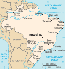
Atlantic Ocean islands
- Arquipelago de Fernando de Noronha
- Arquipélago de São Pedro e São Paulo (Saint Peter and Paul Rocks)
- Atol das Rocas (Rocas Atoll)
- Ilha de Boipeba
- Ilha de Maraca
- Ilha da Queimada Grande
- Ilha de Santa Bárbara
- Ilha de Santa Catarina
- Ilha de Santo Amaro
- Ilha de São Luís
- Ilha Grande
- Ilha Itaparica
- Ilha Tinhare
- Ilha Trindade
- Ilha dos Lobos
- Ilhabela archipelago
- Ilhas Cagarras archipelago
- Ilhas Martim Vaz archipelago
- Vitória archipelago
River Islands
Fluvial-maritime
Chile
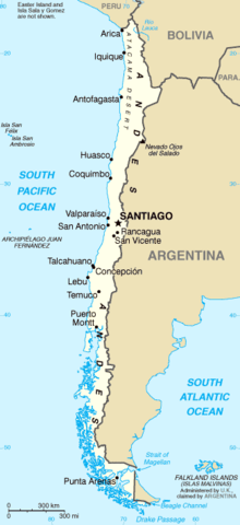
Pacific Ocean islands
- Archipiélago de Chiloé
- Archipiélago de las Guaitecas
- Archipiélago Guayaneco
- Archipiélago Juan Fernández (also considered part of Oceania)
- Isla Chañaral
- Isla de Pascua (Easter Island) (also considered part of Oceania)
- Isla del Rey
- Isla Magdalena
- Isla Mancera
- Isla Mocha
- Isla Quiriquina
- Isla Salas y Gómez
- Islas Desventuradas
- Merino Jarpa Island
- Patagonic Archipelago
- Archipelago de La Reina Adelaida (Queen Adelaide Archipelago)
- Archipiélago de los Chonos
- Archipiélago de Tierra del Fuego
- Isla Dawson
- Isla Desolación
- Isla Gordon
- Isla Grande de Tierra del Fuego (divided with Argentina)
- Isla Magdalena
- Islas Hermite
- Isla Hermite
- Isla Hornos – location of Cape Horn (Cabo de Hornos)
- Isla Hoste
- Isla Navarino
- Isla Santa Inés
- Islas Picton, Lennox y Nueva
- Islas Wollaston
- Londonderry Island
- Isla Angamos
- Isla Aracena
- Isla Campana
- Isla Chatham
- Isla Clarence
- Isla Diego de Almagro
- Isla Duque de York
- Isla Esmeralda
- Isla Farrel
- Isla Guarello
- Isla Hanover
- Isla Jorge Montt
- Isla Juan Guillermos
- Isla Madre de Dios
- Isla Manuel Rodriguez
- Isla Mornington
- Isla Patricio Lynch
- Isla Pratt
- Isla Riesco
- Isla Serrano
- Isla Stosch
- Isla Wellington
- Islas Diego Ramírez
- Islote Águila (Águila Islet) – southernmost point of Chile
- Islas Ildefonso
Lake islands
- Isla Gabriela
- Isla Guapi
- Isla Fresia
- Isla Central
River islands
- Isla Teja
- Isla del Rey
- Isla Mancera
- Isla Haverbeck
- Isla Mota
- Isla Guapi
- Isla Lemuy
- Isla Orrego
Colombia
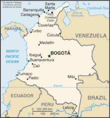
Caribbean Sea islands
- Rosario Islands
- Isla Grande
- Isla Marina
- Isla de Roberto
- Isla Rosario
- Isla del Tesoro
- Fuerte Island
- Tierra Bomba Island
- Isla del Pirata
- Isla de Salamanca
San Andrés and Providencia Department:
- Acuario Cay (also known as Rose Cay)
- Alice Shoal
- Bajo Nuevo Bank
- Bayley Islet
- Basalt Islet
- Brothers Cay
- Crab Cay
- Cayos de Albuquerque
- North Cay
- South Cay
- Córdoba Cay (also known as Haynes Cay)
- Easy Cay
- Grunt Cay
- Cayos de Este Sudeste
- Bolívar Cay (also known as Courtown or West Cay)
- East Cay
- Palm Cay
- Providencia Island
- Quita Sueño Bank
- Rocky Cay
- Roncador Bank
- Roncador Cay
- San Andrés Island
- Santa Catalina Island
- Santander Cay (also known as Cotton Cay)
- Serrana Bank
- Serranilla Bank
- Sucre Islet (also known as Johnny Cay)
Pacific Ocean islands
- Coco Island
- Gorgona Island
- El Horno Islet
- Gorgonilla Island
- El Viudo Islet
- Micay Island
- Cacagual Island
- Bocagrande Island
- El Bajito Island
- El Gallo Island
- El Morro Island
- La Viciosa Island
- Sanquianga Island
- Tumaco Island
- Ají Island
- La Palma Island
- Malpelo Island
Lake islands
- Lake Tota
- Cerro Chiquito Island
- Santa Helena Island
- San Pedro Island
River islands
- Baranoa Island
- Curvaratá Island
- Loreto Island
- Porvenir Island
- Tigre Island
- Yaguas Muñoz Island
|
|
|
|
|
|
|
Ecuador

Pacific Ocean islands
Lake Islands
- Cuicocha Lake
- Teodoro Wolf Island
- Yerovi Island
Falkland Islands
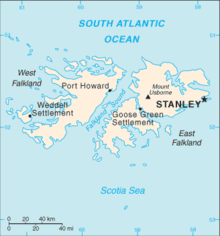
Atlantic Ocean islands
- Falkland Islands (also claimed by Argentina)
French Guiana
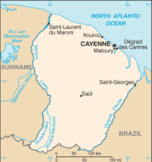
- Îles du Salut
- Constable Islands
- Remire Islands
- Palasisi, island in the Litani River[1]
- Île Portal, island in the Maroni River[2]
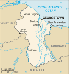
Guyana
Paraguay

Paraguay is a landlocked country with no ocean islands and only a few very small inland islands.
Peru

South Georgia and the South Sandwich Islands

Atlantic Ocean islands
- South Georgia (also claimed by Argentina)
- South Sandwich Islands (also claimed by Argentina)
Suriname

Uruguay

- Brazilian Island
- Gorriti Island
- Juncal Island
- Isla de Flores
- Isla de las Gaviotas
- Isla de Lobos
- Timoteo Domínguez Island
- Vizcaíno Island
Venezuela

Caribbean Sea islands
- Archipiélago Las Aves
- Archipiélago Los Monjes
- Archipiélago Los Roques
- Isla de Aves
- Isla de Coche
- Isla de Cubagua
- Isla de Patos
- Isla de Toas
- Isla de Zapara
- Isla La Orchila
- Isla La Sola
- Isla La Tortuga
- Isla Margarita
- Isla San Carlos
- Islas Caracas
- Islas los Frailes
- Islas los Hermanos
- Islas los Testigos
River islands
- Ankoko Island (also claimed by Guyana)
See also
- List of islands by area
- List of islands by highest point
- List of islands by population
- List of islands in lakes
- List of river islands
- List of islands in the Atlantic Ocean
- List of Caribbean islands
- List of islands in the Pacific Ocean
- Topic outline of South America
References
- ^ Duin, Renzo Sebastiaan (2009). Wayana Socio-political Landscapes: Multi-scalar Regionality and Temporality in Guiana (PDF). University of Florida. p. 138.
- ^ "Les enfants de l'île Portal". Media Part (in French). Retrieved 7 March 2021.
External links
South America at Wikipedia's sister projects
 Definitions from Wiktionary
 Media from Commons
 News from Wikinews
 Quotations from Wikiquote
 Texts from Wikisource
 Textbooks from Wikibooks
 Resources from Wikiversity
- Island Directory @ United Nations Environment Programme
 Wikimedia Atlas of South America
- World island information @ WorldIslandInfo.com
