To install click the Add extension button. That's it.

The source code for the WIKI 2 extension is being checked by specialists of the Mozilla Foundation, Google, and Apple. You could also do it yourself at any point in time.

4,5
Kelly Slayton
Congratulations on this excellent venture… what a great idea!
Alexander Grigorievskiy
I use WIKI 2 every day and almost forgot how the original Wikipedia looks like.
Live Statistics
English Articles
Improved in 24 Hours
Added in 24 Hours
What we do. Every page goes through several hundred of perfecting techniques; in live mode. Quite the same Wikipedia. Just better.
.
Leo
Newton
Brights
Milds

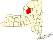
List of hamlets in Lewis County, New York

From Wikipedia, the free encyclopedia

This is a list of the hamlets in Lewis County, New York.

Name Former name(s) Location Elevation GNIS Feature ID
Alpina 44°10′09″N 75°25′36″W / 44.169230°N 75.426592°W / 44.169230; -75.426592 (Alpina) 745 feet (227 m) 972162[1]
Barnes Corners 43°49′01″N 75°49′04″W / 43.817012°N 75.817695°W / 43.817012; -75.817695 (Barnes Corners) 1,411 feet (430 m) 943043[2]
Beaver Falls Beaverfalls, Castorville, Rohr's Mills 43°53′13″N 75°25′39″W / 43.887013°N 75.427408°W / 43.887013; -75.427408 (Beaver Falls) 807 feet (246 m) 943383[3]
Belfort Monterey 43°55′41″N 75°19′56″W / 43.928124°N 75.332132°W / 43.928124; -75.332132 (Belfort) 984 feet (300 m) 972214[4]
Bellwood 43°48′10″N 75°40′54″W / 43.802847°N 75.681579°W / 43.802847; -75.681579 (Bellwood) 1,614 feet (492 m) 972220[5]
Brantingham 43°41′19″N 75°17′32″W / 43.688680°N 75.292122°W / 43.688680; -75.292122 (Brantingham) 1,253 feet (382 m) 944651[6]
Briggs Corner 43°52′28″N 75°32′09″W / 43.874514°N 75.535743°W / 43.874514; -75.535743 (Briggs Corner) 810 feet (250 m) 972259[7]
Bushes Landing 43°46′39″N 75°24′33″W / 43.777569°N 75.409072°W / 43.777569; -75.409072 (Bushes Landing) 764 feet (233 m) 945315[8]
Clark Corners 43°53′01″N 75°39′39″W / 43.883679°N 75.660747°W / 43.883679; -75.660747 (Clark Corners) 1,201 feet (366 m) 946753[9]
Collinsville High Falls Village 43°36′37″N 75°23′03″W / 43.610347°N 75.384066°W / 43.610347; -75.384066 (Collinsville) 1,207 feet (368 m) 947163[10]
Crystal Dale Crystaldale 43°49′17″N 75°19′59″W / 43.821458°N 75.332961°W / 43.821458; -75.332961 (Crystal Dale) 1,086 feet (331 m) 972354[11]
Dadville 43°48′24″N 75°28′29″W / 43.806736°N 75.474629°W / 43.806736; -75.474629 (Dadville) 741 feet (226 m) 947986[12]
Deer River French's Mills, Myers Mills 43°55′47″N 75°35′21″W / 43.929791°N 75.589079°W / 43.929791; -75.589079 (Deer River) 781 feet (238 m) 948232[13]
Denmark 43°53′59″N 75°34′57″W / 43.899791°N 75.582412°W / 43.899791; -75.582412 (Denmark) 971 feet (296 m) 948303[14]
Diana Center Blanchards Settlement 44°04′32″N 75°26′27″W / 44.075622°N 75.440751°W / 44.075622; -75.440751 (Diana Center) 869 feet (265 m) 972381[15]
East Martinsburg 43°44′41″N 75°25′39″W / 43.744791°N 75.427404°W / 43.744791; -75.427404 (East Martinsburg) 755 feet (230 m) 972423[16]
Fish Creek 43°31′13″N 75°32′00″W / 43.520348°N 75.533235°W / 43.520348; -75.533235 (Fish Creek) 1,611 feet (491 m) 972472[17]
Forest City 43°57′07″N 75°26′32″W / 43.952013°N 75.442132°W / 43.952013; -75.442132 (Forest City) 919 feet (280 m) 972489[18]
Fowlersville 43°37′26″N 75°16′27″W / 43.623958°N 75.274064°W / 43.623958; -75.274064 (Fowlersville) 1,168 feet (356 m) 972502[19]
Freeman Mill 43°27′39″N 75°34′43″W / 43.460903°N 75.578514°W / 43.460903; -75.578514 (Freeman Mill) 1,404 feet (428 m) 972510[20]
Glendale 43°42′58″N 75°25′00″W / 43.716180°N 75.41657°W / 43.716180; -75.41657 (Glendale) 843 feet (257 m) 951201[21]
Glenfield 43°42′37″N 75°24′08″W / 43.710347°N 75.402125°W / 43.710347; -75.402125 (Glenfield) 768 feet (234 m) 951212[22]
Goulds Mill 43°36′33″N 75°20′26″W / 43.609236°N 75.340454°W / 43.609236; -75.340454 (Goulds Mill) 863 feet (263 m) 951421[23]
Greig 43°40′53″N 75°21′17″W / 43.681458°N 75.354623°W / 43.681458; -75.354623 (Greig) 807 feet (246 m) 951800[24]
Harrisburg Harrisburgh 43°50′32″N 75°36′10″W / 43.842291°N 75.602689°W / 43.842291; -75.602689 (Harrisburg) 1,362 feet (415 m) 972601[25]
Harrisville
High Falls 43°55′23″N 75°22′20″W / 43.923124°N 75.372131°W / 43.923124; -75.372131 (High Falls) 935 feet (285 m) 972616[26]
Hooker 43°41′33″N 75°44′38″W / 43.69257°N 75.743801°W / 43.69257; -75.743801 (Hooker) 1,765 feet (538 m) 972623[27]
Houseville 43°40′53″N 75°26′41″W / 43.681458°N 75.444625°W / 43.681458; -75.444625 (Huoseville) 1,312 feet (400 m) 972628[28]
Indian River 43°58′35″N 75°22′08″W / 43.976457°N 75.3688°W / 43.976457; -75.3688 (Indian River) 961 feet (293 m) 972650[29]
Jerden Falls 44°00′46″N 75°19′20″W / 44.012845°N 75.322135°W / 44.012845; -75.322135 (Jerden Falls) 922 feet (281 m) 972662[30]
Kimball Mill 44°05′08″N 75°20′53″W / 44.085621°N 75.347974°W / 44.085621; -75.347974 (Kimball Mill) 886 feet (270 m) 972688[31]
Kirschnerville 43°52′59″N 75°20′13″W / 43.883124°N 75.336852°W / 43.883124; -75.336852 (Kirschnerville) 928 feet (283 m) 954719[32]
Kosterville 43°36′57″N 75°20′05″W / 43.615902°N 75.334621°W / 43.615902; -75.334621 (Kosterville) 938 feet (286 m) 972695[33]
Lake Bonaparte 44°08′17″N 75°22′46″W / 44.138120°N 75.379367°W / 44.138120; -75.379367 (Lake Bonaparte) 768 feet (234 m) 954896[34]
Leisher Mill 43°29′07″N 75°38′18″W / 43.485348°N 75.638239°W / 43.485348; -75.638239 (Leisher Mill) 1,368 feet (417 m) 972717[35]
Locust Grove 43°33′48″N 75°22′28″W / 43.563403°N 75.374342°W / 43.563403; -75.374342 (Locust Grove) 1,355 feet (413 m) 970313[36]
Lyonsdale 43°37′07″N 75°18′23″W / 43.618680°N 75.306287°W / 43.618680; -75.306287 (Lyonsdale) 1,066 feet (325 m) 956209[37]
Martinsburg Martinsburgh 43°44′15″N 75°28′11″W / 43.737569°N 75.469627°W / 43.737569; -75.469627 (Martinsburg) 1,263 feet (385 m) 956600[38]
Michigan Mills 43°36′13″N 75°35′51″W / 43.603681°N 75.597406°W / 43.603681; -75.597406 (Michigan Mills) 1,775 feet (541 m) 972796[39]
Mohawk Hill 43°31′29″N 75°28′11″W / 43.524792°N 75.469622°W / 43.524792; -75.469622 (Mohawk Hill) 1,778 feet (542 m) 972808[40]
Monteola 43°38′45″N 75°39′44″W / 43.645903°N 75.662131°W / 43.645903; -75.662131 (Monteola) 1,837 feet (560 m) 972810[41]
Naumburg Naumberg, Naumburgh, Prussian Settlement 43°54′04″N 75°29′39″W / 43.901180°N 75.494075°W / 43.901180; -75.494075 (Naumburg) 741 feet (226 m) 958301[42]
New Boston 43°48′00″N 75°44′45″W / 43.800069°N 75.745748°W / 43.800069; -75.745748 (New Boston) 1,529 feet (466 m) 958392[43]
New Bremen Dayansville 43°50′16″N 75°26′25″W / 43.837847°N 75.440185°W / 43.837847; -75.440185 (New Bremen) 771 feet (235 m) 958394[44]
New Campbellwood Wye 43°36′55″N 75°43′02″W / 43.615348°N 75.717132°W / 43.615348; -75.717132 (New Campbellwood Wye) 1,795 feet (547 m) 972833[45]
North Croghan Crossing 44°02′05″N 75°29′49″W / 44.034791°N 75.496859°W / 44.034791; -75.496859 (North Croghan Crossing) 906 feet (276 m) 972861[46]
North Osceola 43°34′15″N 75°42′45″W / 43.570903°N 75.712409°W / 43.570903; -75.712409 (North Osceola) 1,591 feet (485 m) 972871[47]
Number Four 43°51′56″N 75°10′51″W / 43.865623°N 75.180739°W / 43.865623; -75.180739 (Number Four) 1,568 feet (478 m) 959057[48]
Old Campbellwood Wye Old Campbellwood Y 43°37′01″N 75°39′52″W / 43.617014°N 75.664353°W / 43.617014; -75.664353 (Old Campbellwood Wye) 1,857 feet (566 m) 972891[49]
Osceola 43°30′00″N 75°43′20″W / 43.500070°N 75.722130°W / 43.500070; -75.722130 (Osceola) 1,030 feet (310 m) 959510[50]
Otter Creek 43°43′07″N 75°22′03″W / 43.718680°N 75.367403°W / 43.718680; -75.367403 (Otter Creek) 787 feet (240 m) 959561[51]
Page 43°39′20″N 75°33′42″W / 43.655625°N 75.561572°W / 43.655625; -75.561572 (Page) 1,942 feet (592 m) 972907[52]
Parkers 43°43′56″N 75°40′15″W / 43.732292°N 75.670744°W / 43.732292; -75.670744 (Parkers) 1,837 feet (560 m) 972917[53]
Parson Mill 43°26′58″N 75°34′00″W / 43.449514°N 75.566569°W / 43.449514; -75.566569 (Parson Mill) 1,437 feet (438 m) 972919[54]
Petries Corners Petrie's Corners 43°48′15″N 75°21′42″W / 43.804236°N 75.361572°W / 43.804236; -75.361572 (Petries Corners) 938 feet (286 m) 960255[55]
Pine Grove 43°45′06″N 75°22′37″W / 43.751736°N 75.376848°W / 43.751736; -75.376848 (Pine Grove) 771 feet (235 m) 972945[56]
Rector 43°45′20″N 75°40′37″W / 43.755625°N 75.676855°W / 43.755625; -75.676855 (Rector) 1,808 feet (551 m) 972988[57]
Remington Corners 44°07′24″N 75°21′44″W / 44.123398°N 75.362144°W / 44.123398; -75.362144 (Remington Corners) 797 feet (243 m) 962373[58]
Shuetown 43°37′13″N 75°19′43″W / 43.620347°N 75.328509°W / 43.620347; -75.328509 (Shuetown) 968 feet (295 m) 973066[59]
Soft Maple 43°55′19″N 75°14′29″W / 43.922012°N 75.241298°W / 43.922012; -75.241298 (Soft Maple) 1,181 feet (360 m) 973083[60]
Sperryville 43°46′23″N 75°18′24″W / 43.773125°N 75.306570°W / 43.773125; -75.306570 (Sperryville) 1,234 feet (376 m) 973105[61]
Swancott Mill 43°27′44″N 75°36′11″W / 43.462292°N 75.602959°W / 43.462292; -75.602959 (Swancott Mill) 1,316 feet (401 m) 973130[62]
Talcottville Leyden 43°32′00″N 75°21′55″W / 43.533402°N 75.365174°W / 43.533402; -75.365174 (Talcottville) 1,135 feet (346 m) 967005[63]
Texas 43°59′06″N 75°30′18″W / 43.985069°N 75.504911°W / 43.985069; -75.504911 (Texas) 909 feet (277 m) 973148[64]
Watson 43°46′33″N 75°26′10″W / 43.775903°N 75.436016°W / 43.775903; -75.436016 (Watson) 748 feet (228 m) 968923[65]
Welch Hill 43°38′10″N 75°27′38″W / 43.636181°N 75.460458°W / 43.636181; -75.460458 (Welch Hill) 1,923 feet (586 m) 973215[66]
West Leyden 43°27′34″N 75°27′50″W / 43.459514°N 75.463788°W / 43.459514; -75.463788 (West Leyden) 1,489 feet (454 m) 970784[67]
West Lowville 43°47′36″N 75°32′52″W / 43.793403°N 75.547686°W / 43.793403; -75.547686 (West Lowville) 1,214 feet (370 m) 970786[68]
West Martinsburg West Martinsburgh 43°45′34″N 75°31′03″W / 43.759514°N 75.517406°W / 43.759514; -75.517406 (West Martinsburg) 1,260 feet (380 m) 970789[69]
Wetmore 43°41′52″N 75°33′33″W / 43.697847°N 75.559073°W / 43.697847; -75.559073 (Wetmore) 1,991 feet (607 m) 973257[70]
Windecker 43°47′57″N 75°36′45″W / 43.799236°N 75.612410°W / 43.799236; -75.612410 (Windecker) 1,680 feet (510 m) 973276[71]

YouTube Encyclopedic

  • 1/5
    Views:
    588
    724 236
    521 287
    6 632
    5 800
  • Kim Stanley Robinson’s New York 2140
  • Gary Vaynerchuk's Top 10 Rules For Success (@garyvee)
  • Black Wall Street, Little Africa, Tulsa, Oklahoma (full version)
  • 9 Creepy Mysteries Involving Unidentified People
  • Gateway to Freedom: The Hidden History of the Underground Railroad

Transcription

References

  1. ^ U.S. Geological Survey Geographic Names Information System: Alpina
  2. ^ U.S. Geological Survey Geographic Names Information System: Barnes Corners
  3. ^ U.S. Geological Survey Geographic Names Information System: Beaver Falls
  4. ^ U.S. Geological Survey Geographic Names Information System: Belfort
  5. ^ U.S. Geological Survey Geographic Names Information System: Bellwood
  6. ^ U.S. Geological Survey Geographic Names Information System: Brantingham
  7. ^ U.S. Geological Survey Geographic Names Information System: Briggs Corner
  8. ^ U.S. Geological Survey Geographic Names Information System: Bushes Landing
  9. ^ U.S. Geological Survey Geographic Names Information System: Clark Corners
  10. ^ U.S. Geological Survey Geographic Names Information System: Collinsville
  11. ^ U.S. Geological Survey Geographic Names Information System: Crystal Dale
  12. ^ U.S. Geological Survey Geographic Names Information System: Dadville
  13. ^ U.S. Geological Survey Geographic Names Information System: Deer River
  14. ^ U.S. Geological Survey Geographic Names Information System: Denmark
  15. ^ U.S. Geological Survey Geographic Names Information System: Diana Center
  16. ^ U.S. Geological Survey Geographic Names Information System: East Martinsburg
  17. ^ U.S. Geological Survey Geographic Names Information System: Fish Creek
  18. ^ U.S. Geological Survey Geographic Names Information System: Forest City
  19. ^ U.S. Geological Survey Geographic Names Information System: Fowlersville
  20. ^ U.S. Geological Survey Geographic Names Information System: Freeman Mill
  21. ^ U.S. Geological Survey Geographic Names Information System: Glendale
  22. ^ U.S. Geological Survey Geographic Names Information System: Glenfield
  23. ^ U.S. Geological Survey Geographic Names Information System: Goulds Mill
  24. ^ U.S. Geological Survey Geographic Names Information System: Greig
  25. ^ U.S. Geological Survey Geographic Names Information System: Harrisburg
  26. ^ U.S. Geological Survey Geographic Names Information System: High Falls
  27. ^ U.S. Geological Survey Geographic Names Information System: Hooker
  28. ^ U.S. Geological Survey Geographic Names Information System: Houseville
  29. ^ U.S. Geological Survey Geographic Names Information System: Indian River
  30. ^ U.S. Geological Survey Geographic Names Information System: Jerden Falls
  31. ^ U.S. Geological Survey Geographic Names Information System: Kimball Mill
  32. ^ U.S. Geological Survey Geographic Names Information System: Kirschnerville
  33. ^ U.S. Geological Survey Geographic Names Information System: Kosterville
  34. ^ U.S. Geological Survey Geographic Names Information System: Lake Bonaparte
  35. ^ U.S. Geological Survey Geographic Names Information System: Leisher Mill
  36. ^ U.S. Geological Survey Geographic Names Information System: Locust Grove
  37. ^ U.S. Geological Survey Geographic Names Information System: Lyonsdale
  38. ^ U.S. Geological Survey Geographic Names Information System: Martinsburg
  39. ^ U.S. Geological Survey Geographic Names Information System: Michigan Mills
  40. ^ U.S. Geological Survey Geographic Names Information System: Mohawk Hill
  41. ^ U.S. Geological Survey Geographic Names Information System: Monteola
  42. ^ U.S. Geological Survey Geographic Names Information System: Naumburg
  43. ^ U.S. Geological Survey Geographic Names Information System: New Boston
  44. ^ U.S. Geological Survey Geographic Names Information System: New Bremen
  45. ^ U.S. Geological Survey Geographic Names Information System: New Campbellwood Wye
  46. ^ U.S. Geological Survey Geographic Names Information System: North Croghan Crossing
  47. ^ U.S. Geological Survey Geographic Names Information System: North Osceola
  48. ^ U.S. Geological Survey Geographic Names Information System: Number Four
  49. ^ U.S. Geological Survey Geographic Names Information System: Old Campbellwood Wye
  50. ^ U.S. Geological Survey Geographic Names Information System: Osceola
  51. ^ U.S. Geological Survey Geographic Names Information System: Otter Creek
  52. ^ U.S. Geological Survey Geographic Names Information System: Page
  53. ^ U.S. Geological Survey Geographic Names Information System: Parkers
  54. ^ U.S. Geological Survey Geographic Names Information System: Parson Mill
  55. ^ U.S. Geological Survey Geographic Names Information System: Petries Corners
  56. ^ U.S. Geological Survey Geographic Names Information System: Pine Grove
  57. ^ U.S. Geological Survey Geographic Names Information System: Rector
  58. ^ U.S. Geological Survey Geographic Names Information System: Remington Corners
  59. ^ U.S. Geological Survey Geographic Names Information System: Shuetown
  60. ^ U.S. Geological Survey Geographic Names Information System: Soft Maple
  61. ^ U.S. Geological Survey Geographic Names Information System: Sperryville
  62. ^ U.S. Geological Survey Geographic Names Information System: Swancott Mill
  63. ^ U.S. Geological Survey Geographic Names Information System: Talcottville
  64. ^ U.S. Geological Survey Geographic Names Information System: Texas
  65. ^ U.S. Geological Survey Geographic Names Information System: Watson
  66. ^ U.S. Geological Survey Geographic Names Information System: Welch Hill
  67. ^ U.S. Geological Survey Geographic Names Information System: West Leyden
  68. ^ U.S. Geological Survey Geographic Names Information System: West Lowville
  69. ^ U.S. Geological Survey Geographic Names Information System: West Martinsburg
  70. ^ U.S. Geological Survey Geographic Names Information System: Wetmore
  71. ^ U.S. Geological Survey Geographic Names Information System: Windecker
This page was last edited on 27 July 2023, at 01:59
Basis of this page is in Wikipedia. Text is available under the CC BY-SA 3.0 Unported License. Non-text media are available under their specified licenses. Wikipedia® is a registered trademark of the Wikimedia Foundation, Inc. WIKI 2 is an independent company and has no affiliation with Wikimedia Foundation.