Crossing
Date
Coordinates
Heritage
Locality
Notes
Image
Confluence of River Goyt and River Tame
53°24′51″N 2°09′24″W / 53.4143°N 2.1567°W / 53.4143; -2.1567 (Start of River Mersey ) -
Stockport
Start of River Mersey
Knightsbridge
53°24′50″N 2°09′29″W / 53.4138°N 2.1580°W / 53.4138; -2.1580 (Knightsbridge ) -
Stockport
Merseyway Shopping Centre
53°24′40″N 2°09′33″W / 53.4111°N 2.1591°W / 53.4111; -2.1591 (Merseyway Shopping Centre ) -
Stockport
River in culvert
Wellington Bridge[2]
1826
53°24′33″N 2°09′45″W / 53.4092°N 2.1625°W / 53.4092; -2.1625 (Wellington Bridge ) II
A6
Astley St Bridge
53°24′33″N 2°09′53″W / 53.4093°N 2.1647°W / 53.4093; -2.1647 (Astley St Bridge ) -
Stockport
Stockport Viaduct
1840
53°24′32″N 2°09′55″W / 53.4089°N 2.1653°W / 53.4089; -2.1653 (Stockport Viaduct ) II*
Stockport
King St Bridge
53°24′33″N 2°10′01″W / 53.4092°N 2.1669°W / 53.4092; -2.1669 (King St Bridge ) -
Stockport
Hollywood Way Bridge
53°24′27″N 2°10′26″W / 53.4074°N 2.1739°W / 53.4074; -2.1739 (Hollywood Way Bridge ) -
Stockport
Brinksway Bridge[3]
53°24′26″N 2°10′28″W / 53.4071°N 2.1745°W / 53.4071; -2.1745 (Brinksway Bridge ) -
Stockport
Geoff Funnell Bridge
53°24′21″N 2°11′11″W / 53.4058°N 2.1864°W / 53.4058; -2.1864 (Geoff Funnell Bridge ) -
Pedestrian
M60 Bridge
53°24′21″N 2°11′28″W / 53.4059°N 2.1911°W / 53.4059; -2.1911 -
Stockport
M60
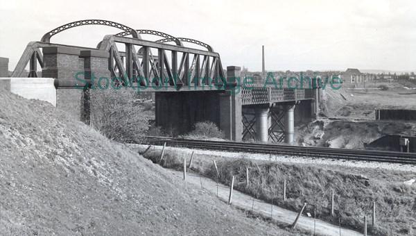
Former Railway Bridge[4]
53°24′22″N 2°11′36″W / 53.406°N 2.1933°W / 53.406; -2.1933 (Former Rail Bridge ) -
Didsbury
Manchester to Derby line. Dismantled
Cheadle Bridge
53°24′20″N 2°13′07″W / 53.4055°N 2.2185°W / 53.4055; -2.2185 (Cheadle Bridge ) -
Didsbury
Kingsway
53°24′05″N 2°13′30″W / 53.4014°N 2.2251°W / 53.4014; -2.2251 (Kingsway ) -
Didsbury
Mersey Viaduct
53°24′04″N 2°13′35″W / 53.4011°N 2.2264°W / 53.4011; -2.2264 (Mersey Viaduct ) -
Didsbury
Styal Line
Simons Bridge
53°24′45″N 2°14′32″W / 53.4125°N 2.2422°W / 53.4125; -2.2422 (Simons Bridge ) -
Didsbury
Pedestrian
M60 Bridge
53°24′29″N 2°15′01″W / 53.408°N 2.2503°W / 53.408; -2.2503 (M60 Bridge ) -
Wythenshawe
M60
Tatton Arms Bridge
53°24′32″N 2°15′10″W / 53.4088°N 2.2529°W / 53.4088; -2.2529 (Tatton Arms Bridge ) -
Wythenshawe
Pedestrian
M60 Bridge
53°24′41″N 2°15′14″W / 53.4114°N 2.254°W / 53.4114; -2.254 (M60 Bridge ) -
Wythenshawe
M60
Palatine Road Bridge
53°24′44″N 2°15′14″W / 53.4121°N 2.2539°W / 53.4121; -2.2539 (Palatine Road Bridge ) -
Wythenshawe
B5167
Princess Parkway Bridge
53°24′58″N 2°15′49″W / 53.4162°N 2.2635°W / 53.4162; -2.2635 (Princess Parkway Bridge ) -
Wythenshawe
Main and slip road bridges and footbridges
Footbridge
53°25′17″N 2°16′10″W / 53.4214°N 2.2695°W / 53.4214; -2.2695 (Footbridge ) -
Chorlton Water Park
Metrolink Bridge
53°25′46″N 2°17′10″W / 53.4294°N 2.286°W / 53.4294; -2.286 (Metrolink Bridge ) -
Sale
Manchester Airport line
Jacksons Bridge[5]
1881
53°25′49″N 2°17′12″W / 53.4302°N 2.2868°W / 53.4302; -2.2868 (Jacksons Bridge ) II
Sale
Pedestrian
Barfoot Bridge
53°26′11″N 2°18′30″W / 53.4365°N 2.3083°W / 53.4365; -2.3083 (Barfoot Bridge ) -
Sale
Footbridge and Metrolink (Altrincham line)
Bridgewater Canal Aqueduct[6] 1776
53°26′12″N 2°18′32″W / 53.4366°N 2.3089°W / 53.4366; -2.3089 (Bridgewater Canal Aqueduct ) II
Sale
M60 Bridge
53°26′09″N 2°18′44″W / 53.4358°N 2.3123°W / 53.4358; -2.3123 (M60 Bridge ) -
Sale
Main and slip road bridges
Crossford Bridge[7]
53°26′05″N 2°18′58″W / 53.4347°N 2.316°W / 53.4347; -2.316 (Crossford Bridge ) -
Sale
A56 , separate bridge for each carriageway
Carrington Spur Bridge
53°26′18″N 2°20′37″W / 53.4383°N 2.3435°W / 53.4383; -2.3435 (Carrington Spur Bridge ) -
Ashton
A6144
Ashton Millennium Bridge
53°26′19″N 2°20′38″W / 53.4385°N 2.3438°W / 53.4385; -2.3438 (Ashton Millennium Bridge ) -
Ashton
Pedestrian
Flixton Bridge
53°26′24″N 2°23′22″W / 53.44°N 2.3895°W / 53.44; -2.3895 (Flixton Bridge ) -
Flixton
Cadishead Viaduct
1893
53°25′29″N 2°25′40″W / 53.4246°N 2.4279°W / 53.4246; -2.4279 (Cadishead Viaduct ) -
Cadishead
Manchester Ship Canal joins the Mersey in this section
Warburton High Level Bridge
1893
53°24′27″N 2°27′32″W / 53.4075°N 2.459°W / 53.4075; -2.459 (Warburton High Level Bridge ) -
Warburton
Works Access Bridge
53°23′50″N 2°28′55″W / 53.3971°N 2.4819°W / 53.3971; -2.4819 (Works Access Bridge ) -
Thelwall
Works Access Bridge
53°23′41″N 2°30′25″W / 53.3947°N 2.5069°W / 53.3947; -2.5069 (Works Access Bridge ) -
Thelwall
Thelwall Viaduct
1963/1996
53°23′40″N 2°30′27″W / 53.3945°N 2.5076°W / 53.3945; -2.5076 (Thelwall Viaduct ) -
Thelwall
Also crosses Manchester Ship Canal
Woolston Weir and footbridge
53°23′38″N 2°31′20″W / 53.3939°N 2.5222°W / 53.3939; -2.5222 (Works Access Bridge ) -
Warrington
Kingsway Bridge
53°23′16″N 2°33′56″W / 53.3879°N 2.5656°W / 53.3879; -2.5656 (Kingsway Bridge ) -
Warrington
A50
Howley Bridge
1912
53°23′14″N 2°34′43″W / 53.3873°N 2.5787°W / 53.3873; -2.5787 (Howley Footbridge ) II
Warrington
Pedestrian
Warrington New Bridge/Warringon Bridge
53°23′10″N 2°35′26″W / 53.386°N 2.5906°W / 53.386; -2.5906 (Warringon Bridge ) -
Warrington
Gyratory System
Arpley Railway Bridge
53°23′06″N 2°35′34″W / 53.3849°N 2.5927°W / 53.3849; -2.5927 (Arpley Railway Bridge ) -
Warrington
Arpley New Bridge
53°23′01″N 2°35′34″W / 53.3835°N 2.5929°W / 53.3835; -2.5929 (Arpley New Bridge ) -
Warrington
Centre Park Link Bridge
53°22′29″N 2°35′55″W / 53.3747°N 2.5987°W / 53.3747; -2.5987 (Centre Park Link Bridge ) -
Warrington
Mersey Viaduct
53°22′28″N 2°36′17″W / 53.3744°N 2.6048°W / 53.3744; -2.6048 (Mersey Viaduct ) -
Warrington
Chester–Warrington line . Includes footbridge
Mersey Viaduct
53°22′29″N 2°36′21″W / 53.3747°N 2.6058°W / 53.3747; -2.6058 (Mersey Viaduct ) -
Warrington
West Coast Main Line
Works Access Bridge
53°22′56″N 2°36′33″W / 53.3821°N 2.6091°W / 53.3821; -2.6091 (Works Access Bridge ) -
Warrington
Warrington Transporter Bridge
1915
53°23′02″N 2°36′27″W / 53.3838°N 2.6075°W / 53.3838; -2.6075 (Warrington Transporter Bridge ) II*
Warrington
Forrest Way Bridge
53°22′45″N 2°37′02″W / 53.3792°N 2.6172°W / 53.3792; -2.6172 (Forrest Way Bridge ) -
Warrington
Mersey Gateway Bridge
2017
53°21′10″N 2°42′47″W / 53.3528°N 2.713°W / 53.3528; -2.713 (Mersey Gateway Bridge ) -
Runcorn
Widnes–Runcorn Transporter Bridge
1905
53°20′48″N 2°44′11″W / 53.3466°N 2.7363°W / 53.3466; -2.7363 (Widnes–Runcorn Transporter Bridge ) -
Runcorn
Dismantled 1961
Silver Jubilee Bridge
1961
53°20′48″N 2°44′16″W / 53.3466°N 2.7377°W / 53.3466; -2.7377 (Silver Jubilee Bridge ) II
Runcorn
Runcorn Railway Bridge
1868
53°20′48″N 2°44′18″W / 53.3468°N 2.7384°W / 53.3468; -2.7384 (Runcorn Railway Bridge ) II*
Runcorn
Liverpool Branch of West Coast Main Line
Mersey Railway Tunnel
1886
53°23′59″N 3°00′09″W / 53.3997°N 3.0026°W / 53.3997; -3.0026 (Mersey Railway Tunnel ) -
Liverpool
Queensway Tunnel
1934
53°24′02″N 3°00′14″W / 53.4006°N 3.004°W / 53.4006; -3.004 (Queensway Tunnel ) II
Liverpool
Entrances listed
Mersey Ferry
53°24′17″N 2°59′54″W / 53.4046°N 2.9982°W / 53.4046; -2.9982 (Pier Head Ferry Terminal ) -
Liverpool
Kingsway Tunnel
1971
53°24′47″N 3°00′35″W / 53.4131°N 3.0098°W / 53.4131; -3.0098 (Kingsway Tunnel ) -
Liverpool
Twin Bore


