
This is a list of the Pennsylvania state historical markers in Sullivan County.
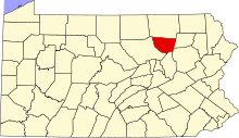
This is intended to be a complete list of the official state historical markers placed in Sullivan County, Pennsylvania by the Pennsylvania Historical and Museum Commission (PHMC). The locations of the historical markers, as well as the latitude and longitude coordinates as provided by the PHMC's database, are included below when available. There are seven historical markers located in Sullivan County.[1]
Historical markers
| Marker title | Image | Date dedicated | Location | Marker type | Topics |
|---|---|---|---|---|---|
| Celestia | October 22, 1999 | Pa. 42 1½ miles west of Laporte 41°25′20″N 76°31′30″W / 41.42221°N 76.52493°W |
Roadside | Early Settlement, Religion | |
| Celestia | July 12, 1951 | U.S. 220 just NE of Laporte 41°25′28″N 76°29′19″W / 41.42454°N 76.48858°W |
Roadside | Religion | |
| Harold "Red" Grange | August 25, 1999 | Rte. 154 off of Rte 87, Forksville 41°29′28″N 76°36′04″W / 41.4911°N 76.60104°W |
Roadside | Agriculture, Business & Industry, Football, Sports | |
| Old Woolen Factory | January 12, 1951 | Junction Pa. 87 & 154, Forksville 41°29′31″N 76°36′04″W / 41.49184°N 76.60112°W |
Roadside | Buildings, Business & Industry | |
| Rural Electrification | September 25, 1987 | Pa. 87 just SW of Pa. 154, Forksville 41°29′18″N 76°36′44″W / 41.48829°N 76.61235°W |
Roadside | Business & Industry, Electricity | |
| Sullivan County | 
|
August 18, 1982 | Courthouse, Main & Muncy Sts., Laporte 41°25′26″N 76°29′36″W / 41.42398°N 76.49326°W |
City | Government & Politics, Government & Politics 19th Century |
| Wyalusing Path | January 12, 1951 | U.S. 220 at Neech Glen, 1 miles S of Muncy Valley 41°20′02″N 76°35′17″W / 41.334°N 76.58798°W |
Roadside | Native American, Paths & Trails, Transportation |
See also
- List of Pennsylvania state historical markers
- National Register of Historic Places listings in Sullivan County, Pennsylvania
References
- ^ "PHMC Historical Markers Search" (Searchable database). Pennsylvania Historical and Museum Commission. Commonwealth of Pennsylvania. Retrieved 2010-07-19.
External links
Municipalities and communities of Sullivan County, Pennsylvania, United States | ||
|---|---|---|
| Boroughs |  | |
| Townships | ||
| Unincorporated communities | ||
| Ghost town | ||
