

This is a list of the Pennsylvania state historical markers in McKean County.
This is intended to be a complete list of the official state historical markers placed in McKean County, Pennsylvania by the Pennsylvania Historical and Museum Commission (PHMC). The locations of the historical markers, as well as the latitude and longitude coordinates as provided by the PHMC's database, are included below when available. There are 16 historical markers located in McKean County.[1]
Historical markers
| Marker title | Image | Date dedicated | Location | Marker type | Topics |
|---|---|---|---|---|---|
| Allegheny Portage | 
|
August 10, 1949 | Junction US 6 & PA 155, Port Allegany 41°48′21″N 78°16′39″W / 41.80578°N 78.27753°W |
Roadside | Native American, Navigation, Paths & Trails, Transportation |
| Bradford Oil Refinery | 
|
September 9, 2006 | At refinery entrance, 77 North Kendall Avenue & Brad Penn Way, Bradford 41°58′01″N 78°37′41″W / 41.96698°N 78.62797°W |
Roadside | Business & Industry, Oil & Gas |
| Bucktails, The | 
|
August 8, 1949 | Grand Army of the Republic Highway (US 6) at courthouse, Smethport 41°48′34″N 78°26′50″W / 41.80958°N 78.44723°W |
Roadside | Civil War, Military |
| Ceres | August 8, 1949 | PA 44 at bridge, Ceres 41°59′55″N 78°16′08″W / 41.998717°N 78.268767°W |
Roadside | Ethnic & Immigration | |
| Dr. Edward H. McCleery | 
|
July 23, 2016 | At former Wolf Park site, Grand Army of the Republic (US 6) near Wolf Farm Road, east of Kane 41°41′14″N 78°43′10″W / 41.687248°N 78.719356°W |
Roadside | Environment |
| Holley Motor Company | 
|
September 13, 2008 | 57 Holley Avenue & Hoffman Avenue, Bradford 41°58′09″N 78°37′39″W / 41.969183°N 78.627500°W |
City | Business & Industry, Military |
| Kinzua Viaduct | 
|
August 15, 1982 | Kinzua Bridge State Park, off SR 3011, 3.5 miles northeast of Mount Jewett (Missing as of 7-23-04)(rededicated 2011) 41°45′34″N 78°35′13″W / 41.759336°N 78.586914°W |
Roadside | Business & Industry, Transportation |
| McKean County | 
|
October 14, 1981 | County Courthouse, 500 West Main Street (US 6), Smethport 41°48′35″N 78°26′50″W / 41.80968°N 78.44723°W |
City | Government & Politics, Government & Politics 19th Century, Oil & Gas |
| Mt. Equity Plantation | 
|
August 11, 1949 | Turtle Point-Larabee Road (PA 155), near Rock Run Road, just northwest of Turtlepoint 41°52′42″N 78°20′55″W / 41.87838°N 78.34863°W |
Roadside | Government & Politics, Government & Politics 19th Century |
| Port Allegany | 
|
October 12, 1948 | Grand Army of the Republic Highway (US 6), west edge of Port Allegany 41°49′10″N 78°17′22″W / 41.819428°N 78.289553°W |
Roadside | Business & Industry, Cities & Towns, Early Settlement, Transportation |
| Port Allegany | October 12, 1948 | In park, Grand Army of the Republic Highway (US 6) between Maple and West Mill Streets, Port Allegany 41°48′40″N 78°16′50″W / 41.811176°N 78.280581°W |
Roadside | Business & Industry, Cities & Towns, Early Settlement, Transportation | |
| Seneca Spring | 
|
September 28, 1951 | Brickyard Road (PA 321) near Hemlock Avenue, S of Kane 41°39′28″N 78°48′01″W / 41.65785°N 78.80035°W |
Roadside | Environment, Native American, Transportation |
| Smethport | 
|
August 8, 1949 | At courthouse, 500 West Main Street (US 6), Smethport 41°48′34″N 78°26′51″W / 41.80958°N 78.44748°W |
Roadside | Cities & Towns, Government & Politics 19th Century |
| St. Mary's Church | 
|
July 7, 1985 | At church, Newell Creek Road, off PA 155 northeast of Turtlepoint 41°54′10″N 78°20′20″W / 41.902850°N 78.338867°W |
Roadside | Ethnic & Immigration, Religion |
| Thomas L. Kane | 
|
June 29, 1980 | 30 Chestnut Street (Thomas L. Kane Memorial Chapel), Kane 41°39′28″N 78°48′32″W / 41.657750°N 78.808750°W |
City | Civil War, Military, Religion |
| Tidewater Pipe Co. | 
|
August 8, 1949 | Farmers Valley-Eldred Road, Coryville 41°52′57″N 78°23′54″W / 41.882500°N 78.398433°W |
Roadside | Business & Industry, Oil & Gas, Transportation |
See also
- List of Pennsylvania state historical markers
- National Register of Historic Places listings in McKean County, Pennsylvania
References
- ^ "PHMC Historical Markers Search" (Searchable database). Pennsylvania Historical and Museum Commission. Commonwealth of Pennsylvania. Retrieved 2010-07-19.
External links
Municipalities and communities of McKean County, Pennsylvania, United States | ||
|---|---|---|
| City | 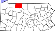 | |
| Boroughs | ||
| Townships | ||
| CDPs | ||
| Unincorporated communities | ||
