
Torfaen is a unitary authority in South East Wales. Torfaen includes 16 communities.
Communities in Torfaen

| Name | Population | Key on map |
|---|---|---|
| Abersychan[a] | 7,064[1] | 2 |
| Blaenavon[a] | 6,055 [2] | 1 |
| Croesyceiliog[b] | 5,246 [3] | 10 |
| Cwmbran Central | 9,947 [4] | 12 |
| Fairwater[c] | 11,632 [5] | 11 |
| Henllys | 2,682 [6] | 14 |
| Llantarnam | 4,125 [7] | 15 |
| Llanyrafon | 3,239 [8] | 13 |
| New Inn[a] | 5,986 [9] | 5 |
| Panteg[a] | 7,217 [10] | 7 |
| Pen Tranch[d] | 5,989 [11] | 3 |
| Ponthir | 1,482 [12] | 16 |
| Pontnewydd | 4,954 [13] | 9 |
| Pontymoile[e] | 5,082 [14] | 6 |
| Trevethin[f] | 5,147 [15] | 4 |
| Upper Cwmbran[a] | 5,228 [16] | 8 |
- ^ a b c d e This community is also an electoral ward with the same name.
- ^ Croesyceiliog community comprises the electoral wards of Croesyceiliog North and Croesyceiliog South.
- ^ Fairwater community comprises the electoral wards of Coed Eva, Fairwater, and Greenmeadow.
- ^ Pen Tranch community comprises the electoral wards of Pontnewynydd, Snatchwood, and Wainfelin.
- ^ Pontymoile community comprises the electoral wards of Brynwern, Cwmyniscoy, and Pontypool.
- ^ Trevethin community comprises the electoral wards of St Cadocs and Penygarn, and Trevethin.
See also
References
All population figures are from the United Kingdom Census 2011, provided by the Office for National Statistics from their Neighbourhood Statistics website www.neighbourhood.statistics.gov.uk. To see the records for a community, enter the name of the community, and select Parish as the type of area. From the topics displayed, select Census, then 2011 Census:Key Statistics, then Key Figures for 2011 Census: Key Statistics.
- ^ "2011 Census, Key Figures for Abersychan". Office for National Statistics. Retrieved 25 November 2013.
- ^ "2011 Census, Key Figures for Blaenavon". Office for National Statistics. Retrieved 25 November 2013.
- ^ "2011 Census, Key Figures for Croesyceiliog". Office for National Statistics. Retrieved 25 November 2013.
- ^ "2011 Census, Key Figures for Cwmbran Central". Office for National Statistics. Retrieved 25 November 2013.
- ^ "2011 Census, Key Figures for Fairwater". Office for National Statistics. Retrieved 25 November 2013.
- ^ "2011 Census, Key Figures for Henllys". Office for National Statistics. Retrieved 25 November 2013.
- ^ "2011 Census, Key Figures for Llantarnam". Office for National Statistics. Retrieved 25 November 2013.
- ^ "2011 Census, Key Figures for Llanyrafon". Office for National Statistics. Retrieved 25 November 2013.
- ^ "2011 Census, Key Figures for New Inn". Office for National Statistics. Retrieved 25 November 2013.
- ^ "2011 Census, Key Figures for Panteg". Office for National Statistics. Retrieved 25 November 2013.
- ^ "2011 Census, Key Figures for Pen Tranch". Office for National Statistics. Retrieved 25 November 2013.
- ^ "2011 Census, Key Figures for Ponthir". Office for National Statistics. Retrieved 25 November 2013.
- ^ "2011 Census, Key Figures for Pontnewydd". Office for National Statistics. Retrieved 25 November 2013.
- ^ "2011 Census, Key Figures for Pontymoile". Office for National Statistics. Retrieved 25 November 2013.
- ^ "2011 Census, Key Figures for Trevethin". Office for National Statistics. Retrieved 25 November 2013.
- ^ "2011 Census, Key Figures for Upper Cwmbran". Office for National Statistics. Retrieved 25 November 2013.
External links
| Principal settlements | 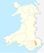 | |
|---|---|---|
| Electoral wards | ||
| Communities | ||
| Places of interest | ||
| Rivers and canals | ||
| Topics | ||