
| Lipu-Lekh Pass | |
|---|---|
  | |
| Elevation | 16,780 ft (5,115 m)[1] |
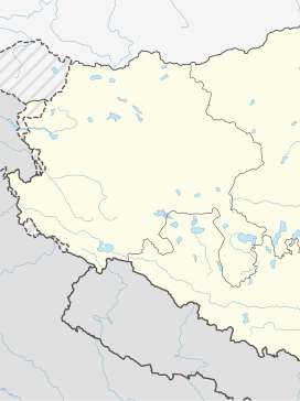
| Location | Border between India and Tibet, China[2] |
| Range | Himalayas |
| Coordinates | 30°14′03″N 81°01′44″E / 30.234080°N 81.028805°E |


Lipulekh La or Lipulekh Pass is a Himalayan pass in the border between India on the northern border with Tibet region held by China.[3][2] The Old Lipulekh Peak or Old Lipulekh Pass, a Mount Kailash viewing point at 17,500 ft elevation, lies west of Lipulekh Pass.[3] The Lipulekh pass is near the trading town of Taklakot (Purang) in Tibet and used since ancient times by traders, mendicants and pilgrims transiting between India and Tibet. It is also used by pilgrims to Kailas and Manasarovar. It is reached by the Pithoragagh-Lipulekh Pass Highway (PLPH), and a spur from Nabhidhang (Nabidhang) runs along a glaciated river to Om Parvat. The Mount Kailash in Tibet can be viewed from India from the Old Lipulekh Peak (via NH-9 motorable till the pass) which lies northeast of Gunji and the Limpiyadhura Pass (via Kuthi Valley) which lies northwest of Gunji.[3] The Kali River (Sharda River) rises from the Limpiyadhura northeast of Gunji and flows by the KMVN Huts (Kumaon Mandal Vikas Nigam resort) at Nabhidhang (a fork route from Nabhidhang goes southeast along the glaciated rivulet to Om Parvat), ITBP Base Camp, Indian Forest Police Checkpost to Gunji.
YouTube Encyclopedic
-
1/5Views:3 112442 4181 3431 020229 398
-
New Map Released ▶▶Lipulekh Pass◀◀ (लिपुलेख ला) Near The Border Between Nepal, India & China
-
India rejects Nepal claim on border road near Lipulekh Pass Current Affairs 2020 #UPSC
-
Project Hirak Constructing Road on a Challenging Area leading Upto to Kailash Mansarovar.
-
LIPULEKH PASS ROAD | KAILAS MANSAROVAR | DAILY CURRENT AFFAIRS | 12 MAY 2020 | DR.V.K.RAMANI | UPSC
-
Nepal upset over India’s announcement to build road in Lipulekh | UK PSC UPSC GS Current Affairs
Transcription
Tourism
This pass links the Pithoragarh district India with the Tibet Autonomous Region of China, and forms the last territorial point in India's territory. The Kailash Mansarovar Yatra, a Hinduism pilgrimage to Mount Kailash and Lake Manasarovar, traverses this pass. Lipulekh pass is connected to Chang Lobochahela, near the old trading town of Purang (Taklakot), in Tibet.
See also
References
- ^ Walton, Almora District Gazetteer (1911), p. 229.
- ^ a b Ling, L.H.M.; Abdenur, Adriana Erthal; Banerjee, Payal (19 September 2016). India China: Rethinking Borders and Security. University of Michigan Press. pp. 49–50. ISBN 978-0-472-13006-1.
- ^ a b c How Uttarakhand Is Providing "Closer Darshan" To Kailash-Mansarovar Pilgrims, NDTV, 29 June 2023.
Bibliography
- Walton, H. G., ed. (1911), Almora: A Gazetteer, District Gazetteers of the United Provinces of Agra and Oudh, vol. 35, Government Press, United Provinces – via archive.org
External links
| On the border | |||||||||||||||||||
|---|---|---|---|---|---|---|---|---|---|---|---|---|---|---|---|---|---|---|---|
| In the interior |
| ||||||||||||||||||