

Lichtetal am Rennsteig is a former municipal association (German: Verwaltungsgemeinschaft) in the district of Saalfeld-Rudolstadt, in Thuringia, Germany. The seat of government was in Lichte (in the Wallendorf section). It was disbanded in January 2019.
The municipal association consisted of the following municipalities:
| Municipality | Lichte | Piesau | Reichmannsdorf | Schmiedefeld (Lichtetal) |
| Mayor | Angelika Weigel | Fedor Wohlfarth | Hanno Leide | |
| Inhabitants | 1,634 | 779 | 817 | 1,056 |
YouTube Encyclopedic
-
1/3Views:9 00016 9953 288
-
Helden auf Gleis - auf der Schmiedefeld Erzbahn 2011 - auf Draisine
-
Draisinentour für Kaltduscher
-
Unterweißbach (Thüringen)
Transcription
History
The municipal association of Lichtetal am Rennsteig was established in line with the administrative reorganization after German reunification. Before 1990, all four municipalities were independent, each with a town hall, administration, and autonomous mayor. The post of mayor is now honorary, with reimbursement of expenses (German: Aufwandsentschädigung). The name Lichtetal am Rennsteig was derived from the close proximity to the Thuringian Rennsteig and the Lichte River.
Gallery
Coats of arms
-

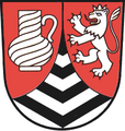
Lichtetal am Rennsteig
-
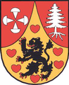
Piesau
-

Reichmannsdorf
-
Schmiedefeld


Pictures
-

Sign on the Rennsteig trail
-

Leipzig tower, Schmiedefeld
See also
External links
- Official website
- Rennsteig hikes individually and comfortable at Rennsteigtripp.de - hiking in Lichtetal am Rennsteig
| International | |
|---|---|
| National | |
50°31′34″N 11°11′34″E / 50.52611°N 11.19278°E
This Saalfeld-Rudolstadt location article is a stub. You can help Wikipedia by expanding it. |