
Liberty Township | |
|---|---|
 Church on State Road 218 | |
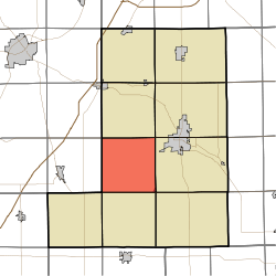 Location in Wells County | |
| Coordinates: 40°41′54″N 85°16′42″W / 40.69833°N 85.27833°W | |
| Country | United States |
| State | Indiana |
| County | Wells |
| Government | |
| • Type | Indiana township |
| Area | |
| • Total | 35.87 sq mi (92.9 km2) |
| • Land | 35.78 sq mi (92.7 km2) |
| • Water | 0.09 sq mi (0.2 km2) 0.25% |
| Elevation | 846 ft (258 m) |
| Population (2010) | |
| • Total | 1,086 |
| • Density | 30.4/sq mi (11.7/km2) |
| Time zone | UTC-5 (Eastern (EST)) |
| • Summer (DST) | UTC-4 (EDT) |
| ZIP codes | 46714, 46750, 46766, 46781, 46792 |
| Area code | 260 |
| GNIS feature ID | 453566 |
Liberty Township is one of nine townships in Wells County, Indiana, United States. As of the 2010 census, its population was 1,086 and it contained 438 housing units.[2]
YouTube Encyclopedic
-
1/1Views:1 152
-
Ephrata Borough Hampton Inn Vehicle Fire 11.06.2011
Transcription
Geography
According to the 2010 census, the township has a total area of 35.87 square miles (92.9 km2), of which 35.78 square miles (92.7 km2) (or 99.75%) is land and 0.09 square miles (0.23 km2) (or 0.25%) is water.[2]
Cities, towns, villages
- Poneto (west three-quarters)
Unincorporated towns
- Liberty Center at 40°41′57″N 85°16′50″W / 40.699213°N 85.280527°W
- Wellsburg at 40°39′58″N 85°13′18″W / 40.666157°N 85.221638°W
(This list is based on USGS data and may include former settlements.)
Adjacent townships
- Rockcreek Township (north)
- Lancaster Township (northeast)
- Harrison Township (east)
- Nottingham Township (southeast)
- Chester Township (south)
- Jackson Township (southwest)
- Salamonie Township, Huntington County (west)
- Rock Creek Township, Huntington County (northwest)
Cemeteries
The township contains these two cemeteries: McFarren and Mossburg.
School districts
- Southern Wells Community Schools
Political districts
- Indiana's 6th congressional district
- State House District 82
- State Senate District 19
References
- United States Census Bureau 2007 TIGER/Line Shapefiles
- United States Board on Geographic Names (GNIS)
- IndianaMap
- ^ "US Board on Geographic Names". United States Geological Survey. October 25, 2007. Retrieved May 9, 2017.
- ^ a b "Population, Housing Units, Area, and Density: 2010 - County -- County Subdivision and Place -- 2010 Census Summary File 1". United States Census. Archived from the original on February 12, 2020. Retrieved May 10, 2013.
External links
Municipalities and communities of Wells County, Indiana, United States | ||
|---|---|---|
| City |  | |
| Towns | ||
| Townships | ||
| CDPs | ||
| Other communities | ||
| Footnotes | ‡This populated place also has portions in an adjacent county or counties | |