
Liberty Township, McKean County, Pennsylvania | |
|---|---|
 Lynn Hall, a historic site in the township | |
 Map of McKean County, Pennsylvania highlighting Liberty Township | |
 Map of McKean County, Pennsylvania | |
| Country | United States |
| State | Pennsylvania |
| County | McKean |
| Settled | 1785 |
| Incorporated | 1828 |
| Area | |
| • Total | 83.73 sq mi (216.86 km2) |
| • Land | 83.34 sq mi (215.86 km2) |
| • Water | 0.39 sq mi (1.00 km2) |
| Population | |
| • Total | 1,604 |
| • Estimate (2022)[2] | 1,564 |
| • Density | 18.48/sq mi (7.13/km2) |
| Time zone | UTC-5 (Eastern (EST)) |
| • Summer (DST) | UTC-4 (EDT) |
| Area code | 814 |
| FIPS code | 42-083-43096 |
Liberty Township is a township in McKean County, Pennsylvania, United States. The population was 1,604 at the time of the census.[2]
YouTube Encyclopedic
-
1/3Views:53721 513927
-
Springfield Falls in Mercer County, Pennsylvania
-
God's Frontiersmen: The Scots-Irish Epic - Episode 2.
-
1st UCCC President Peyton Randolph
Transcription
History
Lynn Hall was listed on the National Register of Historic Places in 2007.[3]
Geography
According to the United States Census Bureau, the township has a total area of 83.5 square miles (216.3 km2), all of it land.
Demographics
| Census | Pop. | Note | %± |
|---|---|---|---|
| 2000 | 1,726 | — | |
| 2010 | 1,612 | −6.6% | |
| 2020 | 1,604 | −0.5% | |
| 2022 (est.) | 1,564 | [2] | −2.5% |
| U.S. Decennial Census[4] | |||
As of the census[5] of 2000, there were 1,726 people, 704 households, and 496 families residing in the township.
The population density was 20.7 people per square mile (8.0/km2). There were 898 housing units at an average density of 10.8/sq mi (4.2/km2).
The racial makeup of the township was 97.97% White, 0.12% African American, 0.23% Native American, 0.06% Pacific Islander, 0.52% from other races, and 1.10% from two or more races. Hispanic or Latino of any race were 0.58% of the population.
There were 704 households, out of which 31.4% had children under the age of eighteen living with them; 55.4% were married couples living together, 9.1% had a female householder with no husband present, and 29.5% were non-families. 24.1% of all households were made up of individuals, and 10.7% had someone living alone who was sixty-five years of age or older.
The average household size was 2.45 and the average family size was 2.88.
In the township the population was spread out, with 24.9% under the age of eighteen, 6.1% from eighteen to twenty-four, 28.7% from twenty-five to forty-four, 25.0% from forty-five to sixty-four, and 15.3% who were sixty-five years of age or older. The median age was thirty-nine years.
For every one hundred females there were 104.5 males. For every one hundred females who were aged eighteen and over, there were 103.6 males.
The median income for a household in the township was $34,200, and the median income for a family was $40,761. Males had a median income of $33,500 compared with that of $20,817 for females.
The per capita income for the township was $16,434.
Roughly 8.3% of families and 13.5% of the population were living below the poverty line, including 15.1% of those who were under the age of eighteen and 12.1% of those who were aged sixty-five or older.
References
- ^ "2016 U.S. Gazetteer Files". United States Census Bureau. Retrieved August 14, 2017.
- ^ a b c d Bureau, US Census. "City and Town Population Totals: 2020-2022". Census.gov. US Census Bureau. Retrieved October 22, 2023.
- ^ "National Register Information System". National Register of Historic Places. National Park Service. July 9, 2010.
- ^ "Census of Population and Housing". Census.gov. Retrieved June 4, 2016.
- ^ "U.S. Census website". United States Census Bureau. Retrieved January 31, 2008.
Municipalities and communities of McKean County, Pennsylvania, United States | ||
|---|---|---|
| City | 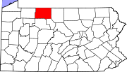 | |
| Boroughs | ||
| Townships | ||
| CDPs | ||
| Unincorporated communities | ||
| International | |
|---|---|
| National | |
41°50′00″N 78°13′59″W / 41.83333°N 78.23306°W