
Li
ลี้ | |
|---|---|
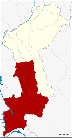 District location in Lamphun province | |
| Coordinates: 17°48′12″N 98°57′0″E / 17.80333°N 98.95000°E | |
| Country | Thailand |
| Province | Lamphun |
| Seat | Li |
| Area | |
| • Total | 1,701.990 km2 (657.142 sq mi) |
| Population (2005) | |
| • Total | 67,240 |
| • Density | 39.5/km2 (102/sq mi) |
| Time zone | UTC+7 (ICT) |
| Postal code | 51110 |
| Geocode | 5104 |
Li (Thai: ลี้, pronounced [líː]) is the southernmost district (amphoe) of Lamphun province, northern Thailand.
History
Li district was established in 1911. By 1951, Li became the most common name in the early 20th century. Originally named Mueang Li, it was shortened to Li in 1917.[1]
Li district is believed to have been an iron smelting site until the middle years of the Ayutthaya Kingdom (the reign of King Borommatrailokkanat), based on excavated ancient metal furnaces, about 2,000 years old in Mae Lan sub-district. Presumably that in the period 327–361 BC or 4th century Buddhist (before the rise of Hariphunchai Kingdom about 1,000 years ago).[2]
Geography
Neighboring districts are (from the north clockwise): Ban Hong, Thung Hua Chang of Lamphun Province, Soem Ngam, Thoen, Mae Phrik of Lampang province, Sam Ngao of Tak province, Doi Tao, Hot and Chom Thong of Chiang Mai province.
Economy
The Ban Pu Coal Company Limited was established in 1983 to extract coal at the Banpu Mine (BP-1 Mine) in the Li District. The company is now known as Banpu and is the largest coal producer in Thailand.[3]: 7
Administration
The district is divided into eight sub-districts (tambons), which are further subdivided into 99 villages (mubans). There are two townships (thesaban tambons): Wang Din covers parts of tambon Li, and Mae Tuen parts of the same-named tambon. There are a further eight tambon administrative organizations (TAO).
| No. | Name | Thai name | Villages | Pop. | |
|---|---|---|---|---|---|
| 1. | Li | ลี้ | 17 | 13,463 | |
| 2. | Mae Tuen | แม่ตืน | 17 | 11,617 | |
| 3. | Na Sai | นาทราย | 23 | 16,645 | |
| 4. | Dong Dam | ดงดำ | 6 | 3,128 | |
| 5. | Ko | ก้อ | 4 | 2,425 | |
| 6. | Mae Lan | แม่ลาน | 7 | 3,017 | |
| 8. | Pa Phai | ป่าไผ่ | 14 | 9,734 | |
| 9. | Si Wichai | ศรีวิชัย | 13 | 7,869 |
The missing number 7 belonged to the now defunct Ban Phai Subdistrict.
References
- ^ ประกาศกระทรวงมหาดไทย เรื่อง เปลี่ยนชื่ออำเภอ (PDF). Royal Gazette (in Thai). 34 (ก): 40–68. April 29, 1917. Archived from the original (PDF) on November 7, 2011.
- ^ Wongthes, Sujit (18 July 2019). "เหล็กสร้างรัฐ บนเส้นทางการค้าและสงคราม เตาถลุงเหล็ก 2,000 ปี บ้านแม่ลาน อ.ลี้ จ.ลำพูน" [Steel built state on the trade and war route, the 2,000-year-old iron smelting furnace, Ban Mae Lan, Li District, Lamphun Province]. Matichon Online (in Thai). No. 15103. Retrieved 18 July 2019.
- ^ Annual Report 2018 (PDF). Banpu Public Company Limited. 2019. Retrieved 15 May 2019.
External links
- amphoe.com (Thai)
| International | |
|---|---|
| National | |
This Lamphun Province location article is a stub. You can help Wikipedia by expanding it. |