
Lhee | |
|---|---|
Hamlet | |
 Farm in Lhee | |
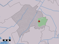 The village (dark red) and the statistical district (light green) of Lhee in the municipality of Westerveld. | |
 Lhee Location in the Netherlands  Lhee Lhee (Netherlands) | |
| Coordinates: 52°49′42″N 6°23′37″E / 52.82833°N 6.39361°E | |
| Country | Netherlands |
| Province | Drenthe |
| Municipality | Westerveld |
| Area | |
| • Total | 29.99 km2 (11.58 sq mi) |
| Elevation | 10 m (30 ft) |
| Population (2021)[1] | |
| • Total | 385 |
| • Density | 13/km2 (33/sq mi) |
| Time zone | UTC+1 (CET) |
| • Summer (DST) | UTC+2 (CEST) |
| Postal code | 7991[1] |
| Dialing code | 0521 |
Lhee is a hamlet in the Dutch province of Drenthe. It is a part of the municipality of Westerveld, and lies about 13 kilometres (8.1 mi) north of Hoogeveen.
The hamlet was first mentioned in 1181 as "In Lede". The etymology is unclear.[3]
Around 1800, a little school was built in Lhee. In 1953, it was moved brick by brick to the Netherlands Open Air Museum despite protests from the former teacher.[4] Lhee was home to 229 people in 1840.[4]
YouTube Encyclopedic
-
1/3Views:2 2012 015338
-
Oogstdag Dwingeloo -Lhee
-
oogstdag Lhee (Drenthe)
-
schaapskooi Lhee Dwingelderveld
Transcription
References
- ^ a b c "Kerncijfers wijken en buurten 2021". Central Bureau of Statistics. Retrieved 12 April 2022.
two entries
- ^ "Postcodetool for 7991AA". Actueel Hoogtebestand Nederland (in Dutch). Het Waterschapshuis. Retrieved 12 April 2022.
- ^ "Lhee - (geografische naam)". Etymologiebank (in Dutch). Retrieved 12 April 2022.
- ^ a b "Lhee". Plaatsengids (in Dutch). Retrieved 12 April 2022.
Wikimedia Commons has media related to Lhee.
This Drenthe location article is a stub. You can help Wikipedia by expanding it. |