
Lembá | |
|---|---|
District | |
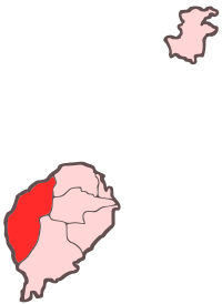 Location within São Tomé and Príncipe | |
| Coordinates: 0°16′52″N 6°29′58″E / 0.28111°N 6.49944°E | |
| Country | São Tomé and Príncipe |
| Island | São Tomé |
| Seat | Neves |
| Area | |
| • Total | 229.5 km2 (88.6 sq mi) |
| Population (2012) | |
| • Total | 14,652 |
| • Density | 64/km2 (170/sq mi) |
| Time zone | UTC+0 (UTC) |
Lembá is a district of São Tomé and Príncipe, on São Tomé Island. Its area is 229.5 km2 (89 sq mi),[1] and its population is 14,652 (2012).[2] The district seat is Neves. It is divided into the two statistical subdistricts Neves and Santa Catarina.[3][2]: 15
Geography
Much of the district lies within Parque Natural Obô de São Tomé.[4] The district has the nation's highest point, Pico de São Tomé. The river Xufexufe flows through the district. A few islets are adjacent to the island coast including Gabado and Ilhéu de São Miguel.
Population
| Year | Population |
|---|---|
| 1940[5] | 6,895
|
| 1950[5] | 6,255
|
| 1960[5] | 6,234
|
| 1970[5] | 6,199
|
| 1981[5] | 7,905
|
| 1991[5] | 9,016
|
| 2001[5][2] | 10,696
|
| 2012[5][2] | 14,652
|
Settlements
The main settlement is the town Neves. Other settlements are:
Politics
Lembá currently has six seats in the National Assembly.[6]
Twin towns - sister cities
Lembá District is twinned with:
- Crato, Portugal[7]
- Santa Marta de Penaguião, Portugal[7]
References
- ^ Sao Tome and Principe, citypopulation.de
- ^ a b c d Projecção a nível distrital 2012 - 2020[permanent dead link], Instituto Nacional de Estatística
- ^ Statistical divisions of São Tomé and Príncipe[permanent dead link], Instituto Nacional de Estatística
- ^ "Parque Natural d'Obô em São Tomé". Retrieved 19 October 2018.
- ^ a b c d e f g h Evolução da População Recenseada, 1940 a 2012, Instituto Nacional de Estatística
- ^ Elections in São Tomé and Principe, African Elections Database.
- ^ a b Geminações de Cidades e Vilas
External links
 Media related to Lembá District at Wikimedia Commons
Places adjacent to Lembá District | ||||||||||||||||
|---|---|---|---|---|---|---|---|---|---|---|---|---|---|---|---|---|
| ||||||||||||||||
| Communities |  | |
|---|---|---|
| Geography | ||