
Laytonville | |
|---|---|
 Laytonville in 1910 | |
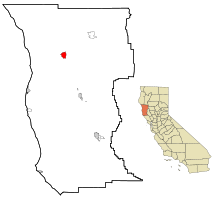 Location in Mendocino County and the state of California | |
 Laytonville Location in the United States | |
| Coordinates: 39°41′18″N 123°28′58″W / 39.68833°N 123.48278°W | |
| Country | |
| State | |
| County | Mendocino |
| Area | |
| • Total | 5.433 sq mi (14.07 km2) |
| • Land | 5.370 sq mi (13.91 km2) |
| • Water | 0.063 sq mi (0.16 km2) 1.16% |
| Elevation | 1,670 ft (509 m) |
| Population (2020)[3] | |
| • Total | 1,152 |
| • Density | 214.5/sq mi (82.8/km2) |
| Time zone | UTC-8 (Pacific (PST)) |
| • Summer (DST) | UTC-7 (PDT) |
| ZIP codes | 95417, 95454 |
| Area code | 707 |
| FIPS code | 06-40928 |
| GNIS feature ID | 1658951 |
Laytonville is a census-designated place (CDP) in Mendocino County, California, United States. It is located 23 miles (37 km) north-northwest of Willits,[4] at an elevation of 1,670 feet (510 m).[2] The population was 1,152 at the 2020 census,[3] down from 1,227 at the 2010 census.
YouTube Encyclopedic
-
1/1Views:425
-
Oaks and Elk Laytonville California.
Transcription
Geography
Laytonville is located in northern Mendocino County at 39°41′18″N 123°28′58″W / 39.68833°N 123.48278°W.[2] It is in the Long Valley, drained to the north by Tenmile Creek, a tributary of the South Fork of the Eel River. The headwaters of the South Fork are 5 miles (8 km) south of Laytonville.
U.S. Route 101 passes through the center of town, leading south through Willits 45 miles (72 km) to Ukiah, the Mendocino county seat, and northwest 22 miles (35 km) to Leggett.
According to the United States Census Bureau, the Laytonville CDP has a total area of 5.4 square miles (14 km2), of which 0.06 square miles (0.16 km2), or 1.16%, are water.[1]
History
The town was founded by Nova Scotian Frank B. Layton,[5] who in 1874 built a blacksmithy and house at the site.[4] The first post office opened in 1879.[4]
Demographics
| Census | Pop. | Note | %± |
|---|---|---|---|
| 1980 | 1,096 | — | |
| 1990 | 1,133 | 3.4% | |
| 2000 | 1,301 | 14.8% | |
| 2010 | 1,227 | −5.7% | |
| 2020 | 1,152 | −6.1% | |
| US Census[6] U.S Census 1880-1980,[7] | |||
2010
The 2010 United States Census[8] reported that the Laytonville CDP had a population of 1,227. The population density was 225.8 inhabitants per square mile (87.2/km2). The racial makeup of Laytonville was 839 (68.4%) White, 16 (1.3%) African American, 244 (19.9%) Native American, 10 (0.8%) Asian, 1 (0.1%) Pacific Islander, 60 (4.9%) from other races, and 57 (4.6%) from two or more races. Hispanic or Latino of any race were 141 persons (11.5%).
The Census reported that 1,226 people (99.9% of the population) lived in households, 1 (0.1%) lived in non-institutionalized group quarters, and 0 (0%) were institutionalized.
There were 493 households, out of which 163 (33.1%) had children under the age of 18 living in them, 166 (33.7%) were opposite-sex married couples living together, 82 (16.6%) had a female householder with no husband present, 48 (9.7%) had a male householder with no wife present. There were 59 (12.0%) unmarried opposite-sex partnerships, and 8 (1.6%) same-sex married couples or partnerships. 146 households (29.6%) were made up of individuals, and 37 (7.5%) had someone living alone who was 65 years of age or older. The average household size was 2.49. There were 296 families (60.0% of all households); the average family size was 3.04.
The population was spread out, with 271 people (22.1%) under the age of 18, 96 people (7.8%) aged 18 to 24, 326 people (26.6%) aged 25 to 44, 384 people (31.3%) aged 45 to 64, and 150 people (12.2%) who were 65 years of age or older. The median age was 40.0 years. For every 100 females, there were 108.3 males. For every 100 females age 18 and over, there were 104.7 males.
There were 562 housing units at a reported average density of 103.4 per square mile (39.9/km2). Of these 562 housing units in the Laytonville area, 270 (54.8%) were owner-occupied, and 223 (45.2%) were occupied by renters. The homeowner vacancy rate was 1.1%; the rental vacancy rate was 9.7%. 640 people (52.2% of the population) lived in owner-occupied housing units and 586 people (47.8%) lived in rental housing units.
2000
As of the census[9] of 2000, there were 1,301 people, 496 households, and 344 families residing in the CDP. The population density in the CDP was 258.0 inhabitants per square mile (99.6/km2). There were 546 housing units at a reported average density of 108.3 per square mile (41.8/km2). The racial makeup of the CDP was 75.17% White, 0.23% African American, 15.37% Native American, 0.69% Asian, 0.77% Pacific Islander, 2.23% from other races, and 5.53% from two or more races. Hispanic or Latino of any race were 8.30% of the population.
There were 496 households, out of which 33.3% had children under the age of 18 living with them, 46.2% were married couples living together, 15.1% had a female householder with no husband present, and 30.6% were non-families. 23.4% of all households were made up of individuals, and 8.7% had someone living alone who was 65 years of age or older. The average household size was 2.62 and the average family size was 3.03.
In the CDP, the population was spread out, with 25.7% under the age of 18, 9.6% from 18 to 24, 26.7% from 25 to 44, 25.8% from 45 to 64, and 12.1% who were 65 years of age or older. The median age was 38 years. For every 100 females, there were 101.1 males. For every 100 females age 18 and over, there were 100.8 males.
The median income for a household in the CDP was $34,432, and the median income for a family was $38,080. Males had a median income of $33,269 versus $21,563 for females. The per capita income for the CDP was $19,367. About 19.0% of families and 21.9% of the population were below the poverty line, including 29.1% of those under age 18 and 11.0% of those age 65 or over.
Transportation
The Amtrak Thruway 7 bus provides daily connections to/from Laytonville (with a curbside stop at 44900 Highway 101), Martinez to the south, and Arcata to the north. Additional Amtrak connections are available from Martinez station.[10]
Politics
In the state legislature, Laytonville is in the 2nd Senate District, represented by Democrat Mike McGuire,[11] and the 2nd Assembly District, represented by Democrat Jim Wood.[12]
Federally, Laytonville is in California's 2nd congressional district, represented by Democrat Jared Huffman.[13]
See also
References
- ^ a b "2021 U.S. Gazetteer Files: California". United States Census Bureau. Retrieved August 4, 2022.
- ^ a b c U.S. Geological Survey Geographic Names Information System: Laytonville, California
- ^ a b "P1. Race – Laytonville CDP, California: 2020 DEC Redistricting Data (PL 94-171)". U.S. Census Bureau. Retrieved August 4, 2022.
- ^ a b c Durham, David L. (1998). California's Geographic Names: A Gazetteer of Historic and Modern Names of the State. Clovis, Calif.: Word Dancer Press. p. 91. ISBN 1-884995-14-4.
- ^ Hogle, Gene NAC Green Book of Pacific Coast Touring (1931) National Automobile Club p.45
- ^ "Census of Population and Housing". Census.gov.
- ^ "Population Totals by Township and Place for California Counties: 1860 to 1950". dof.ca.gov.
- ^ "2010 Census Interactive Population Search: CA - Laytonville CDP". U.S. Census Bureau. Archived from the original on July 15, 2014. Retrieved July 12, 2014.
- ^ "U.S. Census website". United States Census Bureau. Retrieved January 31, 2008.
- ^ https://amtraksanjoaquins.com/route-7/
- ^ "Senators". State of California. Retrieved March 10, 2013.
- ^ "Members Assembly". State of California. Retrieved March 2, 2013.
- ^ "California's 2nd Congressional District - Representatives & District Map". Civic Impulse, LLC. Retrieved March 1, 2013.
Municipalities and communities of Mendocino County, California, United States | ||
|---|---|---|
| Cities |  | |
| CDPs | ||
| Unincorporated communities |
| |
| Indian reservations | ||
| Former settlements | ||
| Footnotes | ‡This populated place also has portions in an adjacent county or counties | |