| Laurel-Snow State Natural Area | |
|---|---|
 Laurel-Snow State Natural Area | |
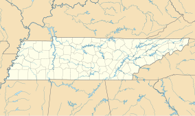
Map of Tennessee | |
| Location | Rhea County, Tennessee |
| Nearest city | Dayton |
| Coordinates | 35°31′36″N 85°01′20″W / 35.5267°N 85.0223°W |
| Area | 2,259 acres (914 ha) |
| Designated | 1973 |
| www | |
Laurel-Snow State Natural Area is a Tennessee Class II Natural-Scientific State Natural Area located in Rhea County, Tennessee, near Dayton, on Walden Ridge of the Cumberland Plateau. The 2,259-acre (9.14 km2) area is owned by the State of Tennessee and managed by the Tennessee Department of Environment and Conservation. It is a component of the Cumberland Trail, a linear park.[1]
The Laurel-Snow trail within the natural area was the first National Recreation Trail designated in Tennessee.[1]
The Laurel-Snow State Natural Area got its name from two of the four waterfalls in the area, the 80-foot (24 m) Laurel Falls[2] and the 12-foot (3.7 m) Snow Falls.[3]
A 710-acre (2.9 km2) portion of the area was formerly a Bowater pocket wilderness.[4]
YouTube Encyclopedic
-
1/5Views:6395 097378358452
-
Cumberland Trail - A Tour of Laurel-Snow Segment (rev 1)
-
Hiking Laurel-Snow Pocket Wilderness, Dayton, TN
-
Laurel-Snow Falls Trail at the Wilderness Pocket in Cumberland Mountains Tennessee BACKPACK'N Trip
-
2011 Laurel Snow Pocket Wilderness
-
Laurel Falls / Jan-2016 / music: Carbon Based Lifeforms
Transcription
References
- ^ a b "Laurel-Snow Class II Natural-Scientific State Natural Area". The Official State of Tennessee's Department of Environment and Conservation. Retrieved 16 September 2016.
- ^ Dunigan, Tom. "Laurel Falls 80'". Tennessee Landforms. Retrieved October 26, 2016.
- ^ Dunigan, Tom. "Snow Falls 12'". Tennessee Landforms. Retrieved October 26, 2016.
- ^ Van West, Carroll (January 1, 2010), Pocket Wilderness Areas, Nashville, Tennessee: Tennessee Historical Society (published December 25, 2009), retrieved October 26, 2016
External links
- Laurel-Snow SNA Section, Cumberland Trails Conference, retrieved October 26, 2016

