
Cueva de las Caldas | |
 | |
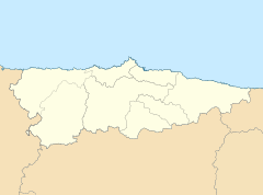 Location in Spain  Las Caldas cave (Spain) | |
| Location | Nalón Valley |
|---|---|
| Region | Asturias |
| Coordinates | 43°19′45″N 5°55′38″W / 43.32917°N 5.92722°W |
Las Caldas Cave and the surrounding partial nature reserve (Reserva Natural Parcial de la Cueva de las Caldas) is a protected area covering 45 hectares within the Nalón Valley in the Municipality of Oviedo in the vicinity of the towns of La Piñera and Las Caldas.
The cave itself has a length of about 600 m and has three entrances. The main cavity is around 5 m high and contains a subterranean river. The cave has no particular geological significance but it is important for the wildlife and archaeological sites from the Solutrean and Magdalenian periods located there.[1]
Bats living in the cave include the medium mouse-eared bat, cave bat, greater horseshoe bat, lesser horseshoe bat and Natterer's bat.
Archeological excavations in the cave have become one of the most important Upper Paleolithic sites in the Asturias region. Finds from the cave are of exceptional quality[2] and include amongst others:
- the Venus of Las Caldas, a Magdalenian antler carving with an ibex's head and a woman's legs and genitals, that may be either a Venus figurine or decorated atlatl-type device
- paleolithic rock art[3]
- two stylised overlapping female profiles on an engraved rod dating from the Middle Magdalenian.[4]
- a stone plaque displaying a woman's stylised profile,[4]
- a whale and 2 bisons engraved onto a sperm whale teeth,[4]
- a high quality unused rock-crystal laurel leaf point,[4]
- engraved horse teeth,[4]
- a horse bone carved with bison heads.[4]
YouTube Encyclopedic
-
1/5Views:114 3961 699678489449
-
My glacier cave discoveries - Eddy Cartaya
-
Caldas - La Hermida
-
Portugal - Aliança Underground Museum - Aliança perfeita, vinho e arte
-
El Paisa Bar
-
CUEVAS DE CRISTAL
Transcription
So how many of you have ever been in a cave before? Okay, a few of you. When you think of a cave, most of you think of a tunnel going through solid rock. In fact, that's how most caves are. Around this half of the country, most of your caves are made of limestone. Back where I'm from, most of our caves are made from lava rock because we have a lot of volcanoes out there. But the caves I want to share with you today are made completely of ice, specifically glacier ice as formed in the side of the tallest mountain in the state of Oregon called Mount Hood. Now, Mount Hood's only one hour's drive from Portland, the largest city in Oregon where over two million people live. Now, the most exciting thing for a cave explorer is to find a new cave and be the first human to ever go into it. The second most exciting thing for a cave explorer is to be the first one to make a map of a cave. Now, these days, with so many people hiking around, it's pretty hard to find a new cave, so you can imagine how excited we were to find three new caves within sight of Oregon's largest city and realize that they have never been explored or mapped before. It was kind of like being an astronaut because we were getting to see things and go places that no one had ever seen or gone before. So, what is a glacier? Well, those of you that have ever seen or touched snow, you know that it's really light because it's just a bunch of tiny ice crystals clumped together and it's mostly air. If you squish a handful of snow to make a snowball, it gets really small, hard, and dense. Well, in a mountain like Hood where it snows over twenty feet a year, it crushes the air out of it and gradually forms it into hard, blue ice. Now, each year more and more ice stacks up on top of it and eventually gets so heavy that it starts to slide down the mountain under its own weight, forming a slow-moving river of ice. When an ice pack like that starts to move, we call it a glacier and we give it a name. The name of the glacier these caves were formed is the Sandy Glacier. Now, each year as new snow lands on the glacier, it melts in the summer sun, and it forms little rivers of water on the flow along the ice and they start to melt and bore their way down through the glacier, forming big networks of caves, sometimes going all the way down to the underlying bedrock. Now, the crazy thing about glacier caves is that each year new tunnels form, different waterfalls pop up or move around from place to place inside the cave. Warm water from the top of the ice is boring its way down, and warm air from below the mountain actually rises up, gets into the cave, and melts the ceilings back taller and taller. But the weirdest thing about glacier caves is that the entire cave is moving because it's formed inside a block of ice the size of a small city that's slowly sliding down the mountain. Now, this is Brent McGregor, my cave exploration partner. He and I have both been exploring caves a long time and we've been climbing mountains a long time, but neither of us have ever really explored a glacier cave before. Back in 2011, Brent saw a YouTube video of a couple of hikers that stumbled across the entrance to one of these caves. There were no GPS coordinates for it, and all we knew was that it was somewhere out on the Sandy Glacier. So, in July of that year, we went out on the glacier, and we found a big crack in the ice. We had to build snow and ice anchors, so we could tie off ropes and repel down into the hole. This is me looking into the entrance crevasse. At the end of this hole, we found a huge tunnel going right up the mountain underneath thousands of tons of glacier ice. We followed this cave back for about a half mile until it came to an end. And then with the help of our survey tools, we made a three-dimensional map of the cave on our way back out. So, how do you map a cave? Well, cave maps aren't like trail maps or road maps because they have pits and holes going to overlapping levels. To make a cave map, you have to set up survey stations every few feet inside the cave, and you use a laser to measure the distance between those stations. And you use a compass and an inclinometer to measure the direction the cave is headed and measure the slope of the floor and the ceilings. Now, those of you taking trigonometry, that particular type of math is very useful for making maps like this because it allows you to measure heights and distances without actually having to go there. In fact, the more I mapped and studied caves, the more useful I found all that math that I originally hated in school to be. So, when you're done surveying, you take all this data, you punch it into the computer, and you find someone that can draw really well, and you have them draft up a map that looks something like this. And it will show you both a bird's eye view of the passage as well as a profile view of the passage, kind of like an ant farm view. We named this cave Snow Dragon Cave because it was like a big dragon sleeping under the snow. Now, later this summer as more snow melted off the glacier, we found more caves, and we realized they were all connected. Not long after we mapped Snow Dragon, Brent discovered this new cave not very far away. The inside of it was coated with ice so we had to wear big spikes in our feet called crampons, so we could walk around without slipping. This cave was amazing! The ice in the ceiling was glowing blue and green because the sunlight from far above was shining through the ice and lighting it all up. Now, we couldn't understand why this cave was so much colder than Snow Dragon until we got to the end, and we found out why. There was a huge pit or shaft called a moulin going a 130 feet straight up to the surface of the glacier. Cold air from the top of the mountain was flowing down this hole, blasting through the cave, freezing everything inside of it. And we were so excited about finding this new pit, we actually came back in January the following year so we could be the first ones to explore it. It was so cold outside, we actually had to sleep inside the cave. Here's our camp on the left side of this entrance room. The next morning we climbed out of the cave and hiked all the way to the top of the glacier where we finally rigged and repelled this pit for the very first time. Brent named this cave Pure Imagination, I think, because the beautiful sights we saw in there were beyond what we could have ever imagined. So, besides really cool ice, what else is inside these caves? Well, not too much lives in them because they're so cold, and the entrance is actually covered up with snow for about eight months of the year, but there are some really cool things in there. There's weird bacteria living in the water that actually eat and digest rocks to make their own food to live under this ice. In fact, this past summer scientists collected samples of water and ice specifically to see if things called extremophiles, tiny lifeforms that have evolved to live in a completely hostile conditions, might be living under the ice, kind of like what they hope to find in the polar ice caps of Mars some day. Another really cool thing is that as seeds and birds land on the surface of the glacier and die, they get buried in the snow and gradually become part of the glacier, sinking deeper and deeper into the ice. As these caves form and melt their way up into the ice, they make these artifacts rain down from the ceiling and fall into the cave floor where we end up finding them. For example, this is a nodal first seed we found. It's been frozen in ice for over a hundred years, and it's just now starting to sprout. This mallard duck feather was found over 1800 feet in the back of Snow Dragon Cave. This duck died on the surface of the glacier long, long ago, and its feathers have finally made it down through over a hundred feet of ice before falling inside the cave. And this beautiful quartz crystal was also found in the back of Snow Dragon. Even now Brent and I find it hard to believe that all these discoveries were essentially in our own backyard, hidden away just waiting to be found. Like I said earlier, the idea of discovery in this busy world we live in kind of seems like something you can only do with space travel now, but that's not true. Every year new caves get discovered that no one has ever been in before. So, it's actually not too late for one of you to become a discoverer yourself. You just have to be willing to look and go where people don't often go and focus your eyes and your mind to recognize the discovery when you see it because it might be in your own backyard. Thank you very much.
References
- ^ "Infoasturias. Portal oficial de turismo - Detalle". asturias.es. 2013. Retrieved 2 June 2013.
- ^ "Astrurias_top". muse.or.jp. 2013. Retrieved 2 June 2013.
- ^ "Academia.edu | Documents in Las Caldas cave - Academia.edu". academia.edu. 2013. Retrieved 2 June 2013.
- ^ a b c d e f "Venus figure from Las Caldas". donsmaps.com. 2013. Retrieved 2 June 2013.