
City of Lake View [1] | |
|---|---|
City | |
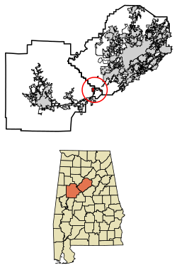 Location of Lake View in Jefferson County and Tuscaloosa County, Alabama. | |
| Coordinates: 33°16′48″N 87°8′19″W / 33.28000°N 87.13861°W | |
| Country | United States |
| State | Alabama |
| County | Tuscaloosa (most) Jefferson (portion) |
| Area | |
| • Total | 2.34 sq mi (6.05 km2) |
| • Land | 2.10 sq mi (5.44 km2) |
| • Water | 0.23 sq mi (0.61 km2) |
| Population (2020) | |
| • Total | 3,560 |
| • Density | 1,693.63/sq mi (653.84/km2) |
| Time zone | UTC-6 (Central (CST)) |
| • Summer (DST) | UTC-5 (CDT) |
| FIPS code | 01-40928 |
| Website | lakeviewalabama |
Lake View is a city in Alabama, United States, with the majority in Tuscaloosa County and with a small portion in Jefferson County.[3] At the 2010 census the population was 1,943, up from 1,357 in 2000. It is part of the Tuscaloosa Metropolitan Statistical Area (the Tuscaloosa County portion) and the Birmingham metropolitan area (the Jefferson County portion). It is located approximately halfway between Tuscaloosa and Birmingham via Interstates 20 and 59.
History
Lake View was incorporated in 1998.[4]
Geography
Lake View is located at 33°16′48″N 87°8′19″W / 33.28000°N 87.13861°W (33.279933, -87.138667).[5]
According to the U.S. Census Bureau, the town has a total area of 1.8 square miles (4.7 km2), of which 1.6 square miles (4.1 km2) is land and 0.2 square miles (0.52 km2) (12.57%) is water.
Demographics
| Census | Pop. | Note | %± |
|---|---|---|---|
| 2000 | 1,357 | — | |
| 2010 | 1,943 | 43.2% | |
| 2020 | 3,560 | 83.2% | |
| U.S. Decennial Census[6] 2013 Estimate[7] | |||
At the 2000 census there were 1,357 people, 457 households, and 405 families in the town. The population density was 847.7 inhabitants per square mile (327.3/km2). There were 475 housing units at an average density of 296.7 per square mile (114.6/km2). The racial makeup of the town was 97.35% White, 0.81% Black or African American, 0.07% Native American, 0.22% Asian, and 1.55% from two or more races. 0.22% of the population were Hispanic or Latino of any race.[8] Of the 457 households 44.4% had children under the age of 18 living with them, 82.3% were married couples living together, 3.7% had a female householder with no husband present, and 11.2% were non-families. 10.1% of households were one person and 3.7% were one person aged 65 or older. The average household size was 2.97 and the average family size was 3.17.
The age distribution was 28.8% under the age of 18, 6.6% from 18 to 24, 36.6% from 25 to 44, 20.6% from 45 to 64, and 7.4% 65 or older. The median age was 34 years. For every 100 females, there were 100.7 males. For every 100 females age 18 and over, there were 100.0 males.
The median household income was $54,879 and the median family income was $60,119. Males had a median income of $37,583 versus $29,688 for females. The per capita income for the town was $22,096. About 2.8% of families and 5.1% of the population were below the poverty line, including 6.8% of those under age 18 and 4.2% of those age 65 or over.
2010 census
At the 2010 census there were 1,943 people, 676 households, and 564 families in the town. The population density was 1,214.4 inhabitants per square mile (468.9/km2). There were 700 housing units at an average density of 437.5 per square mile (168.9/km2). The racial makeup of the town was 93.9% White, 4.2% Black or African American, 0.1% Native American, 0.7% Asian, and .9% from two or more races. 0.6% of the population were Hispanic or Latino of any race.[9] Of the 676 households 39.3% had children under the age of 18 living with them, 73.2% were married couples living together, 6.4% had a female householder with no husband present, and 16.6% were non-families. 13.2% of households were one person and 3.9% were one person aged 65 or older. The average household size was 2.87 and the average family size was 3.16.
The age distribution was 26.4% under the age of 18, 7.1% from 18 to 24, 30.8% from 25 to 44, 27.5% from 45 to 64, and 8.3% 65 or older. The median age was 35.9 years. For every 100 females, there were 96.9 males. For every 100 females age 18 and over, there were 97.8 males.
The median household income was $77,750 and the median family income was $81,250. Males had a median income of $53,646 versus $37,109 for females. The per capita income for the town was $28,334. About 0% of families and 2.4% of the population were below the poverty line, including 0% of those under age 18 and 0% of those age 65 or over.
Education
The portion in Tuscaloosa County is in the Tuscaloosa County School District.[10]
The portion in Jefferson County is in the Jefferson County School District.[11]
See also
References
- ^ Code of Alabama 1975, Title 11, Chapter 40, Section 11-40-1 Archived March 17, 2010, at the Wayback Machine
- ^ "2020 U.S. Gazetteer Files". United States Census Bureau. Retrieved October 29, 2021.
- ^ "2020 CENSUS - CENSUS BLOCK MAP: Lake View town, AL" (PDF). U.S. Census Bureau. Retrieved March 29, 2024.
- ^ "What's in a name". The Tuscaloosa News. April 20, 2000. pp. 4B. Retrieved May 30, 2015.
- ^ "US Gazetteer files: 2010, 2000, and 1990". United States Census Bureau. February 12, 2011. Retrieved April 23, 2011.
- ^ "U.S. Decennial Census". Census.gov. Retrieved June 6, 2013.
- ^ "Annual Estimates of the Resident Population: April 1, 2010 to July 1, 2013". Archived from the original on May 22, 2014. Retrieved June 3, 2014.
- ^ "U.S. Census website". United States Census Bureau. Retrieved January 31, 2008.
- ^ "U.S. Census website". United States Census Bureau. Retrieved August 13, 2015.
- ^ "2020 CENSUS - SCHOOL DISTRICT REFERENCE MAP: Tuscaloosa County, AL" (PDF). U.S. Census Bureau. pp. 37-38 (PDF p. 38-39/41). Retrieved March 29, 2024. - Text list
- ^ "2020 CENSUS - SCHOOL DISTRICT REFERENCE MAP: Jefferson County, AL" (PDF). U.S. Census Bureau. p. 22 (PDF p. 23/24). Retrieved March 29, 2024. - Text list
External links
![]() Media related to Lake View, Alabama at Wikimedia Commons
Media related to Lake View, Alabama at Wikimedia Commons
Municipalities and communities of Tuscaloosa County, Alabama, United States | ||
|---|---|---|
| Cities | 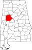 | |
| Towns | ||
| CDPs | ||
| Other unincorporated communities | ||
| Ghost town | ||
| Footnotes | ‡This populated place also has portions in an adjacent county or counties | |
Municipalities and communities of Jefferson County, Alabama, United States | ||
|---|---|---|
| Cities |  | |
| Towns | ||
| CDPs | ||
| Other unincorporated communities | ||
| Former towns | ||
| Footnotes | ‡This populated place also has portions in an adjacent county or counties | |