
| Lake Dukan | |
|---|---|
 Lake Dukan | |
 Lake Dukan | |
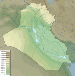
| Location | Sulaymaniyah Governorate |
| Coordinates | 36°08′N 44°55′E / 36.133°N 44.917°E |
| Type | Reservoir |
| Native name | دوكان (Arabic) |
| Primary inflows | Little Zab |
| Primary outflows | Little Zab |
| Catchment area | 11,700 km2 (4,500 sq mi) |
| Basin countries | Iran, Iraq |
| Surface area | 270 km2 (100 sq mi) |
| Water volume | 6.8–8.3 km3 (1.6–2.0 cu mi) |
Lake Dukan (or Lake Dokan; Arabic: بحيرة دوكان) is a lake in Kurdistan Region Iraq. It is located close to the city of Ranya, and is a reservoir on the Little Zab created by the construction of the Dukan Dam. The Dukan Dam was built between 1954 and 1959 as a multi-purpose dam to provide water storage, irrigation and hydroelectricity.[1] Prior to the flooding of Lake Dukan, the area has been subjected to archaeological research to investigate as many archaeological sites as possible. An archaeological survey in the Ranya Plain documented some 40 archaeological sites with evidence for occupation ranging from the sixth millennium BCE up to the present. Five of these sites were then excavated: Tell Bazmusian, ed-Dem, Kamarian, Qarashina and Tell Shemshara. The excavations at Tell Bazmusian revealed a temple dating to the second millennium BCE.[2] At Tell Shemshara, an early-sixth millennium BCE village was excavated, as well as an early-second millennium BCE palace with a small archive of clay tablets.[3][4] The inhabitants of some 50 villages in the flooded area, around 1,000–1,200 families, were resettled to the west of the lake.[5]
The surface area of the lake is 270 square kilometres (100 sq mi). At normal operation, the capacity of the reservoir is 6.8 cubic kilometres (1.6 cu mi) while its maximum capacity is 8.3 cubic kilometres (2.0 cu mi). At that capacity, the surface elevation is 515 metres (1,690 ft) above sea-level. In order to operate the power station, the surface elevation must be between 469 and 511 metres (1,539 and 1,677 ft). The drainage basin of the Dukan Dam is 11,700 square kilometres (4,500 sq mi).[5][6][7]

YouTube Encyclopedic
-
1/3Views:1 189 51082 411 578558 501
-
The importance of saving || मारवाड़ी अमीर क्यों होते हैं? Avadh Ojha Sir
-
Lahan Mazi Bahuli Animated Video Song | Best Marathi Balgeet & Badbad Geete
-
এক্সেলে দোকান বা ব্যাবসার হিসাব রাখুন | Excel Bangla Tutorial
Transcription
See also
References
- ^ Kliot, Nurit (1994). Water Resources and Conflict in the Middle East. Milton Park: Routledge. ISBN 0-415-09752-5.
- ^ Al-Soof, Behnam Abu (1970). "Mounds in the Rania Plain and excavations at Tell Bazmusian (1956)". Sumer. 26: 65–104. ISSN 0081-9271.
- ^ Eidem, Jesper; Læssøe, Jørgen (2001). The Shemshara archives 1. The letters. Historisk-Filosofiske Skrifter. Vol. 23. Copenhagen: Kongelige Danske videnskabernes selskab. ISBN 87-7876-245-6.
- ^ Mortensen, Peder (1970). Tell Shimshara. The Hassuna period. Historisk-Filosofiske Skrifter. Vol. 5, 2. Copenhagen: Kongelige Danske videnskabernes selskab. OCLC 562453801.
- ^ a b Juwaideh, Albertine (1996). "Dukan Dam". In Simon, Reeva S.; Mattar, Philip; Bulliet, Richard W. (eds.). Encyclopedia of the modern Middle East. New York: Macmillan Reference. pp. 587–588. ISBN 0-02-896011-4.
- ^ Fink, A.K.; Ostrizhnov, I.D. (1984). "Dokan hydroelectric station in Iraq". Power Technology and Engineering. 17 (10): 519–522. doi:10.1007/BF01425181. S2CID 109889149.
- ^ Iraqi Ministries of Environment, Water Resources and Municipalities and Public Works (2006). "Annex III: Main water control structures (dams and water diversions) and reservoirs". New Eden Master Plan for integrated water resources management in the marshlands areas. New Eden Group.