
| Cullulleraine Victoria | |||||||||||||||
|---|---|---|---|---|---|---|---|---|---|---|---|---|---|---|---|
 Sturt Highway passing through Cullulleraine | |||||||||||||||
 Cullulleraine | |||||||||||||||
| Coordinates | 34°16′48″S 141°35′53″E / 34.280°S 141.598°E | ||||||||||||||
| Population | 69 (2016 census)[1] | ||||||||||||||
| Postcode(s) | 3496 | ||||||||||||||
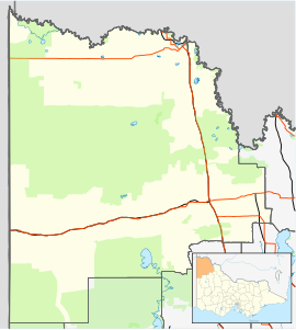
| Location | |||||||||||||||
| LGA(s) | Rural City of Mildura | ||||||||||||||
| Region | Millewa | ||||||||||||||
| State electorate(s) | Mildura | ||||||||||||||
| Federal division(s) | Mallee | ||||||||||||||
| |||||||||||||||
Cullulleraine is a locality on the Sturt Highway in northwestern Victoria, Australia, 56 kilometres (35 mi) west of Mildura and 16 kilometres (10 mi) north of Werrimull.
The local business Golden Grain Flour Mills Pty Ltd is a major employer in the rural community.
The Cullulleraine Post Office opened on 17 November 1924.[3]
YouTube Encyclopedic
-
1/3Views:7858042 057
-
Lake Cullulleraine camping - just off the Murray River, Victoria
-
BIG4 Renmark Riverfront Holiday Park
-
Briagolong.mov
Transcription
References
- ^ Australian Bureau of Statistics (27 June 2017). "Cullulleraine (State Suburb)". 2016 Census QuickStats. Retrieved 1 September 2020.
- ^ Travelmate Archived 24 March 2007 at the Wayback Machine[dead link]
- ^ Phoenix Auctions History, Post Office List, retrieved 13 February 2021
External links
![]() Media related to Cullulleraine at Wikimedia Commons
Media related to Cullulleraine at Wikimedia Commons
Localities in the Rural City of Mildura | ||
|---|---|---|
| City |  | |
| Town | ||
| Locality | ||
^ - Territory divided with another LGA | ||
This article about a location in the Mallee is a stub. You can help Wikipedia by expanding it. |