
La Feria, Texas | |
|---|---|
| Motto: As Always | |
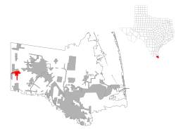
 Location of La Feria, Texas | |
 | |
| Coordinates: 26°9′30″N 97°49′30″W / 26.15833°N 97.82500°W | |
| Country | United States |
| State | Texas |
| County | Cameron |
| Area | |
| • Total | 4.40 sq mi (11.40 km2) |
| • Land | 4.31 sq mi (11.17 km2) |
| • Water | 0.09 sq mi (0.23 km2) |
| Elevation | 56 ft (17 m) |
| Population (2010) | |
| • Total | 7,302 |
| • Estimate (2019)[2] | 7,230 |
| • Density | 1,676.33/sq mi (647.22/km2) |
| Time zone | UTC-6 (Central (CST)) |
| • Summer (DST) | UTC-5 (CDT) |
| ZIP code | 78559 |
| Area code | 956 |
| FIPS code | 48-40204[3] |
| GNIS feature ID | 1339313[4] |
| Website | www |
La Feria is a city in Cameron County, Texas, United States. Its population was 7,302 at the time of the 2010 census.[5] It is part of the Brownsville–Harlingen–Raymondville, the Matamoros–Brownsville, and the McAllen–Edinburg–Mission metropolitan areas.
YouTube Encyclopedic
-
1/1Views:1 544
-
parranda en la feria de dallas tx
Transcription
Geography
La Feria is located in western Cameron County at 26°9′30″N 97°49′30″W / 26.15833°N 97.82500°W (26.158253, –97.824973).[6]
According to the United States Census Bureau, the city has a total area of 5.5 square miles (14.3 km2), of which 0.1 square miles (0.2 km2), or 1.69%, is covered by water.[5]
In 2004, the city annexed the Arroyo Alto CDP, increasing the population of the city by roughly 300 people.[7]
Demographics
| Census | Pop. | Note | %± |
|---|---|---|---|
| 1920 | 236 | — | |
| 1930 | 1,594 | 575.4% | |
| 1940 | 1,644 | 3.1% | |
| 1950 | 2,952 | 79.6% | |
| 1960 | 3,047 | 3.2% | |
| 1970 | 2,642 | −13.3% | |
| 1980 | 3,495 | 32.3% | |
| 1990 | 4,360 | 24.7% | |
| 2000 | 6,115 | 40.3% | |
| 2010 | 7,302 | 19.4% | |
| 2020 | 6,817 | −6.6% | |
| U.S. Decennial Census[8] | |||
2020 census
| Race | Number | Percentage |
|---|---|---|
| White (NH) | 828 | 12.15% |
| Black or African American (NH) | 9 | 0.13% |
| Native American or Alaska Native (NH) | 4 | 0.06% |
| Asian (NH) | 21 | 0.31% |
| Pacific Islander (NH) | 1 | 0.01% |
| Some Other Race (NH) | 14 | 0.21% |
| Mixed/Multi-Racial (NH) | 20 | 0.29% |
| Hispanic or Latino | 5,920 | 86.84% |
| Total | 6,817 |
As of the 2020 United States census, there were 6,817 people, 2,470 households, and 1,548 families residing in the city.
The ancestry was 3.5% English, 2.3% German, 2.0% Irish, 0.8% Norwegian, 0.8% French, and 0.3% Italian.[12]
The median age was 34.1 years old. 22.3% of the population were older than 65, with 10.1% between the ages of 65 to 74, 9.5% between the ages of 75 to 84, and 2.6% were 85 or older. 35.0% of the population were under 18, and 8.1% were under 5. The gender makeup was 51.7% female and 48.3% male.[12][13]
55.8% of people spoke Spanish at home, and 44.2% spoke English at home. 15.1% of the population were foreign born, with 31.8% of those being US citizens, and 68.2% not being US citizens.[12]
The median household income was $35,722, with families having $38,866, married couples having $60,046, and non-families had $33,317. 32.1% of the population were in poverty. The per capita income was $19,724.[12][13]
2000 census
As of the census[3] of 2000, 6,115 people, 2,021 households, and 1,620 families were residing in the city. The population density was 3,075.1 people/sq mi (1,186.4/km2). The 2,895 housing units averaged 1,455.8/sq mi (561.7/km2). The racial makeup of the city was 74.91% White, 0.26% African American, 0.43% Native American, 0.33% Asian, 20.76% from other races, and 3.32% from two or more races. Hispanics or Latinos of any race were 77.45% of the population.
Of the 2,021 households, 35.3% had children under 18 living with them, 58.4% were married couples living together, 18.6% had a female householder with no husband present, and 19.8% were not families. About 17.4% of all households were made up of individuals, and 11.4% had someone living alone who was 65 or older. The average household size was 3.03, and the average family size was 3.44.
In the city, the age istribution was 30.6% under 18, 9.6% from 18 to 24, 22.4% from 25 to 44, 18.6% from 45 to 64, and 18.9% who were 65 or older. The median age was 34 years. For every 100 females, there were 86.5 males. For every 100 females age 18 and over, there were 81.5 males.
The median income for a household in the city was $24,660, and for a family was $28,832. Males had a median income of $22,933 versus $15,497 for females. The per capita income for the city was $12,064. About 21.9% of families and 29.2% of the population were below the poverty line, including 44.1% of those under age 18 and 19.5% of those age 65 or over.
Government and infrastructure
The United States Postal Service operates the La Feria Post Office.[14]
Education
La Feria is served by the La Feria Independent School District. In addition, residents may apply to magnet schools in the South Texas Independent School District.
Climate
The climate in this area is characterized by hot, humid summers and generally mild to cool winters. According to the Köppen climate classification, La Feria has a humid subtropical climate, Cfa on climate maps.[15]
Notable people
- Raquel González, WWE wrestler and NXT Women's Champion
- Edward Nordman, fruit farmer and member of the Wisconsin State Assembly[16]
- Emmy Ruiz, White House director of political strategy and outreach
- Billy Storms, Professional golfer[17] competing in the PGA Senior Open three times.[18]
References
- ^ "2019 U.S. Gazetteer Files". United States Census Bureau. Retrieved August 7, 2020.
- ^ "Population and Housing Unit Estimates". United States Census Bureau. May 24, 2020. Retrieved May 27, 2020.
- ^ a b "U.S. Census website". United States Census Bureau. Retrieved January 31, 2008.
- ^ "US Board on Geographic Names". United States Geological Survey. October 25, 2007. Retrieved January 31, 2008.
- ^ a b "Geographic Identifiers: 2010 Census Summary File 1 (G001): La Feria city, Texas". U.S. Census Bureau, American Factfinder. Archived from the original on February 13, 2020. Retrieved July 8, 2015.
- ^ "US Gazetteer files: 2010, 2000, and 1990". United States Census Bureau. February 12, 2011. Retrieved April 23, 2011.
- ^ US Census change list Archived 2006-02-06 at the Wayback Machine
- ^ "Census of Population and Housing". Census.gov. Retrieved June 4, 2015.
- ^ "Explore Census Data". data.census.gov. Retrieved May 21, 2022.
- ^ https://www.census.gov/[not specific enough to verify]
- ^ "About the Hispanic Population and its Origin". www.census.gov. Retrieved May 18, 2022.
- ^ a b c d "Explore Census Data". data.census.gov. Retrieved June 2, 2023.
- ^ a b "U.S. Census Bureau QuickFacts: La Feria city, Texas". www.census.gov. Retrieved June 2, 2023.
- ^ "Post Office Location - LA FERIA Archived 2010-10-03 at the Wayback Machine." United States Postal Service. Retrieved on May 9, 2010.
- ^ Climate Summary for La Feria, Texas
- ^ 'Edward Nordman, Ex-Assemblyman, Dies at 75,' Wisconsin State Journal, January 22, 1939, pg. 24
- ^ "Billy Storms - Tournament Results | S. Texas PGA". stpga.bluegolf.com. Retrieved July 3, 2022.
- ^ "Who We Are | Safe Harbor Fellowship". covenantbaptistcc.com. March 21, 2017. Retrieved July 3, 2022.
External links
Municipalities and communities of Cameron County, Texas, United States | ||
|---|---|---|
| Cities |  | |
| Towns | ||
| Village | ||
| CDPs |
| |
| Other communities | ||
| Ghost towns |
| |
| International | |
|---|---|
| National | |
| Other | |