
Kuwana-juku 桑名宿 | |
|---|---|
| post station | |
 Hiroshige's print of Kuwana-juku, part of the Hōeidō edition The Fifty-three Stations of the Tōkaidō series | |
| General information | |
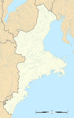
| Location | Kuwana, Mie (former Ise Province) Japan |
| Coordinates | 35°04′06.44″N 136°41′46.59″E / 35.0684556°N 136.6962750°E |
| Elevation | 7 meters |
| Line(s) | Tōkaidō |
| Distance | 376.9 km from Edo |
| Location | |
 Kuwana-juku Location within Mie Prefecture  Kuwana-juku Kuwana-juku (Japan) | |


Kuwana-juku (桑名宿, Kuwana-juku) was the forty-second of the fifty-three stations (shukuba) of the Tōkaidō connecting Edo with Kyoto in Edo period Japan. It was located in former Ise Province in what is now part of the city of Kuwana, Mie Prefecture, Japan.[1]
YouTube Encyclopedic
-
1/3Views:485 9877 48917 365
-
[ 4K Ultra HD ] 長岡花火大会 2017 復興祈願花火 フェニックス - Nagaoka Fireworks Festival 2017 Phoenix - 2017.08.02
-
[ 4K Ultra HD ] 絶景空撮:新緑の多摩・奥多摩 TOKYO Tama Oku-Tama in fresh green (Aerial Drone shots)
-
[ 4K UHD ] 長野えびす講煙火大会 2017 ハイライト - Nagano Ebisuko Fireworks Festival 2017 Highlights -
Transcription
History
Kuwana-juku was located in the castle town of Kuwana Domain, which was a major security barrier on the Tōkaidō for the Tokugawa shogunate. The post station was located on the western shores of the Ibi River. Between Kuwana and the next station to the west, Miya-juku, were the Kiso Three Rivers, which included the Nagara River and the Kiso River in addition to the Ibi River. As all three rivers were near their outlets to Ise Bay, their channels were wide, and the shogunate forbid the construction of any bridges, as this would facilitate the crossing of any army from the west across the rivers towards Edo. This posed a problem however for travelers. The preferred connection for many travelers between Kuwana-juku and Miya-juku was by the Shichiri no watashi (七里の渡し), a roughly 28-kilometer boat ride across Ise Bay. A large torii gate on the Kuwana side of the crossing indicated that this was also on the route for pilgrims to the Ise Grand Shrine. For those leery of travel on the ocean, the alternative was the Saya Kaidō (佐屋街道), which consisted of a shorter riverboat ride, the Sanri no watashi (三里の渡し) which connected Kuwana-juku with Saya-juku (佐屋宿), a post station in Owari Province, and thence overland via the Saya Kaidō highway to Miya-juku, with three intermediate post stations en route. This route was roughly eight kilometers longer than the direct sea route, and was much more expensive in terms of tolls, but was also much quicker. This route was constructed by Owari Domain for the visit of Shogun Tokugawa Ieyasu to Kyoto, and was the route used two centuries later by Emperor Meiji when he first travelled from Kyoto to Tokyo. [2]
Per the 1843 "東海道宿村大概帳" (Tōkaidō Shukuson Taigaichō) guidebook issued by the Inspector of Highways (道中奉行, Dōchu-būgyō), the town had a population of 8849 in 2544 houses, including two honjin, four wakihonjin, and 120 hatago, making it one of the largest of the post stations on the highway. The popular local specialities of Kuwana-juku was grilled hamaguri clams, whitebait and banko ware pottery. Kuwana-juku was 376.9 kilometers from Edo.
During the Edo period, Kuwana was directly on the shores of the river, but after the Kansai Railroad built Kuwana Station, the city center was shifted further to the west.
Kuwana-juku in The Fifty-three Stations of the Tōkaidō
Utagawa Hiroshige's ukiyo-e Hōeidō edition print of Kuwana-juku dates from 1833 -1834. The print depicts the two large ships of the Shichiri no watashi ferries preparing to depart with travelers from in front of Kuwana Castle, with other ships sailing away in the background. [3]
Neighboring post towns
- Tōkaidō
- Miya-juku - Kuwana-juku - Yokkaichi-juku
- Saya Kaidō
- Saya-juku - Kuwana-juku (ending location)
References
- ^ Yagi, Makio (2019). 新版 ちゃんと歩ける東海道五十三次 西 見付宿~京三条大橋 +佐屋街道. 山と渓谷社. ISBN 4635600874.(in Japanese)
- ^ "Shichiri no Watashi Old Port". Kuwana-city Tourist guide. Kuwana-City. Retrieved April 30, 2017.
- ^ Sasaki, Moritoshi (2010). 歌川広重保永堂版 東海道五拾三次 (謎解き浮世絵叢書). Nigensha. ISBN 4544212014.(in Japanese)
Further reading
- Berna, Cristina (2020). Hokusai 53 Stations of the Tōkaidō 1805-1806. Missys Clan. ISBN 1649454767.
- Carey, Patrick. Rediscovering the Old Tokaido:In the Footsteps of Hiroshige. Global Books UK (2000). ISBN 1-901903-10-9
- Chiba, Reiko. Hiroshige's Tokaido in Prints and Poetry. Tuttle. (1982) ISBN 0-8048-0246-7
- Taganau, Jilly. The Tokaido Road: Travelling and Representation in Edo and Meiji Japan. RoutledgeCurzon (2004). ISBN 0-415-31091-1
External links
![]() Media related to Kuwana-juku at Wikimedia Commons
Media related to Kuwana-juku at Wikimedia Commons
- THE WOODBLOCK PRINTS OF UTAGAWA HIROSHIGE The Great Tōkaidō
- Official home page (in Japanese)
- Mie Prefecture Tourist Association home page (in Japanese)