
Kumlu | |
|---|---|
District and municipality | |
 Map showing Kumlu District in Hatay Province | |
 Kumlu Location in Turkey | |
| Coordinates: 36°22′22″N 36°27′10″E / 36.37278°N 36.45278°E | |
| Country | Turkey |
| Province | Hatay |
| Government | |
| • Mayor | Mehmet Deli (MHP) |
| Area | 193 km2 (75 sq mi) |
| Elevation | 89 m (292 ft) |
| Population (2022)[1] | 13,333 |
| • Density | 69/km2 (180/sq mi) |
| Time zone | TRT (UTC+3) |
| Postal code | 31520 |
| Area code | 0326 |
| Website | www |
Kumlu is a municipality and district of Hatay Province, Turkey.[2] Its area is 193 km2,[3] and its population is 13,333 (2022).[1] It lies in the Amik Valley plain, on the road between Antakya and Reyhanlı.
YouTube Encyclopedic
-
1/2Views:1 15299 039
-
İbrahim Sami Özen - Kumlu Ebru Yapımı
-
Madde ve Özellikleri - Kuru Kum Problemleri
Transcription
History
Kumlu is known for the mineral baths of "Hamamat"[citation needed]. Kumlu was founded in 1968 by Aziz Tavım.[citation needed]
Geography
To the west and north of Kumlu is Kırıkhan; to the east is Syria; and to the south is Reyhanlı. The general landscape of Kumlu is very flat. The Amik Plain includes tiny plateaus. Kumlu is situated at a height of 97 meters (318 feet). At the centre of Kumlu is a flat area in the Amik Plain.[4]
Composition
There are 16 neighbourhoods in Kumlu District:[5]
Population
| Year | Pop. | ±% p.a. |
|---|---|---|
| 1990 | 15,541 | — |
| 1997 | 13,258 | −2.24% |
| 2007 | 13,210 | −0.04% |
| 2012 | 13,065 | −0.22% |
| 2017 | 13,228 | +0.25% |
| 2022 | 13,333 | +0.16% |
| Source: 1990 census,[6] 1997 census[7] and TÜIK (2007-2022)[1] | ||
References
- ^ a b c "Population Of SRE-1, SRE-2, Provinces and Districts". TÜIK. Retrieved 20 September 2023.
- ^ Büyükşehir İlçe Belediyesi, Turkey Civil Administration Departments Inventory. Retrieved 19 September 2023.
- ^ "İl ve İlçe Yüz ölçümleri". General Directorate of Mapping. Retrieved 19 September 2023.
- ^ "Kumlu Republic Geographical Data". Kumlu Directorate of Meteorology.
- ^ Mahalle, Turkey Civil Administration Departments Inventory. Retrieved 19 September 2023.
- ^ "1990 General Census" (PDF) (in Turkish). Turkish Statistical Institute. 1991. Archived (PDF) from the original on 31 August 2021.
- ^ "1997 Population Count" (PDF) (in Turkish). Turkish Statistical Institute. 1999. Archived (PDF) from the original on 30 October 2022.
Kumlu in Hatay Province of Turkey | |||||||||||||||||||||||||||
|---|---|---|---|---|---|---|---|---|---|---|---|---|---|---|---|---|---|---|---|---|---|---|---|---|---|---|---|
| Districts |  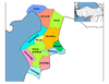 | ||||||||||||||||||||||||||
|
Metropolitan municipalities are bolded. | |||||||||||||||||||||||||||
This article about a Mediterranean Region of Turkey location is a stub. You can help Wikipedia by expanding it. |