
Kula | |
|---|---|
District and municipality | |
 Yanıkyöre rock formations near Kula | |
 Map showing Kula District in Manisa Province | |
 Kula Location in Turkey  Kula Kula (Turkey Aegean) | |
| Coordinates: 38°32′45″N 28°38′58″E / 38.54583°N 28.64944°E | |
| Country | Turkey |
| Province | Manisa |
| Government | |
| • Mayor | Hüseyin Tosun (MHP) |
| Area | 981 km2 (379 sq mi) |
| Elevation | 635 m (2,083 ft) |
| Population (2022)[1] | 43,227 |
| • Density | 44/km2 (110/sq mi) |
| Time zone | TRT (UTC+3) |
| Postal code | 45170 |
| Area code | 0236 |
| Website | www |
Kula is a municipality and district of Manisa Province, Turkey.[2] Its area is 981 km2,[3] and its population is 43,227 (2022).[1] The town lies at an elevation of 635 m (2,083 ft).[4]
YouTube Encyclopedic
-
1/3Views:3 1032 1261 991
-
GÜZERGÂH (Kula - Manisa) 07.09.2014
-
Kula / Manisa
-
Kula /Manisa Yanık Ülke
Transcription
History
From 1867 until 1922, Kula was part of the Aidin Vilayet of the Ottoman Empire. Until at least 1923, the town was inhabited by a mixed population of Christians and Muslims.[5] The Christian population was composed of Turkified descendants of the original Greek inhabitants of the town, as well as by more recent immigrants from Samos and other Aegean islands.[5]
Composition
There are 60 neighbourhoods in Kula District:[6]
- Ahmetli
- Akgün
- Aktaş
- Ayazören
- Ayvatlar
- Balıbey
- Başıbüyük
- Battalmustafa
- Bayramşah
- Bebekli
- Bey
- Börtlüce
- Camicedit
- Çarıkballı
- Çarıkmahmutlu
- Çiftçiibrahim
- Dereköy
- Dört Eylül
- Emre
- Encekler
- Erenbağı
- Eroğlu
- Esenyazı
- Evciler
- Gökçeören
- Gökdere
- Gölbaşı
- Güvercinlik
- Hacıtufan
- Hamidiye
- Hayalli
- İbrahimağa
- İncesu
- Kalınharman
- Karaoba
- Kavacık
- Kenger
- Kızılkaya
- Konurca
- Körez
- Narıncalıpıtrak
- Narıncalısüleyman
- Ortaköy
- Papuçlu
- Sandal
- Saraçlar
- Sarnıçköy
- Şehitlioğlu
- Şeremet
- Şeritli
- Şeyhli
- Seyitali
- Söğütdere
- Tatlıçeşme
- Topuzdamları
- Yağbastı
- Yeniköy
- Yeşilyayla
- Yurtbaşı
- Zaferiye
Economy
As of 1920, Kula's main industry was carpet making.[7]
Yanıkyöre volcanic rock formations
The district is renowned for the cone-shaped volcanic rock formations, numbering at about eighty, in the nearby Yanıkyöre (literally the burnt land) area, also sometimes still referred to, including in Turkey, under the Greek name of Katakekaumene, which has the same meaning. Increasingly brought to the attention of a wider public in recent years as a natural curiosity, other recently coined terms to describe the area include "Cappadocia of the Aegean Region, Turkey" or even "Kuladocia".

Kula Volcanic Geopark was accepted and certificated by UNESCO on 6 September 2013 at 37th UNESCO general conference in Naples. So that Kula Volcanic Geopark joined UNESCO Global Geopark Network. Also this patent became the first geopark of Turkey, 58th geopark in Europe, and 96th geopark in the world.
See also
References
- ^ a b "Address-based population registration system (ADNKS) results dated 31 December 2022, Favorite Reports" (XLS). TÜİK. Retrieved 12 July 2023.
- ^ Büyükşehir İlçe Belediyesi, Turkey Civil Administration Departments Inventory. Retrieved 12 July 2023.
- ^ "İl ve İlçe Yüz ölçümleri". General Directorate of Mapping. Retrieved 12 July 2023.
- ^ Falling Rain Genomics, Inc. "Geographical information on Kula, Turkey". Retrieved 6 October 2023.
- ^ a b Toynbee, Arnold (1923). The Western Question in Greece and Turkey: A Study in the Contact of Civilisations. Constable Publishing. p. 123.
- ^ Mahalle, Turkey Civil Administration Departments Inventory. Retrieved 19 September 2023.
- ^ Prothero, G.W. (1920). Anatolia. London: H.M. Stationery Office. p. 110.
Kula, Manisa in Manisa Province of Turkey | |||||||||||||||||||||||||||
|---|---|---|---|---|---|---|---|---|---|---|---|---|---|---|---|---|---|---|---|---|---|---|---|---|---|---|---|
| Districts |  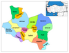 | ||||||||||||||||||||||||||
|
Metropolitan municipalities are bolded. | |||||||||||||||||||||||||||