
Koziova
Козьова | |
|---|---|
 | |
 Koziova 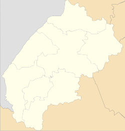 Koziova | |
| Coordinates: 48°57′03″N 23°20′43″E / 48.95083°N 23.34528°E | |
| Country | |
| Province | |
| District | Stryi Raion |
| Established | 1538 |
| Area | |
| • Total | 0,650 km2 (250 sq mi) |
| Elevation /(average value of) | 622 m (2,041 ft) |
| Population | |
| • Total | 960 |
| • Density | .690/km2 (1.79/sq mi) |
| Time zone | UTC+2 (EET) |
| • Summer (DST) | UTC+3 (EEST) |
| Postal code | 82631 |
| Area code | +380 3251 |
| Website | село Козьова (Ukrainian) |
Koziova — (Ukrainian: Козьова́, Polish: Koziowa) is a village located in Stryi Raion (district) of Lviv Oblast (province) in Western Ukraine. It is located in the Ukrainian Carpathians, within the limits of the Eastern Beskids (Skole Beskids). Koziova hosts the administration of Koziova rural hromada, one of the hromadas of Ukraine.[1] Local government – Kozivska village council.[2]
History
The first written mention of Koziova which dates from the year 1538.[3] The first settlers were hiding in the mountains from the Mongol invasion.
Until 18 July 2020, Koziova belonged to Skole Raion. The raion was abolished in July 2020 as part of the administrative reform of Ukraine, which reduced the number of raions of Lviv Oblast to seven. The area of Skole Raion was merged into Stryi Raion.[4][5]
Geography
The village is located along the Highway M06 (Ukraine) (![]() M 06). And is located along the Oriava River, it is surrounded on all sides by mountains and forests. The average height of the village is 622 metres (0.386 mi) above the sea level.
M 06). And is located along the Oriava River, it is surrounded on all sides by mountains and forests. The average height of the village is 622 metres (0.386 mi) above the sea level.
The village Koziova is situated in the 128 kilometres (80 mi) from the regional center Lviv, 19 kilometres (12 mi) from the district center Skole, and 140 kilometres (87 mi) from Uzhhorod.[6]
Attractions
In the village is an architectural monument of local importance of Skole Raion (Skole district).[7] It is a wooden church of St. Nicholas, 1926.
-
 Wooden church of St. Nicholas (1926), Koziova, Skole Raion
 -
 Carpathian village Koziova along the Highway M06. Skole Raion.
References
- ^ "Козовская громада" (in Russian). Портал об'єднаних громад України.
- ^ Козівська сільська рада (in Ukrainian)
- ^ [1] (in Ukrainian)
- ^ "Про утворення та ліквідацію районів. Постанова Верховної Ради України № 807-ІХ". Голос України (in Ukrainian). 2020-07-18. Retrieved 2020-10-03.
- ^ "Нові райони: карти + склад" (in Ukrainian). Міністерство розвитку громад та територій України.
- ^ Della (in Ukrainian)
- ^ Пам'ятки архітектури Сколівського району (in Ukrainian)
External links
- weather.in.ua
- Про село Козьова (in Ukrainian)
- Козьова, Матеріал з Вікіпедії (in Ukrainian)
- Козьова (in Ukrainian)
Literature
- Ukrainian: Історія міст і сіл УРСР : Львівська область. – К. : ГРУРЕ, 1968 р. Page 717.
| Cities |  | |
|---|---|---|
| Urban-type settlements | ||
| Villages |
| |