
Koziakas
Δήμος/Δημοτική Ενότητα Κόζιακα | |
|---|---|
 Koziakas Location within the regional unit 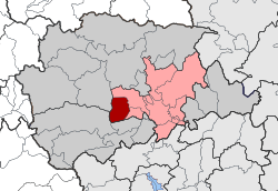 | |
| Coordinates: 39°34′N 21°36′E / 39.567°N 21.600°E | |
| Country | Greece |
| Administrative region | Thessaly |
| Regional unit | Trikala |
| Municipality | Trikala |
| Area | |
| • Municipal unit | 59.2 km2 (22.9 sq mi) |
| Population (2021)[1] | |
| • Municipal unit | 1,894 |
| • Municipal unit density | 32/km2 (83/sq mi) |
| Time zone | UTC+2 (EET) |
| • Summer (DST) | UTC+3 (EEST) |
| Vehicle registration | ΤΚ |
Koziakas (Greek: Δήμος/Δημοτική Ενότητα Κόζιακα) is a former municipality in the Trikala regional unit, Thessaly, Greece named after Mount Koziakas or Kerketion (in ancient times). Since the 2011 local government reform it is part of the municipality Trikala, of which it is a municipal unit.[2] The municipal unit has an area of 59.193 km2.[3] Population 1,894 (2021). The seat of the municipality was in Prinos.
YouTube Encyclopedic
-
1/3Views:2 6021 7841 608
-
Το Περτούλι απο ψηλά με drone (Aerial Video) - Pertouli Mt Koziakas
-
Μοναστήρι Αγίας Παρασκευής Aerial Video | Agia Paraskevi Monastery Koziakas
-
Koziakas-Κόζιακας 1900μ ΟΡΕΙΒΑΣΙΑ
Transcription
References
- ^ "Αποτελέσματα Μόνιμου Πληθυσμού κατά δημοτική κοινότητα" (in Greek). Hellenic Statistical Authority. 21 April 2023.
- ^ "ΦΕΚ B 1292/2010, Kallikratis reform municipalities" (in Greek). Government Gazette.
- ^ "Population & housing census 2001 (incl. area and average elevation)" (PDF) (in Greek). National Statistical Service of Greece. Archived from the original (PDF) on 2015-09-21.
This Thessaly location article is a stub. You can help Wikipedia by expanding it. |