
Korogwe Mjini
Wilaya ya Korogwe Mjini (Swahili) | |
|---|---|
| Wilaya ya Korogowe Mjini, Mkoa wa Tanga | |
 Streetview of Kilole Ward, Korogwe Town | |
| Nickname: City on the banks of Pangani | |
 Korogwe Town in Tanga 2022 | |
| Coordinates: 5°9′39.6″S 38°27′12.96″E / 5.161000°S 38.4536000°E | |
| Country | |
| Region | Tanga Region |
| Capital | Mkata |
| Area | |
| • Total | 225.3 km2 (87.0 sq mi) |
| Population (2012) | |
| • Total | 68,308 |
| • Density | 300/km2 (790/sq mi) |
| Demonym | Town Korogwean |
| Ethnic groups | |
| • Settler | Swahili |
| • Native | Sambaa, Bondei & Digo |
| Website | korogwetc |
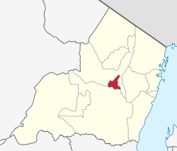
Korogwe Urban District (or Korogwe Town Council) is one of the eleven districts of the Tanga Region of Tanzania. The District covers an area of 225.3 km2 (87.0 sq mi).[1] Korogwe Urban District is bordered to the north by Korogwe Rural District and to the south by Handeni Rural District. The administrative capital of the district is Korogwe town. According to the 2012 Tanzania National Census, the population of Korogwe Urban District was 68,308.[2]
Transport
Paved trunk road T2 from Dar es Salaam to Arusha passes through the district.[3]
Administrative subdivisions
As of 2012, Korogwe Urban District was administratively divided into 8 wards.[2]
Wards
References
- ^ "Tanzania: Northern Zone(Districts and Wards) - Population Statistics, Charts and Map".
- ^ a b "2012 Population and Housing Census" (PDF). Development Partners Group Tanzania. Archived from the original (PDF) on 29 March 2018. Retrieved 7 August 2019.
- ^ "Tanga Region Roads Network" (PDF). Tanroads. Retrieved 8 August 2019.